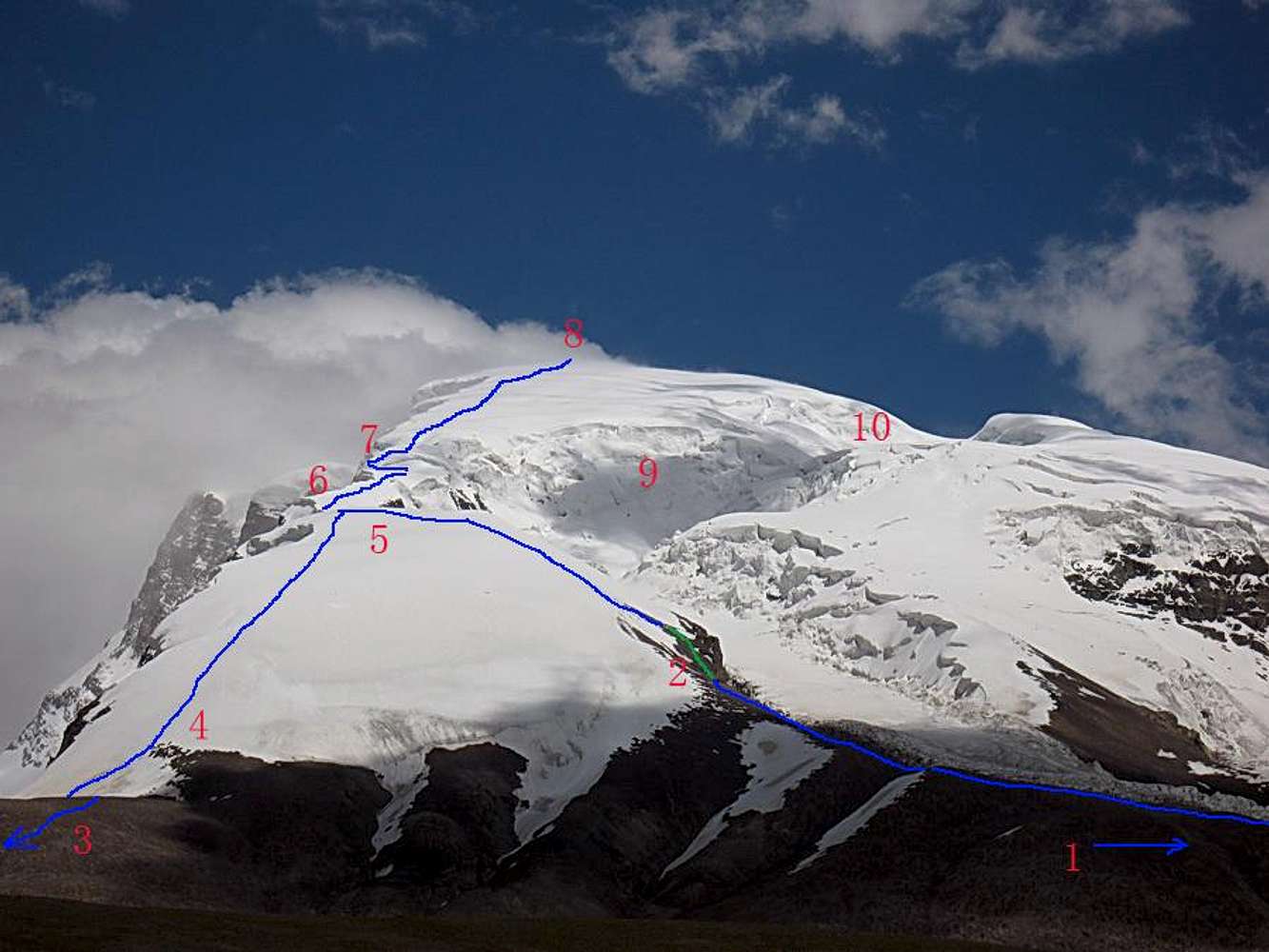
1. To the southern BC, located at the end of the glacier. On a moraine. Not that good and the ridge from it up to C1 is boring, axing and long on loose gravel and rock.
2. Site for C1. You can find flat enough places where the line is green. If lucky even old platforms from earlier expeditions.
Note: If you have sharp eyes you may see a tent in the middle of the snowfield at about 5500-5550m. A three person team had chosen to camp there.
3. To the
northern BC, located on a grassy spot next to a stream and two ponds. Well sheltered from the wind.
4. I saw traces of a camp here on the last gravel section. May be an alternative.
5. The two alternative routes meet. From here on the route is a little bit up and down and there are many places where you can pitch a tent.
6. The traverse. This section may change from year to year.
7. Navigation between crevasses. Also this section may be different next year. If the second crevasse gets much bigger it'll split the ridge in two and then the long SW ridge may be a more feasible alternative.
8. Summit, 7028m somewhere up there in the clouds.
9. Central icefall.
10. The only difficult section on the long SW ridge route.


