Toggle navigation
Mountains
Routes
Images
Trip Reports
Forum
What's New
People
Areas & Ranges
Articles
Trailheads
Canyons
Huts & Campgrounds
Albums
Logistical Centers
Fact Sheets
Lists
Custom Objects
Gear
Plans & Partners
WELCOME TO SUMMITPOST
SIGN IN
REGISTER
My Topographic Maps
Additional Parents
Orizaba
Image
Orizaba, Mexico
View High-Resolution Image
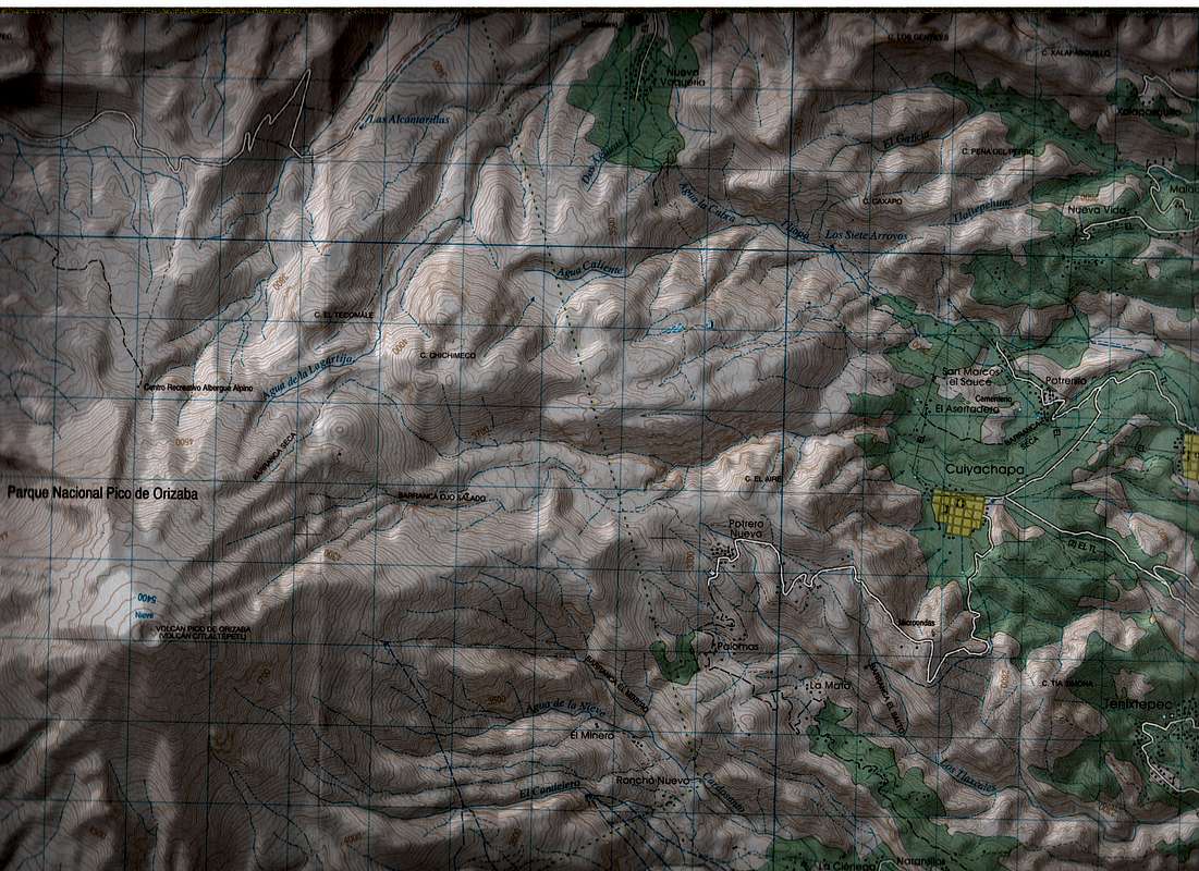
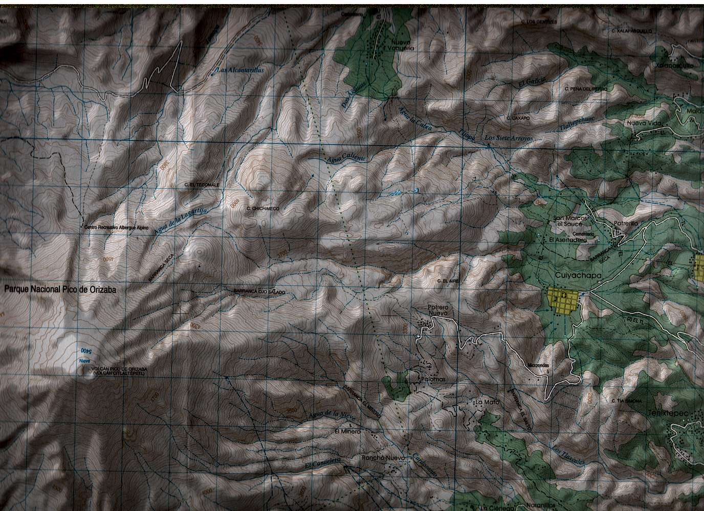
Orizaba, Mexico
Published by INEGI of Mexico. Map name: Coscomatepec de Bravo, Reference E14B46. Primary contour intervals are at 20 meters. This section of the map includes most of Orizaba and the Jamapa Glacier.
« PREV
NEXT »
mmcguigan
on
May 11, 2008 11:16 pm
Comments & voting
Other parents
Image ID:
403038
2670 Hits
71.06
% Score
1
Votes
Log in to vote
Comments
No comments posted yet.
to post!
Don't have an account?
My Topographic Maps
(Album)
You are at
the First
Image
Viewing
#1 of 1
GALLERY
You are at
the Last
Image
mmcguigan's Image Gallery
« PREV
Viewing
#142 of 393
GALLERY
NEXT »
Orizaba
(Album)
Loading....
×
You need to login in order to vote!
User Name
Password
Remember me
Forgot your password?
Log me out when I close my browser.
Keep me logged in all the time.
sign in as a user
Don't have an account?
Register now for FREE
Rating available
Suggested routes for you
People who climb the same things as you
Comments Available
Create Albums
Register Here


