Toggle navigation
Mountains
Routes
Images
Trip Reports
Forum
What's New
People
Areas & Ranges
Articles
Trailheads
Canyons
Huts & Campgrounds
Albums
Logistical Centers
Fact Sheets
Lists
Custom Objects
Gear
Plans & Partners
WELCOME TO SUMMITPOST
SIGN IN
REGISTER
Overview Map
View High-Resolution Image
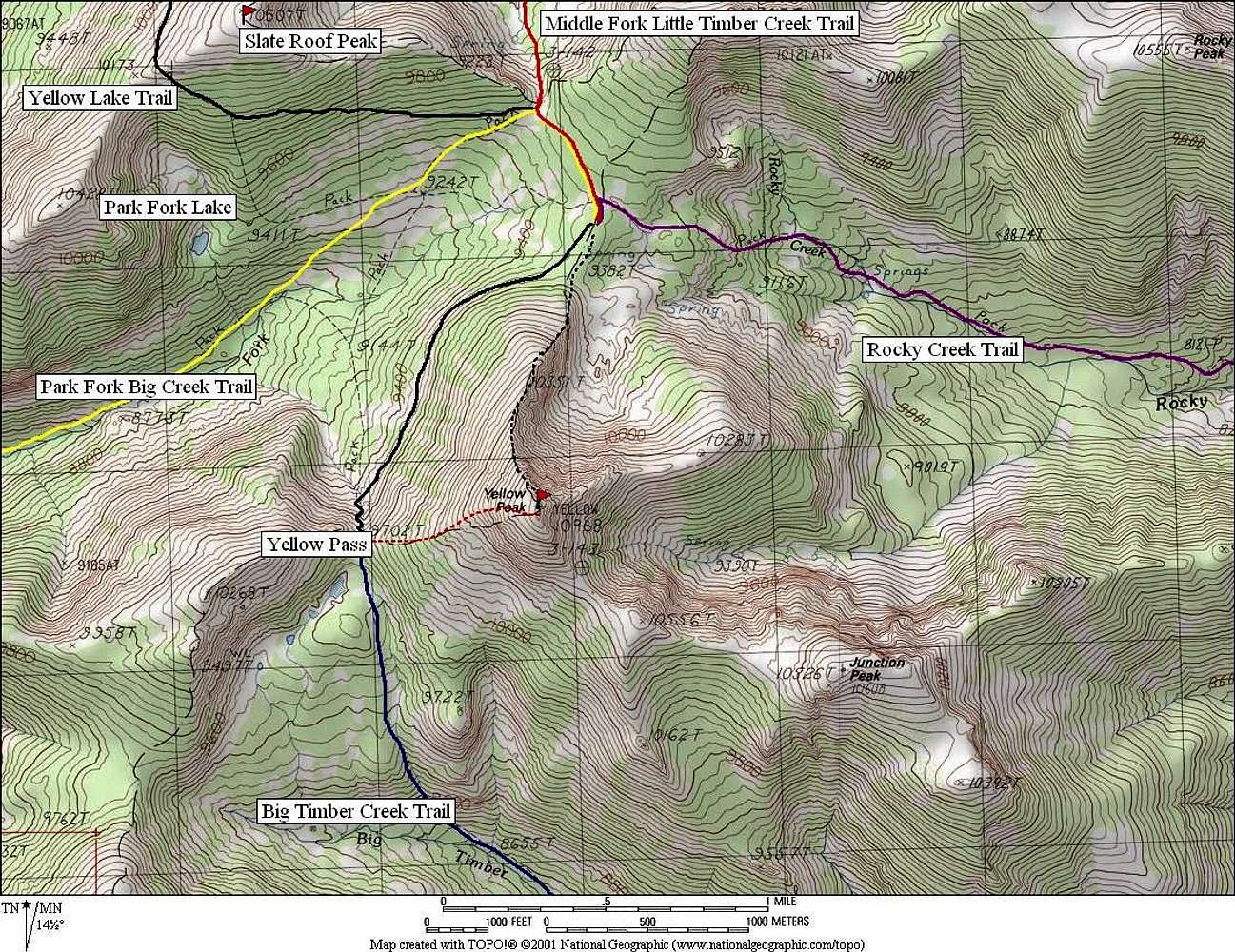
Overview Map
Overview map of the various trails in the vicinity of Yellow Peak. The most recent USGS Quad is a bit outdated. Several trails have been created, re-routed, or abandoned.
« PREV
NEXT »
Super Dave
on
Nov 15, 2006 3:17 am
Comments & voting
Other parents
Image Type(s):
Topo/Diagram
,
Informational
Image ID:
244276
3594 Hits
79.78
% Score
11
Votes
Log in to vote
Comments
No comments posted yet.
to post!
Don't have an account?
Yellow Peak
(Mountain/Rock)
You are at
the First
Image
Viewing
#1 of 1
GALLERY
You are at
the Last
Image
Super Dave's Image Gallery
« PREV
Viewing
#247 of 487
GALLERY
NEXT »
Yellow Peak
(Mountain/Rock)
Loading....
×
You need to login in order to vote!
User Name
Password
Remember me
Forgot your password?
Log me out when I close my browser.
Keep me logged in all the time.
sign in as a user
Don't have an account?
Register now for FREE
Rating available
Suggested routes for you
People who climb the same things as you
Comments Available
Create Albums
Register Here


