
|
|
Mountain/Rock |
|---|---|
|
|
39.68108°N / 120.6835°W |
|
|
Plumas and Sierra |
|
|
Hiking |
|
|
Spring, Summer, Fall |
|
|
7541 ft / 2298 m |
|
|
Overview
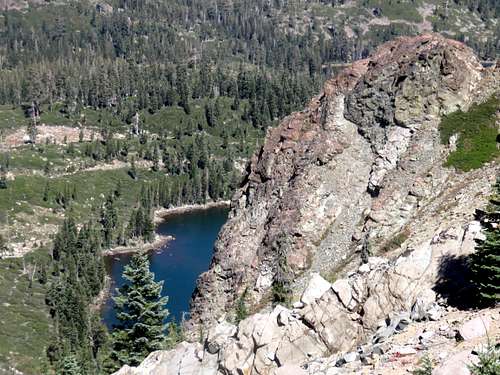
Round Lake from Round Lake Peak
Most people who pass the summit have no idea that it actually is a summit or that it has over 450’ of prominence above its saddle with Mount Elwell. That is because it is hard to tell that it is its own summit. It is just the highest bump along a ridge with numerous bumps above 7,500'. Round Lake Peak just happens to be the highest bump.
Round Lake Peak is located about 50’ above the Pacific Crest Trail (PCT), so it is an easy summit to bag. Summit views are excellent, with views towards numerous lakes, including an excellent view of Gold Lake. Sierra Buttes 8,591’ is a prominent feature seen from the summit. There is no summit register and thus no recognition of this very worthy destination.
The Lakes Basin area gets plenty of snow in a good winter. The trails are rocky, so it is best to avoid hiking in slippery conditions. The best time to hike here is definitely fall – from Labor Day through early November.
Getting There
There are two primary starting points for Round Lake Peak. Elwell Lodge is a good starting point if wanting to hike Mount Elwell 7,818’ and Round Lake Peak together. A shorter hike can be accomplished if parking at the trailhead near Gold Lake Lodge.Both trailheads are located off of Gold Lake Highway. Both trailheads are accessed from the west side of the road.
The Long Lake Trail past Elwell Lodge has a turn off sign from the south noting Elwell Lodge. If coming in from the north from Graeagle, take the right at the sign that says Lakes Basin Campground. Drive all the way to the end of the road where the trailhead has space for about 20 cars. The turnoff is 6.8 miles south on the Gold Lake Highway from Highway 89.
The turnoff to Gold Lake Lodge is another mile to the south of the Lakes Basin Campground turnoff on the Gold Lake Highway.
Route
Take the trail to Round Lake from past Gold Lake lodge. This is the southern trail. There is another trail that goes past Big Bear Lake, but this is longer. Follow trail signs to the PCT which leads you up to the PCT in about 2.3 miles from the trailhead. Continue north on the PCT until it is right under Round Lake Peak. The way to know you are below Round Lake Peak is that it is the first high point on the ridge that you encounter while heading north on the PCT. It is about 50’ above the PCT.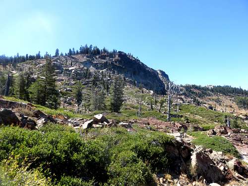
View south to Round Lake Peak from the trail up to the PCT
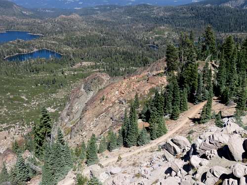
Pacific Crest Trail seen from Round Lake Peak
The summit is reached in about 2 ¾ miles with an elevation gain of about 1,000’. Take a good trail map with you so you can explore other lakes in the area.
From the Long Lake Trailhead past Elwell Lodge, there are also couple trails located at the trailhead. One has a trail sign and is pretty obvious. You can take this trail towards Round Lake and then up to Round Lake Peak. Or you can take the Long Lake Trail towards Mount Elwell. That trail starts on the access road just next to the entrance to the parking lot.
If hiking the obvious trail with the trail sign, hike up to Big Bear Lake, pass it on the north side. You will reach a junction about 1 ¼ miles from the trailhead. Take the trail to Silver Lake and Round Lake. You reach Round Lake at about 2 miles from the trailhead. Take the trail to the PCT and then hike up to Round Lake Peak. It is a little under 3 ¼ miles to the summit gaining about 1,300’.
If taking the Long Lake Trail to Mount Elwell, you will head to Long Lake in about ½ mile and then go around to the north side. The trail then climbs up above the west side of Long Lake reaching the saddle in 2 ½ miles. Mount Elwell is ¾ miles up from the junction. Once back at the junction take the trail on the ridge to the PCT. Once at the PCT head south and all the way to the last high point on the ridge. You reach the summit in about 7 ½ miles of hiking (6 miles if not hiking Mount Elwell). Hike 3 ¼ miles back to the trailhead via the route described above.
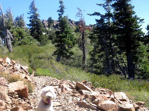
Round Lake Peak's rocky summit seen poking out above the PCT