
Viewing: 1-2 of 2

Klenke - Aug 25, 2004 9:49 pm - Voted 10/10
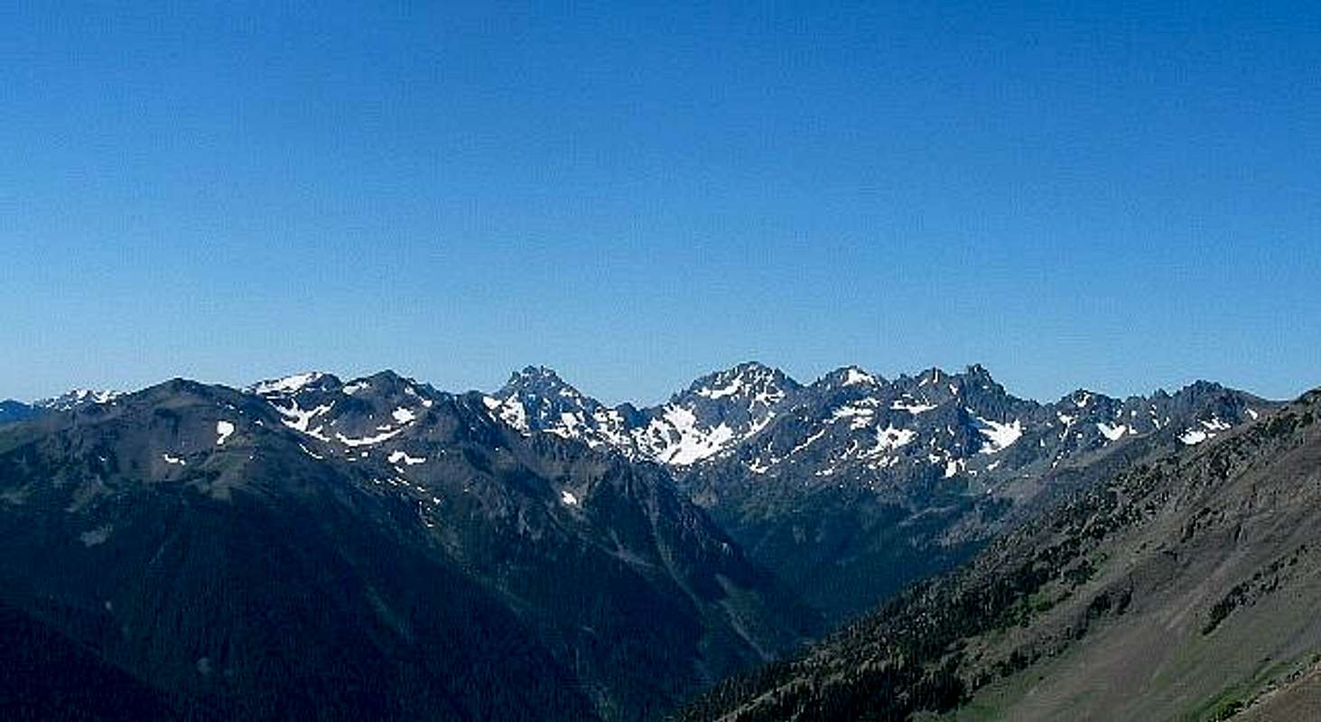
Peak namingThe view is southward toward Royal Basin (end of Royal Creek, which is below). This map may help. One of the lesser peaks at left is Petunia Peak (Pk 6953). Behind it at left is Mt. Fricaba (7139 ft). Fricaba is not really visible. Just left of center is Mt. Mystery (7,639 ft). At right are (L to R): Mt. Deception (7,788 ft), Mt. Clark (7,528 ft), and Mt. Walkinshaw (7,378 ft). Or something like that.

Dean - Aug 25, 2004 9:57 pm - Hasn't voted
Re: Peak namingI knew I could depend on you. Nice map too. Thanks for the input, I'll label the caption now.
Viewing: 1-2 of 2


Comments
Post a Comment