Toggle navigation
Mountains
Routes
Images
Trip Reports
Forum
What's New
People
Areas & Ranges
Articles
Trailheads
Canyons
Huts & Campgrounds
Albums
Logistical Centers
Fact Sheets
Lists
Custom Objects
Gear
Plans & Partners
WELCOME TO SUMMITPOST
SIGN IN
REGISTER
Fred Burr Trail
Additional Parents
Image
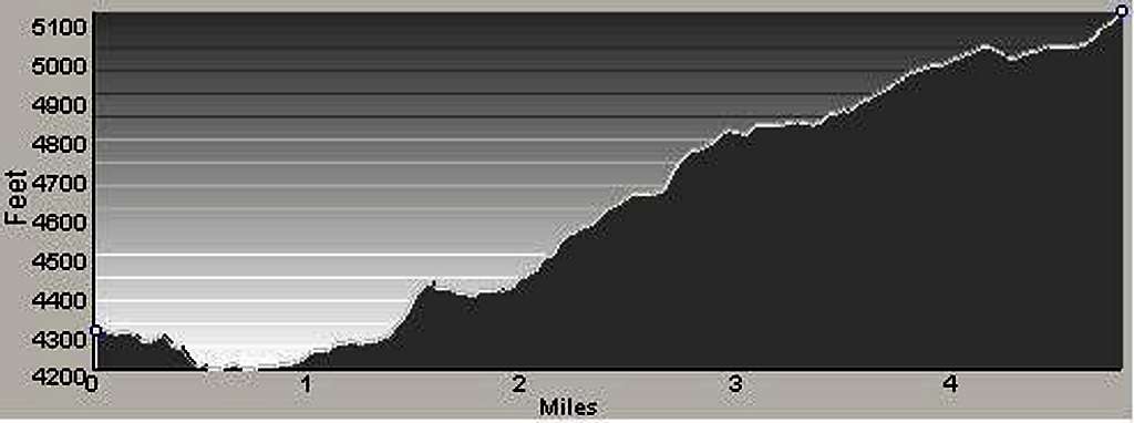
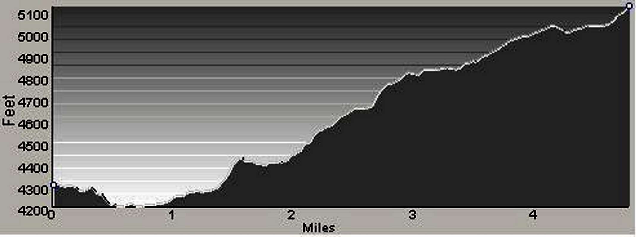
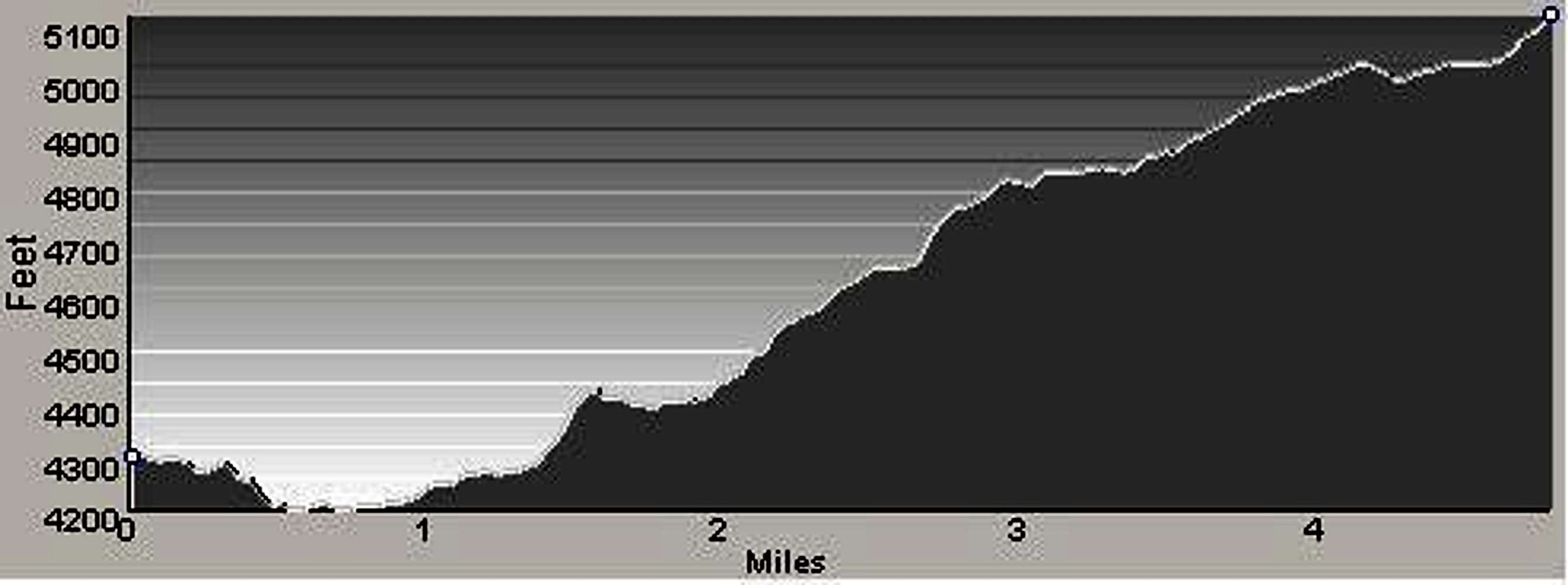
Profile O Fred Burr Route
View High-Resolution Image
Profile O Fred Burr Route
This is the profile (from my GPS) of the route to the Fred Burr Reservoir, recorded 5jul06.
« PREV
NEXT »
Michael Hoyt
on
Jul 6, 2006 2:08 am
Comments & voting
Other parents
Lat/Lon:
46.36479°N / 114.22406°W
Image Type(s):
Hiking
Image ID:
205180
3085 Hits
71.06
% Score
1
Votes
Log in to vote
Comments
No comments posted yet.
to post!
Don't have an account?
Fred Burr Trail
(Custom Object)
« PREV
Viewing
#7 of 10
GALLERY
NEXT »
Michael Hoyt's Image Gallery
« PREV
Viewing
#1473 of 1801
GALLERY
NEXT »
×
You need to login in order to vote!
User Name
Password
Remember me
Forgot your password?
Log me out when I close my browser.
Keep me logged in all the time.
sign in as a user
Don't have an account?
Register now for FREE
Rating available
Suggested routes for you
People who climb the same things as you
Comments Available
Create Albums
Register Here


