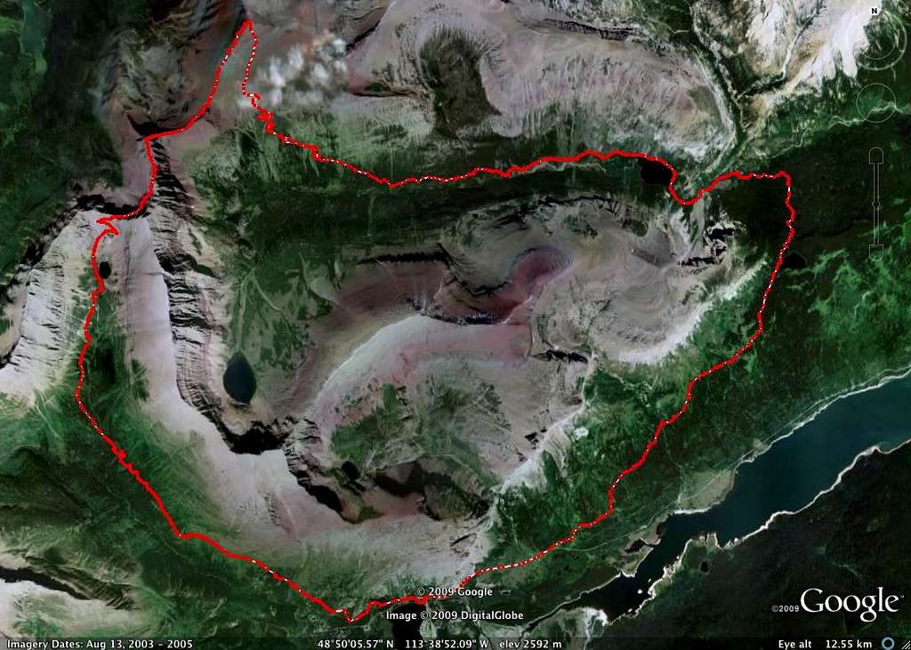
Ptarmigan Tunnel to Redgap Pass via Goat Trail Map
Hopefully gives some persepctive as to how much ground you cover via this route. It begins near the © 2009 google near the bottom of the image, and takes you on a clockwise circuit of some of Many Glacier's rugged terrain. The small lake in the middle left of the photo is Ptarmigan Lake, with a series of three switchbacks leading up to Ptarmigan Tunnel. Soon after heading through the tunnel, the route heads off-trail, joining up with a goat trail to shortcut to Redgap Pass. The Summit of Seward Mountain is located at the uppermost stretch of the route; the last 13 miles takes you past Poia Lake and back to Many Glacier Road.
PLEASE DO NOT VOTE!


