Toggle navigation
Mountains
Routes
Images
Trip Reports
Forum
What's New
People
Areas & Ranges
Articles
Trailheads
Canyons
Huts & Campgrounds
Albums
Logistical Centers
Fact Sheets
Lists
Custom Objects
Gear
Plans & Partners
WELCOME TO SUMMITPOST
SIGN IN
REGISTER
Purmamarca village - Argentina
Additional Parents
Image
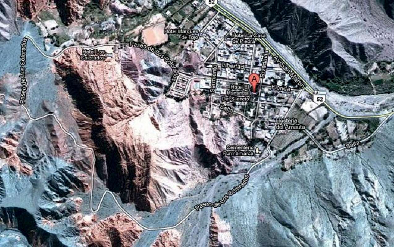
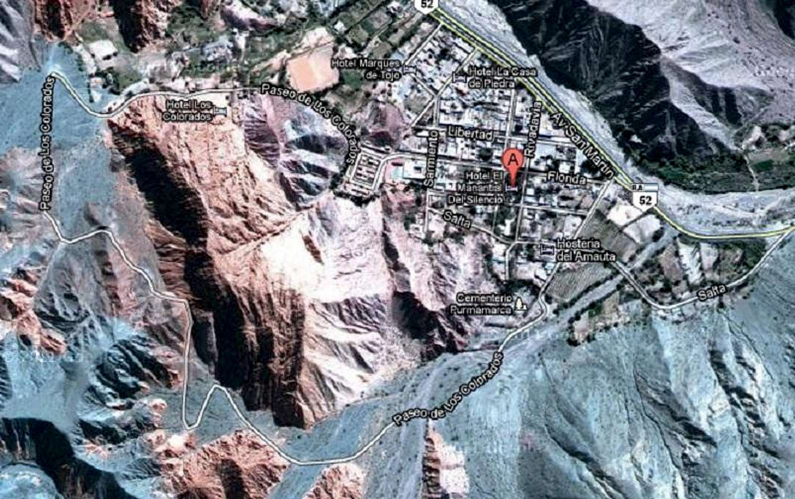
Purmamarca map
View High-Resolution Image
Purmamarca map
Map of Purmamarca (similar to those on the main page but with street signs). Note the Paseo de los Colorados winding around the mountains in the bottom left. You can drive but it's much better experienced by walking. Image from Google Maps.
« PREV
NEXT »
Baarb
on
Oct 31, 2011 9:10 pm
Comments & voting
Other parents
Lat/Lon:
23.72753°S / 65.51147°W
Image Type(s):
Topo/Diagram
Image ID:
757182
1133 Hits
71.06
% Score
1
Votes
Log in to vote
Comments
No comments posted yet.
to post!
Don't have an account?
Purmamarca village - Argentina
(Area/Range)
« PREV
Viewing
#13 of 13
GALLERY
You are at
the Last
Image
Baarb's Image Gallery
« PREV
Viewing
#246 of 361
GALLERY
NEXT »
×
You need to login in order to vote!
User Name
Password
Remember me
Forgot your password?
Log me out when I close my browser.
Keep me logged in all the time.
sign in as a user
Don't have an account?
Register now for FREE
Rating available
Suggested routes for you
People who climb the same things as you
Comments Available
Create Albums
Register Here


