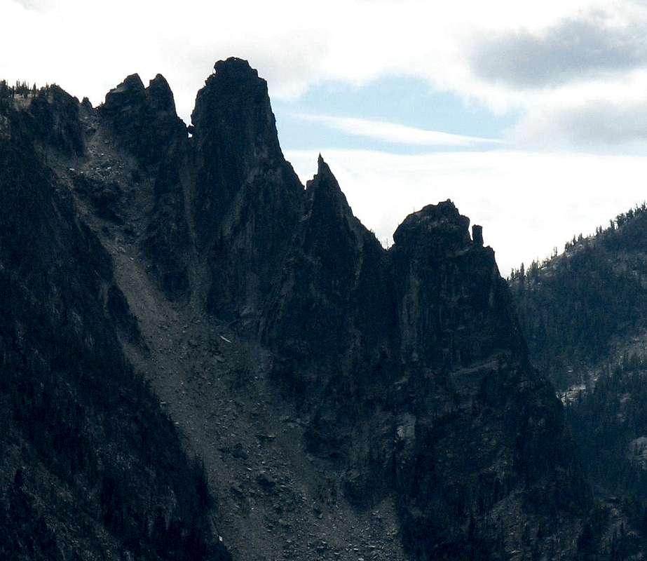
At the very northern edge of the Enchantments Plateau is Edward Mesa, and hanging off its northwest corner is the Rat Creek Group, a ridge of fine spires dividing Rat Creek from this dry gully (Hook Creek) to its east. Beckey's
Cascade Alpine Guide, Volume 1 identifies the summits as:
The Doulith (class 4) - the double summit at top-left
The Mole (II 5.7 or harder) - large tower (called
Edward Peak on the USGS map) with a chockstone between it and the Doulith
The Shrew (class 4) - the pointy one
The Blockhouse (class 5 & aid)- the lowest big tower
If you're in the Enchantments, approach through Prusik pass, across the Lost World Plateau and Edwards Mesa. They can be approached by simply hiking up the gully from Icicle Creek, but it's a grunt.
This shot is from 3.5 miles (5.6 km) NNE, on Icicle Ridge. For an idea of the scale, Beckey says the N Face route on The Mole is about 500 feet. The opposite side, above Rat Creek, is much higher, and at least as vertical. The descent is a couple of long rappels (the first one gets very airy), ending under the chockstone, which is small, as suburban American houses go, but bigger than a cabin.
Beckey refers to the gully between The Shrew and The Blockhouse as "dirty." It's the rottenest, scariest gully I ever climbed.
Photo from a mountain bike ride in August, 2007


Comments
Post a Comment