

-
 29977 Hits
-
 74.01% Score
-
 4 Votes
|
|
Mountain/Rock |
|---|---|
|
|
47.84676°N / 116.92764°W |
|
|
Kootenai |
|
|
5003 ft / 1525 m |
|
|
Overview
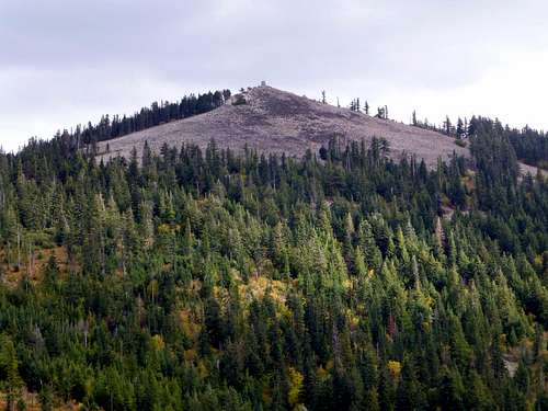 Rathdrum Mountain from the west
Disclaimer: I live over three hundred miles away from Rathdrum Mountain. I have no idea if my route to the summit is the most efficient, but it worked well for me. Anyone with information on better routes to the summit is encouraged to add to this page. Additionally, I will gladly give up ownership of this page to someone more local if they so desire.
Rathdrum Mountain is a 5003' peak located three miles northwest of (appropriately enough) Rathdrum, ID. While not particularly high in elevation (18th in Kootenai County), its low footings gives it 1303' of prominence (6th in Kootenai County), and gives the mountain high visibility from Coeur d'Alene and vicinity. Rathdrum Mountain's flanks are covered with a large number of logging roads - to the best of my knowledge, the best approach to Rathdrum Mountain's summit is via a road network owned by Inland Empire Paper Company. These roads can be walked all the way to Rathdrum Mountain's summit, assuming you purchase a $10 permit to gain access to this area.
Getting There
On Highway 53 just southwest of Rathdrum, turn west onto Hidden Valley Road. Follow this road to its end in three miles, where the pavement will end. Continue straight ahead on the gravel road, which becomes Nelson Loop Road. After one-half mile, turn right onto N Scenic Lodge Road (N47 49.237 W116 57.480). After one-third mile on this road, you will arrive at one of six approved entry/exit points for Inland Empire Paper.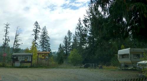 N Scenic Lodge Road entry/exit point
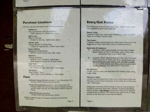 Inland Empire Paper permit information
If you forgot to purchase your permit in town, the gentleman at the entry point will be happy to sell you one. If you did purchase your permit in town, you are still required to check in with the gate host.
Route
Once through the entry point, continue on the main gravel road, ignoring spurs, for an additional 3.5 miles. At this point, you will arrive at a spur road (N Rathdrum Mountain Road) leading off to the right (N47 50.472 W116 57.756 Elev. 3800'). If you have a low clearance vehicle, park here. If you have a high clearance vehicle, or you just don't like your car very much, continue driving.Drive/walk this road for 1.2 miles, to a point just below the Rathdrum Mountain/Huckleberry Hill saddle (N47 50.820 W116 56.448). If you have not already done so, park here. Follow the dirt 4x4 trail straight up the hill several hundred feet to the saddle (Note: This saddle can also be accessed from a different spur off of N Scenic Lodge Road - high clearance vehicle recommended).
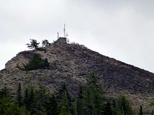 Rathdrum Mountain's summit from the west
From the saddle, follow the dirt 4x4 trail east for several hundred feet, where it will intersect with the main gravel road leading to Rathdrum Mountain's summit. From this point, follow the gravel road uphill, which will lead to the summit in less than one mile.
While on the summit, I was disappointed to discover a "No trespassing" sign located on the road about 50' below the summit (I had not noticed this on the way up since I scrambled the talus slope to the top). I'm not sure what the official status is on the summit area of this mountain - I do know that the gate host did not seem too concerned when I told him where I would be hiking.
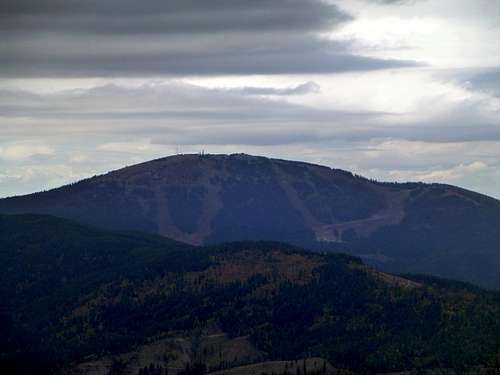 Mount Spokane from Rathdrum Mountain
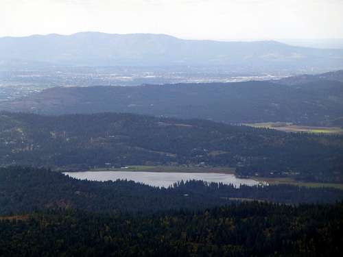 Hauser Lake from Rathdrum Mountain
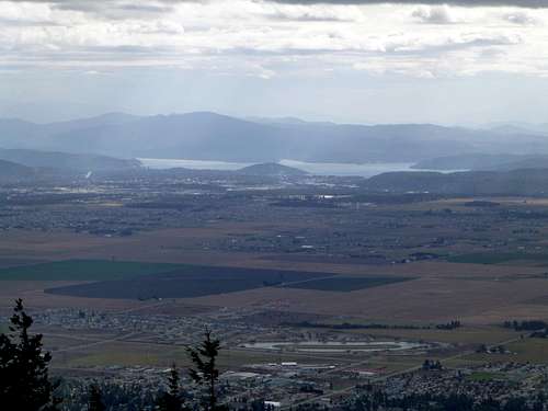 Coeur d'Alene from Rathdrum Mountain
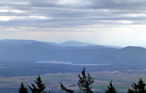 Hayden Lake from Rathdrum Mountain
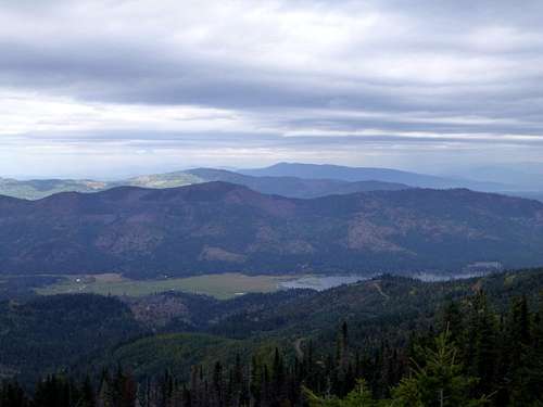 Upper Twin Lake from Rathdrum Mountain
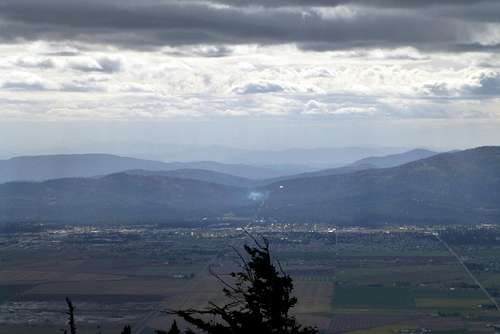 Post Falls from Rathdrum Mountain
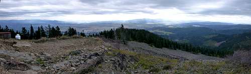 Rathdrum Mountain pano - southeast through west
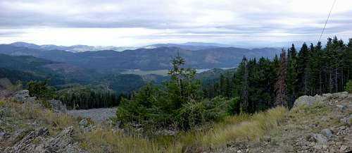 Rathdrum Mountain pano - west through north
Brian Jenkins - Aug 16, 2022 10:03 pm - Hasn't voted
PermitThe permit from IEP is now $19.