GR1805 ***********************************************************************
GR1805 DESIGNATION - RED
GR1805 PID - GR1805
GR1805 STATE/COUNTY- NV/CLARK
GR1805 COUNTRY - US
GR1805 USGS QUAD - BLUE DIAMOND NE (1983)
GR1805
GR1805 *CURRENT SURVEY CONTROL
GR1805 ______________________________________________________________________
GR1805* NAD 83(1994) POSITION- 36 07 56.27454(N) 115 21 50.20800(W) ADJUSTED
GR1805* NAVD 88 ORTHO HEIGHT - 1219.1 (meters) 4000. (feet) VERTCON
GR1805 ______________________________________________________________________
GR1805 GEOID HEIGHT - -27.23 (meters) GEOID12A
GR1805 LAPLACE CORR - -9.56 (seconds) DEFLEC12A
GR1805 HORZ ORDER - THIRD
GR1805
GR1805.The horizontal coordinates were established by classical geodetic methods
GR1805.and adjusted by the National Geodetic Survey in June 1998.
GR1805.
GR1805.The NAVD 88 height was computed by applying the VERTCON shift value to
GR1805.the NGVD 29 height (displayed under SUPERSEDED SURVEY CONTROL.)
GR1805
GR1805.The Laplace correction was computed from DEFLEC12A derived deflections.
GR1805
GR1805. The following values were computed from the NAD 83(1994) position.
GR1805
GR1805; North East Units Scale Factor Converg.
GR1805;SPC NV E - 8,153,371.165 219,745.659 MT 0.99990480 +0 07 45.7
GR1805;SPC NV E -26,749,851.90 720,948.88 sFT 0.99990480 +0 07 45.7
GR1805;UTM 11 - 3,999,861.976 647,213.068 MT 0.99986703 +0 57 53.6
GR1805
GR1805! - Elev Factor x Scale Factor = Combined Factor
GR1805!SPC NV E - 0.99981297 x 0.99990480 = 0.99971779
GR1805!UTM 11 - 0.99981297 x 0.99986703 = 0.99968002
GR1805
GR1805: Primary Azimuth Mark Grid Az
GR1805:SPC NV E - WILSON 248 15 27.0
GR1805:UTM 11 - WILSON 247 25 19.1
GR1805
GR1805|---------------------------------------------------------------------|
GR1805| PID Reference Object Distance Geod. Az |
GR1805| dddmmss.s |
GR1805| GR1809 WILSON APPROX.11.6 KM 2482312.7 |
GR1805|---------------------------------------------------------------------|
GR1805
GR1805 SUPERSEDED SURVEY CONTROL
GR1805
GR1805 NAD 83(1994)- 36 07 56.27630(N) 115 21 50.21321(W) AD( ) 3
GR1805 NAD 83(1992)- 36 07 56.27588(N) 115 21 50.21342(W) AD( ) 3
GR1805 NAD 83(1992)- 36 07 56.27190(N) 115 21 50.20999(W) AD( ) 3
GR1805 NAD 83(1986)- 36 07 56.26859(N) 115 21 50.20104(W) AD( ) 3
GR1805 NGVD 29 (05/01/88) 1218.4 (m) 3997. (f) VERT ANG
GR1805
GR1805.Superseded values are not recommended for survey control.
GR1805
GR1805.NGS no longer adjusts projects to the NAD 27 or NGVD 29 datums.
GR1805.See file dsdata.txt to determine how the superseded data were derived.
GR1805
GR1805_U.S. NATIONAL GRID SPATIAL ADDRESS: 11SPV4721399861(NAD 83)
GR1805
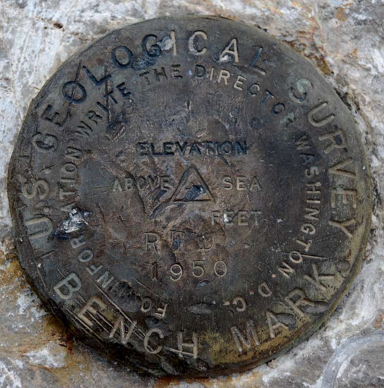
GR1805_MARKER: DS = TRIANGULATION STATION DISK
GR1805_SETTING: 66 = SET IN ROCK OUTCROP
GR1805_SP_SET: SET IN BEDROCK
GR1805_STABILITY: A = MOST RELIABLE AND EXPECTED TO HOLD
GR1805+STABILITY: POSITION/ELEVATION WELL
GR1805
GR1805 HISTORY - Date Condition Report By
GR1805 HISTORY - 1950 MONUMENTED USGS
GR1805
GR1805 STATION DESCRIPTION
GR1805
GR1805'DESCRIBED BY US GEOLOGICAL SURVEY 1950
GR1805'LOCATED ABOUT 14 MI W. OF LAS VEGAS, 8 MI NE. OF WILSONS RANCH.
GR1805'ON EXTREME SOUTH AND HIGHEST POINT OF LOW, ROCK TOP.
GR1805'
GR1805'REACHED BY HELICOPTER FROM LAS VEGAS LANDING AT STATION.
GR1805'
GR1805'STATION MARK--STANDARD TABLET STAMPED---RED 1950---, CEMENTED IN
GR1805'SOLID ROCK.
GR1805'
GR1805'RM 1--STANDARD RM TABLET STAMPED---1---, CEMENTED IN SOLID ROCK.
GR1805'
GR1805'RM 2--STANDARD RM TABLET STAMPED---2---, CEMENTED IN SOLID ROCK.


