Toggle navigation
Mountains
Routes
Images
Trip Reports
Forum
What's New
People
Areas & Ranges
Articles
Trailheads
Canyons
Huts & Campgrounds
Albums
Logistical Centers
Fact Sheets
Lists
Custom Objects
Gear
Plans & Partners
WELCOME TO SUMMITPOST
SIGN IN
REGISTER
Rhinogs/Rhinogydd
Additional Parents
Image
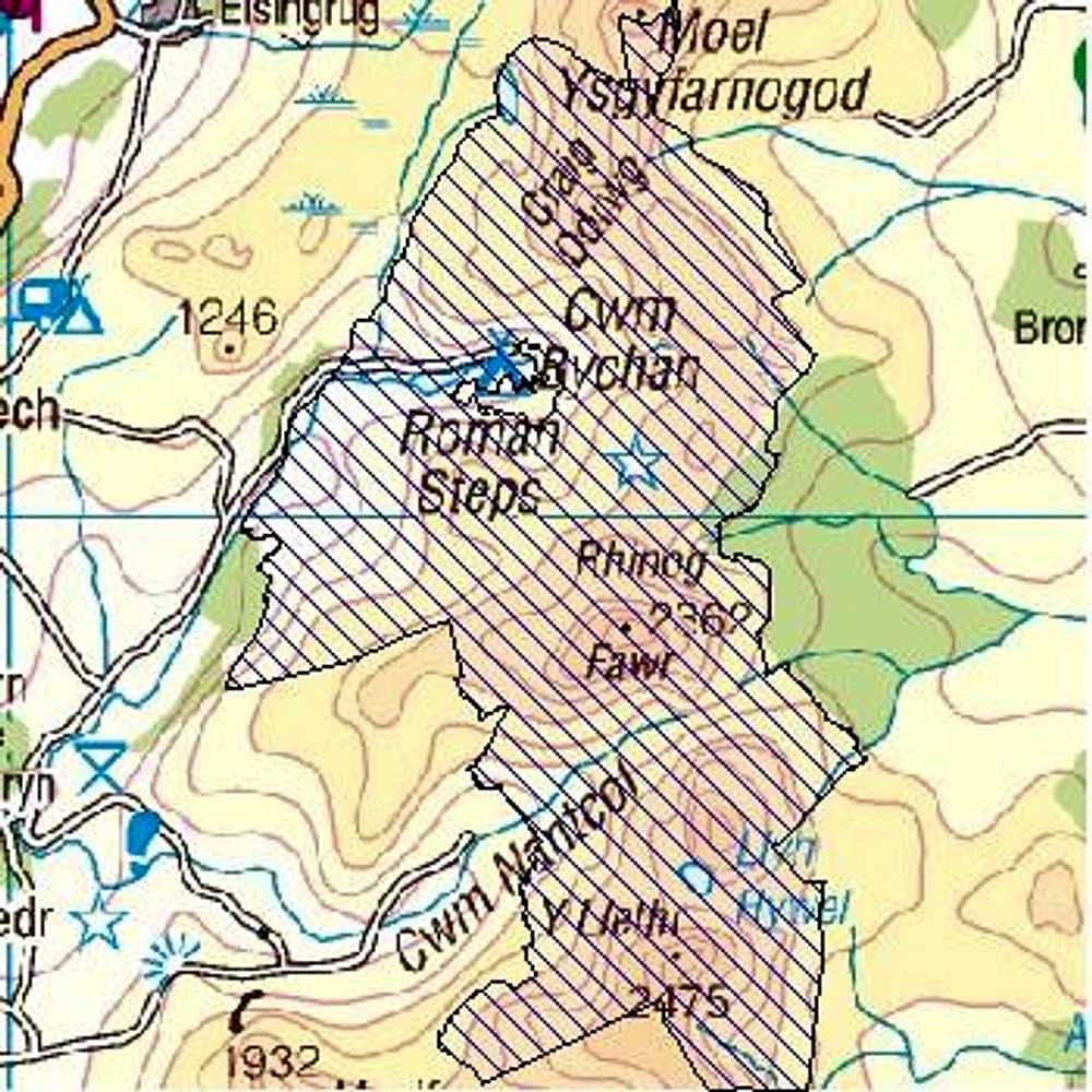
Rhinogs Special Area of Conservation
View High-Resolution Image
Rhinogs Special Area of Conservation
Rhinogs SAC
© Crown copyright. All rights reserved. Ordnance Survey maps can be purchased online at the
Ordnance Survey Leisure Map Shop
.
« PREV
NEXT »
Nanuls
on
Apr 26, 2007 7:38 am
Comments & voting
Other parents
Lat/Lon:
52.80940°N / 4.01001°W
Image Type(s):
Topo/Diagram
Image ID:
288491
2069 Hits
0
% Score
0
Votes
Log in to vote
Comments
No comments posted yet.
to post!
Don't have an account?
Rhinogs/Rhinogydd
(Area/Range)
You are at
the First
Image
Viewing
#1 of 1
GALLERY
You are at
the Last
Image
Nanuls's Image Gallery
« PREV
Viewing
#2336 of 2366
GALLERY
NEXT »
×
You need to login in order to vote!
User Name
Password
Remember me
Forgot your password?
Log me out when I close my browser.
Keep me logged in all the time.
sign in as a user
Don't have an account?
Register now for FREE
Rating available
Suggested routes for you
People who climb the same things as you
Comments Available
Create Albums
Register Here


