Toggle navigation
Mountains
Routes
Images
Trip Reports
Forum
What's New
People
Areas & Ranges
Articles
Trailheads
Canyons
Huts & Campgrounds
Albums
Logistical Centers
Fact Sheets
Lists
Custom Objects
Gear
Plans & Partners
WELCOME TO SUMMITPOST
SIGN IN
REGISTER
Rocca di Garda
Additional Parents
Image
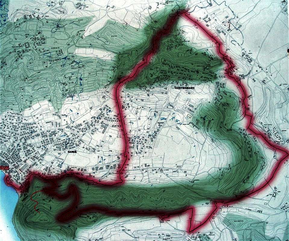
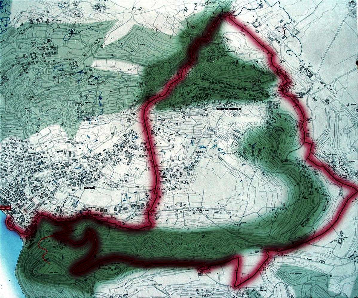
Rocca - more detailed map
View High-Resolution Image
Rocca - more detailed map
Not prettiest, still more detailed map of Rocca. Thick red line indicates complete loop around trail (some 11 kilometres), hand added dotted red line shows the shortest ascend route to the top
« PREV
NEXT »
toc
on
May 4, 2008 4:01 pm
Comments & voting
Other parents
Image Type(s):
Topo/Diagram
,
Informational
Image ID:
401131
2483 Hits
0
% Score
0
Votes
Log in to vote
Comments
No comments posted yet.
to post!
Don't have an account?
Rocca di Garda
(Mountain/Rock)
« PREV
Viewing
#13 of 13
GALLERY
You are at
the Last
Image
toc's Image Gallery
« PREV
Viewing
#644 of 664
GALLERY
NEXT »
×
You need to login in order to vote!
User Name
Password
Remember me
Forgot your password?
Log me out when I close my browser.
Keep me logged in all the time.
sign in as a user
Don't have an account?
Register now for FREE
Rating available
Suggested routes for you
People who climb the same things as you
Comments Available
Create Albums
Register Here


