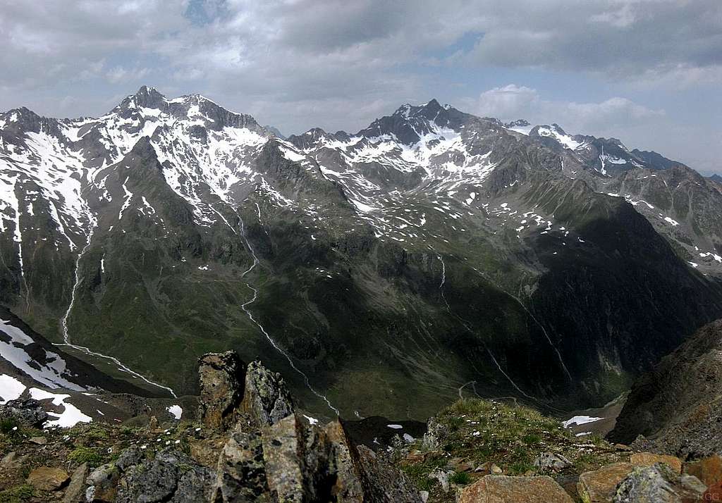
Rotkogel summit panorama towards the Geigenkamm
The Rotkogel (2947m) lies on the Polleskamm (kamm = ridge). To its west, and separated by the glacier carved Pollestal valley, is the long Geigenkamm.
The Puitkogel (4343m), left of center, appears to be the highest peak in this panorama, but it's not. That distinction goes to the Hohe Geige (3395m), which is the highest of the whole Geigenkamm. In fact, most of the Hohe Geige is not even visible, as it is blocked by the dark pyramid shape of the Silberschneide (3341m): the two summits are directly in line.
A steep hiking trail crosses the ridge at the lowest point, the Weißmaurachjoch (2953m), slightly left of center. Behind it, far away in the distance, are the contours of the mountains of the Kaunertal ridge.
1 July 2012/


