Toggle navigation
Mountains
Routes
Images
Trip Reports
Forum
What's New
People
Areas & Ranges
Articles
Trailheads
Canyons
Huts & Campgrounds
Albums
Logistical Centers
Fact Sheets
Lists
Custom Objects
Gear
Plans & Partners
WELCOME TO SUMMITPOST
SIGN IN
REGISTER
Tokewanna Peak
Additional Parents
Image
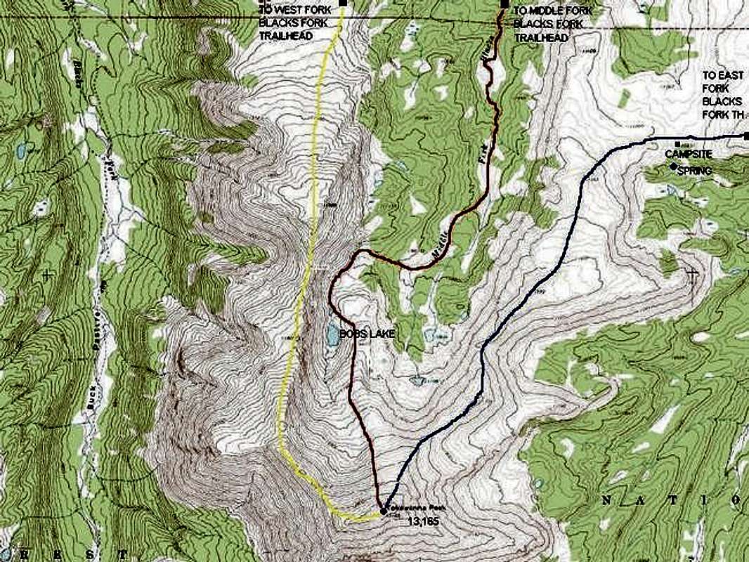
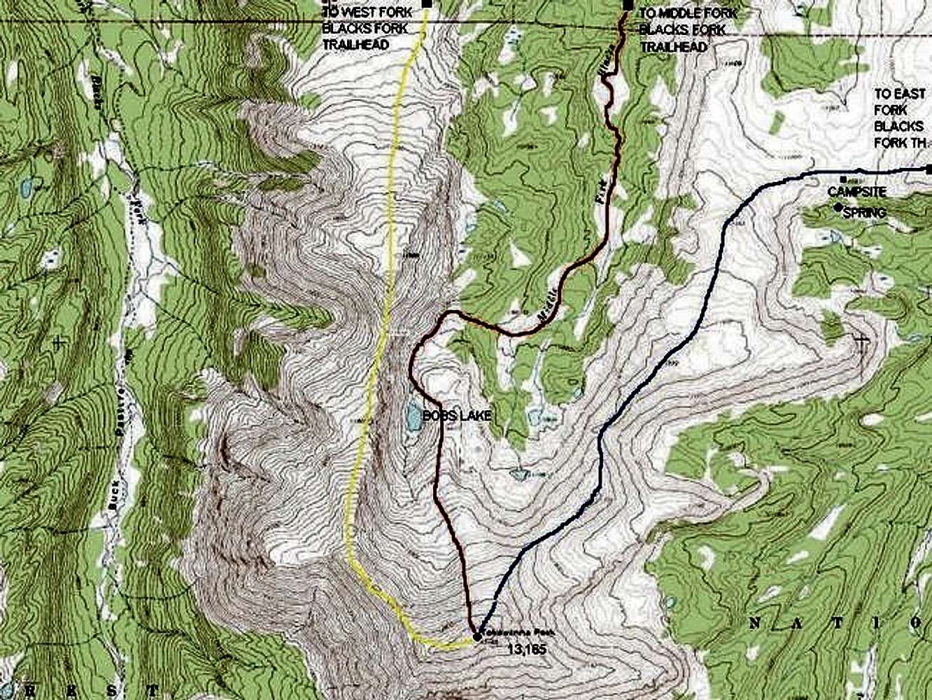
Route diagram of Tokewanna...
View High-Resolution Image
Route diagram of Tokewanna...
Route diagram of Tokewanna Peak. The approaches are long so the trailheads are still well north of the top of the map. See the route descriptions for details.
BLUE =
Northeast Ridge Route
RED=
Middle Forks Blacks Fork-Bobs Lake Route
YELLOW =
Northwest Ridge Route
Credit: Topozone
« PREV
NEXT »
Scott
on
Jun 15, 2005 5:26 pm
Comments & voting
Other parents
Lat/Lon:
40.81020°N / 110.6231°W
Image ID:
110430
5115 Hits
72.08
% Score
2
Votes
Log in to vote
Comments
No comments posted yet.
to post!
Don't have an account?
Tokewanna Peak
(Mountain/Rock)
You are at
the First
Image
Viewing
#1 of 1
GALLERY
You are at
the Last
Image
Scott's Image Gallery
« PREV
Viewing
#3876 of 8110
GALLERY
NEXT »
×
You need to login in order to vote!
User Name
Password
Remember me
Forgot your password?
Log me out when I close my browser.
Keep me logged in all the time.
sign in as a user
Don't have an account?
Register now for FREE
Rating available
Suggested routes for you
People who climb the same things as you
Comments Available
Create Albums
Register Here


