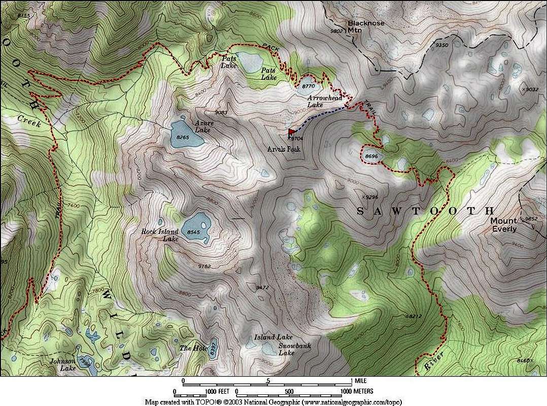
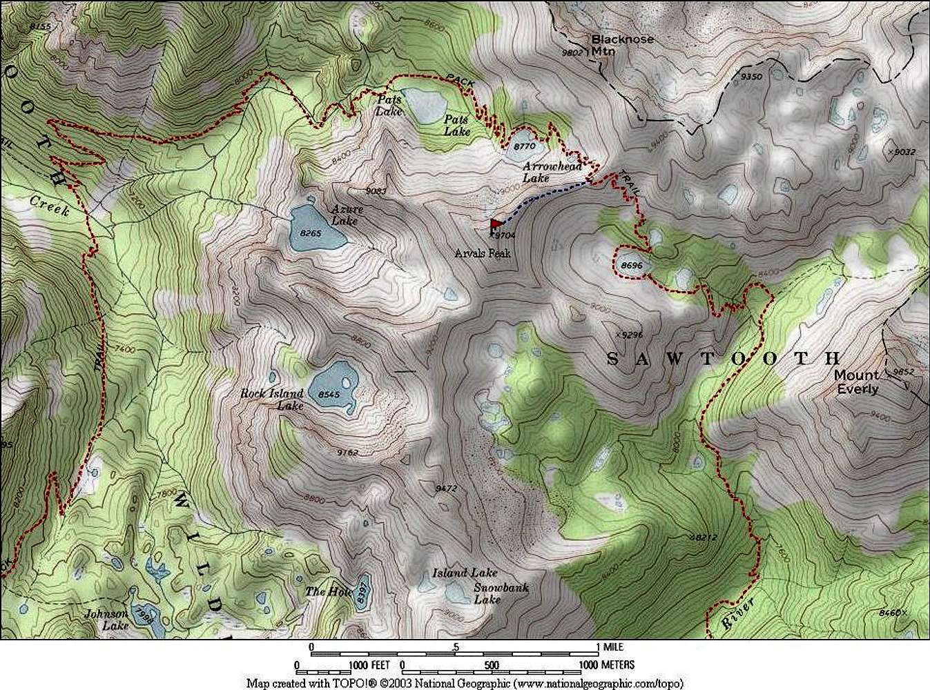
Route map showing the northern section of the "Queens River Loop", and Arvals Peak. The main loop is somewhere around 32 miles, but is longer depending on how many side trips are taken to the various lakes and peak in the area. Most invest 4-5 days when hiking the full loop.


