Toggle navigation
Mountains
Routes
Images
Trip Reports
Forum
What's New
People
Areas & Ranges
Articles
Trailheads
Canyons
Huts & Campgrounds
Albums
Logistical Centers
Fact Sheets
Lists
Custom Objects
Gear
Plans & Partners
WELCOME TO SUMMITPOST
SIGN IN
REGISTER
Mt. Williwaw
Additional Parents
Image
Route Map
View High-Resolution Image
Route Map
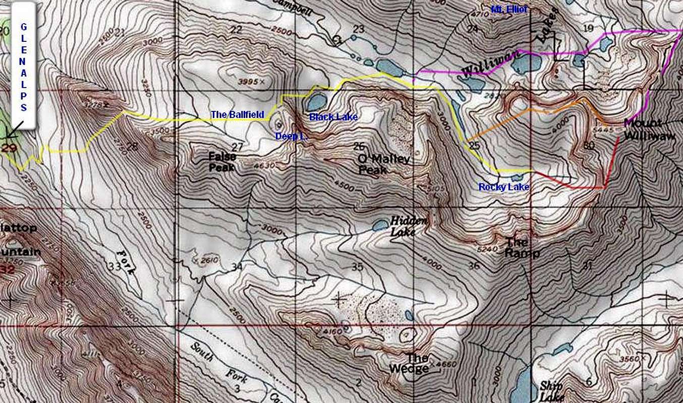
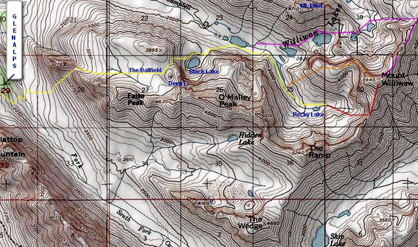
Mt. Williwaw routes. Standard approach: yellow. South ridge route: red. Northwest ridge route: orange. Northeast ridge route: purple. Click to further enlarge.
« PREV
NEXT »
chugach mtn boy
on
Oct 5, 2010 7:39 am
Comments & voting
Other parents
Lat/Lon:
61.10336°N / 149.515°W
Image Type(s):
Hiking
,
Topo/Diagram
Image ID:
667994
11895 Hits
73.06
% Score
3
Votes
Log in to vote
Comments
No comments posted yet.
to post!
Don't have an account?
Mt. Williwaw
(Mountain/Rock)
« PREV
Viewing
#19 of 21
GALLERY
NEXT »
chugach mtn boy's Image Gallery
« PREV
Viewing
#609 of 713
GALLERY
NEXT »
×
You need to login in order to vote!
User Name
Password
Remember me
Forgot your password?
Log me out when I close my browser.
Keep me logged in all the time.
sign in as a user
Don't have an account?
Register now for FREE
Rating available
Suggested routes for you
People who climb the same things as you
Comments Available
Create Albums
Register Here


