Toggle navigation
Mountains
Routes
Images
Trip Reports
Forum
What's New
People
Areas & Ranges
Articles
Trailheads
Canyons
Huts & Campgrounds
Albums
Logistical Centers
Fact Sheets
Lists
Custom Objects
Gear
Plans & Partners
WELCOME TO SUMMITPOST
SIGN IN
REGISTER
Gordon Hirabayashi Rec Area
Additional Parents
Image
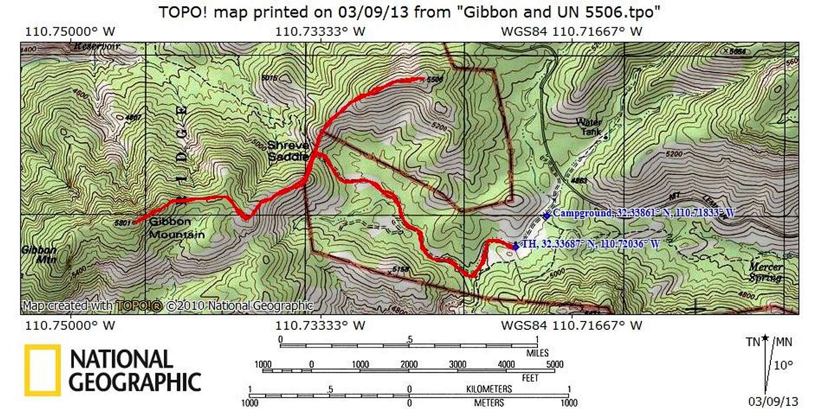
Route Map
View High-Resolution Image
Route Map
Roundtrip Distance:
5.25 miles
NET Elevation Gain:
1,400 feet
YDS Class:
2
March 2013
« PREV
NEXT »
Sarah Simon
on
Mar 17, 2013 3:33 pm
Comments & voting
Other parents
Image Type(s):
Topo/Diagram
Image ID:
842609
1520 Hits
72.08
% Score
2
Votes
Log in to vote
Comments
No comments posted yet.
to post!
Don't have an account?
Gordon Hirabayashi Rec Area
(Route)
« PREV
Viewing
#2 of 20
GALLERY
NEXT »
Sarah Simon's Image Gallery
« PREV
Viewing
#4090 of 5480
GALLERY
NEXT »
×
You need to login in order to vote!
User Name
Password
Remember me
Forgot your password?
Log me out when I close my browser.
Keep me logged in all the time.
sign in as a user
Don't have an account?
Register now for FREE
Rating available
Suggested routes for you
People who climb the same things as you
Comments Available
Create Albums
Register Here


