
-
 11623 Hits
-
 70.06% Score
-
 3 Votes
|
|
Route |
|---|---|
|
|
42.11000°N / 23.35000°E |
|
|
hike, basic snow and ice climb in winter |
|
|
A few days |
|
|
not very difficult, but some experience may turn out useful |
|
|
Approach
The route crosses the whole Rila range and one can start either in Borovec or in Rilski Manastir.
to Borovec:
by car- road nr 82 from Sofia to Kostenec (70 km)
by bus/coach- from Sofia via Samokov
by train- trains arrive only at Kostenec (Sofia-Plovdiv line), then a local bus, taxi necessary
to Rilski Manastir:
by car- from Sofia due south (E79) towards Blagoevgrad and Thessaloniki, 12 km after Dupnica turn east ( ca 100 km)
by bus/coach- from Sofia to Blagoevgrad and then local transport
by train- as above
Rila Mts are available also from other towns and villages, but the approach way in most cases will be similar to above described.
Route Description
The route follows marked paths all way long. Firstly there are red marks from Borovec via Musala peak, Ribni Ezera challet to Kobylino Branishte shelter, where one takes green marks that lead downhills to Kupulova Poljana. From that place follow either yellow marks or asphalt road directly to the Rilski Manastir.
suggested schedule:
day 1
Borovec- Musalenska bistrica valley- Musala challet/Ledenoto ezero shelter
a pleasant, couple of hours', starting walk from the gates of Rila Mts upto the starting poit for summit attempt for Musala (the highest peak of Bulgaria and Balkan Peninsula, 2925 m asl)
day 2
Musala challet/Ledenoto ezero shelter- Musala peak- Grincar challet
summit attemp, scenic views, whole range panorama- of course if weather is good ;)
day 3
Grincar challet- Ribni Ezera challet
long, mostly flat walk that ends with a steep descend (~400-500m vertically) towards picturesque ponds (lakes) and pleasant challet
* from Ribni Ezera challet one can make it directlyfor the monastery, but is dirt (later asphalt) road worth it? (yellow marks)
day 4
Ribni Ezera challet- Vodni Vryh (2683)- Kobilino Branishte shelter
traverse of Sredna Rila to a cute wooden shelter on a wide pass. In the morning breathtaking view towards Maljowica complex walls
day 5
Kobilino Branishte- Kupulova Poljana- Rilski Manastir
descend to the pearl of Bulgarian architecture and culture, on the way it is possible to visti Ivan Rilski place of solitare.
 |  |  |  |
Essential Gear
There is no need to have any sophisticated gear and equipment, but still some things may make the hike more comfortable and may enable to enjoy it without any problems.
Things that one may find quite usefull on 'The Rila Traverse' route:
- comfortable shoes
- tent and all sleeping facilities
- kitchen stuff e.g. gas burner/oven etc
- umbrella as Rila Mts are, according to their name, mountains full of warter ;)
- trekking sticks
in winter some additional equimpmet that may let one feel more safe is required
- ice-axe
- rope
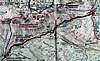
Map
Despite of very sophisticated way of folding, not always real presentation of marked paths and 50m relief sections "Rila 1:55 000" map published by Kartografija EOOD in 2003 is quite useful and can be recommended.
As far as in 2005 it costs ca 4-5 euro depending on the place of purchase.