
-
 4284 Hits
-
 74.01% Score
-
 4 Votes
|
|
Route |
|---|---|
|
|
51.22463°N / 116.10987°W |
|
|
Scrambling |
|
|
Summer |
|
|
Most of a day |
|
|
Moderate |
|
|
Overview/Approach

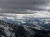
This is a 4200’+/- ascent day. Mount Whymper has to be one of the most accessible scrambles in Alan Kane’s Scrambles in the Canadian Rockies guide book. You start gaining elevation from the Kootenay Parkway (Highway 93). I did Mount Whymper in 4.5 hours round trip. Alan suggests 6-8 hours which is no doubt more in line. I did do a variation from the book and descended differently than I ascended making for a nice traverse.
Park at the Stanley Glacier parking lot on Highway 93. Mount Whymper is directly across from Stanley Peak and bestows fantastic views of its north glacier/face routes on your entire ascent. Hike back east on the highway for approximately half a kilometer aiming for a broad avalanche gully flanking Mount Whymper to the east. A serious fire in Kootenay several years ago has laid waste to most of Mount Whymper’s eastern tree line. There are no trails to follow on ascent, but the going is fast and easy on the left side of the drainage bank.
Route Description

After a fast 2000’ ascent, you reach easy water worn rock. Follow the left drainage up a few steps of scrambling and continue up the drainage as it sucks you back left some more and the rock becomes less firm and more rubble. Another 1000’ of ascent puts you right below a large cirque full of rock bands and snow (early June). This is where I varied from the standard scramble route due to steep rotten snow slopes and opted instead to climb some large quartzite blocks on the left side of the cirque. I gained the left hand ridge (which continues to circumvent Mount Whymper) and maneveauvered through a few short sections of snow to the base of these massive blocks. I climbed the first set via some 5th class climbing through the middle and then traversed to my right to break through the steeper higher blocks on easier ground, albeit still 5th class.

Once on top of these rock band obstacles, I ascended snow to the summit ridge, but was faced with significant overhanging cornices to break through. If you traverse right under these cornices (if the sun is out, you are taking a risk), it is easier to chop through a less severely angled portion. Once through the cornice and onto the ridge, it is a pleasant hike to the summit cairn. There was a summit register in 2006. I was the first to sign the register in 2006 (June), the last sign in coming in August, 2005.
I chose to descend via the south ridge to a col between Mount Whymper and an unnamed peak. From this col, I glissaded down snow for approximately 1000’. You come to an area full of avalanche debris and the start of a running drainage atop the tree line. I stayed in the burnt forest to the left of the drainage for another 1000’ before moving along side it to avoid the deadfall. The drainage is not easy going, I recommend staying in the trees. The deadfall is not overwhelming due to the fire. You must angle left to reach the Stanley Glacier parking area.
Essential Gear
Helmet, Gaiters, Alpine Ax, Hiking BootsClimbing Sequence
 |
 |
 |
 |
 |
 |
External Links
- 100’s of Canmore and Banff National Park multi-pitch rock climbs, ice climbs, alpine climbs and scrambles, just scroll down to routes
- OR: Best True Technical Clothing and Accessories in the Outdoor Industry
- Scarpa, has surpassed La Sportiva in terms of quality, function, value
- Osprey Backpacks, Not a Second Choice
- Great Outdoors Depot
- Mont-Bell
- Cascade Designs (MSR; Thermarest; Platypus)