|
|
Route |
|---|---|
|
|
36.46380°N / 50.92588°E |
|
|
Mountaineering |
|
|
Summer |
|
|
A few days |
|
|
Hike |
|
|
Getting There
From the shelter on the west end of the town of Roodbarak, drive a dirt road to a place called Vandar Bon. You will find another shelter at this spot. The road continues a little more to end at an elevation of 2350 m. Total distance from Roodbarak shelter to the end of the road is 12 Km.Route Description
All distances are per my GPSPlace………………Elevation (m)…………Distance (Km)
Vandar Bon………..2350…………………...zero
Kaljaran Pass………4104……………………9.5
Ghobi……………….4430……………………3.1
Looy Na…………….4340……………………1.5
Mazi Gardan………...4140……………………2.2
Total……………………………………………16.3 Km
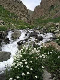
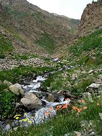
Start hiking on the established trail. Soon you will reach a signed (In English & Farsi) split. Left will take you to Alam Kooh. Take right for Kaljaran/Kalahoo and follow the stream all the way up the Kaljaran Valley to Kaljaran Pass (4104 m). You will find a trail that follows the stream but in some places the trail fades away and you might have to whack your way through dense bushes. For the most part, however, the growth is not dense. In a few places, you will have to cross the stream but you can just hop over the rocks.