
|
|
Route |
|---|---|
|
|
37.25910°N / 111.92344°W |
|
|
Hiking, Scrambling |
|
|
Spring, Fall |
|
|
Most of a day |
|
|
Overview
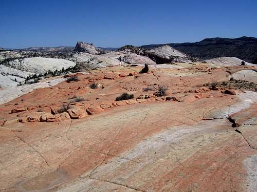
This route is the easiest route up Yellow Rock. It can be done in a few hours each way, but there is so much to see and so much fantastic scenery that you will likely want to take much longer. There is no shade along the route so try doing the route in cooler weather. Also, make sure to do it on a clear day for the best colors. Castle Rock as seen from the climb up Yellow Rock. Both Castle Rock and Yellow Rock are fantastic little summits to climb.
Getting There
You can access the Yellow Rock trailhead from the north or the south, but either route involves the Cottonwood Wash Road. In dry conditions, roads are good for all vehicles.From the north, drive Highway 12 from Cannonville (between Bryce Canyon National Park and Escalante) south then east along the paved road to Kodachrome Basin State Park. After 7.3 miles, there is a junction with the left fork heading for Kodachrome Basin. Instead of turning north to the state park, continue along the Cottonwood Wash Road (mostly unpaved but in good condition). Drive another 24.6 miles (use a map) to the trailhead at the mouth of Hackberry Canyon.
From the south, drive Highway 89 between Kanab and Page to the Cottonwood Wash Road between mile markers 17 and 18. Follow the Cottonwood Wash Road for 14.6 miles to the trailhead at the mouth of Hackberry Canyon.
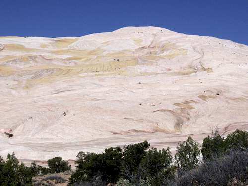
 View of the very colorful country around Yellow Rock.
Route Description
From the trailhead, walk west and cross Cottonwood Wash, which usually has water in it (maybe bring an old pair of wading shoes just for this crossing). The mouth of Hackberry is just ahead, but instead of heading into the canyon turn left and hike south along the cliffs. A short distance after hiking along the cliffs, look for a hiker made trail up the drainage to the right (south). Follow this steep trail up the slopes and it will access the slickrock sea of Yellow Rock which will be seen dead ahead. There is a cairned route up the rock, but you must pay close attention to where you are in order to keep the route at class 2.The entire route across the slickrock and up to the summit of the peak is a fantasy land of colored rocks including, red, white, yellow, orange and purple. Enjoy this fantastic summits and the excellent views.
There are other routes available up the peak, but the above route is by far the easiest. If trying another route, use caution as some of the slopes surrounding the rock are quite loose. The route above has stable footing and is fairly easy.
 Yellow Rock is easy to climb, but is one of the best summits in the world. This is the upper part of the route.