Routes

Routes

6/13/09 We biked/hiked/climbed the red route to the summit. You can see our starting point in the lower left, by the "SUNDAY" waypoint. On our ascent, we started up the yellow route, but needed to drop down to the left to avoid a large ridge gendarme. Based on Tom Cushing's trip report, I'm confident the dotted-yellow route would go. On 6/7/08, Brian Booth followed the purple route, before avy danger turned us around at 4800.' Brian's done this route a couple of times, so I'm confident the dotted purple route would go too. "SAD" is the 4200' Phelps-McLain saddle, and "ROCK" marks the rock outcroppings where the south ridge starts. You either go right to follow the south ridge, or left to traverse toward the saddle. The logging roads and waypoints on the left are in preparation for a possible future logging road approach to McLain Peak.
larryN
on Nov 8, 2009 1:29 am
Image Type(s): Topo/Diagram
Image ID: 571516

Comments

Post a Comment
Viewing: 1-2 of 2

JR1 - Jul 20, 2010 12:31 pm - Hasn't voted
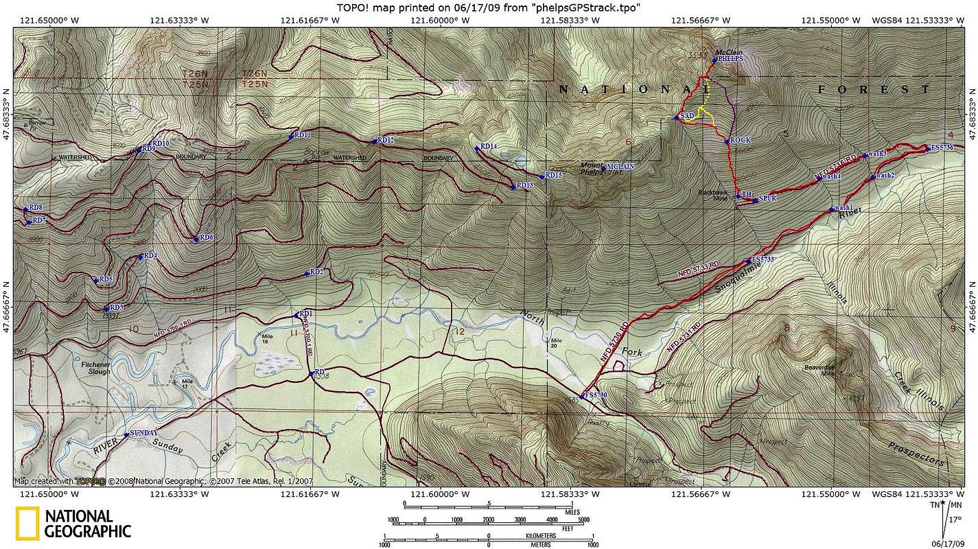
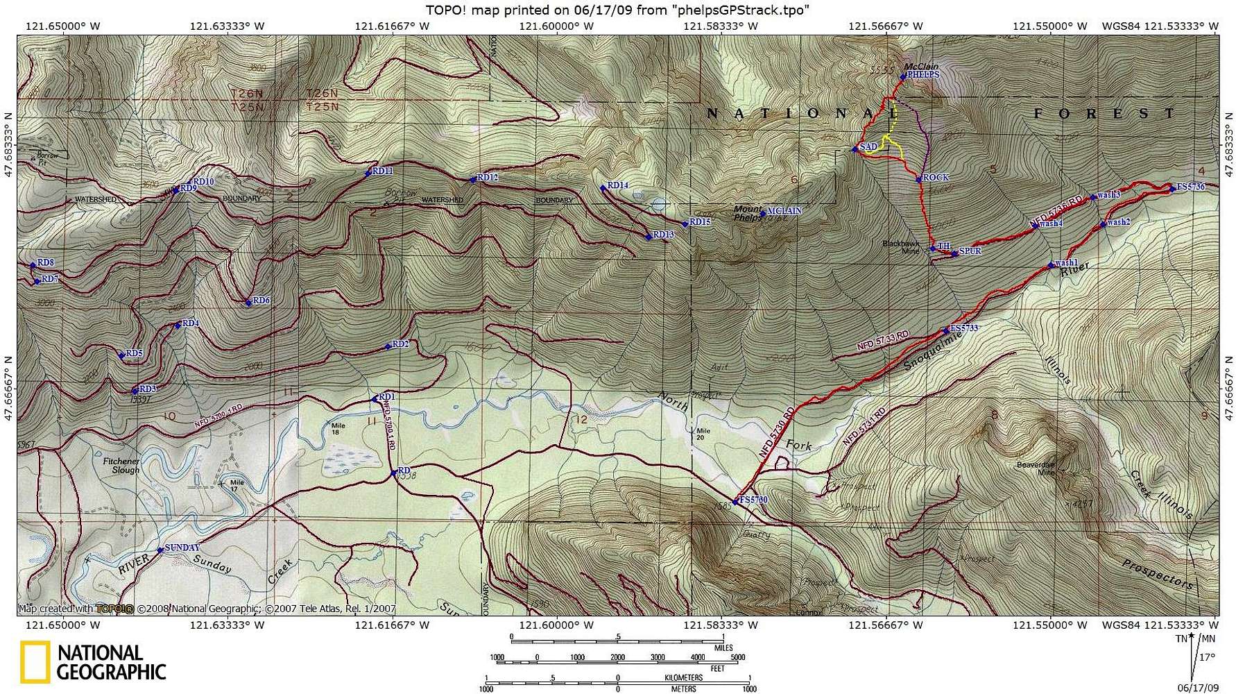
GPS waypoints

Do you have and would you mind sharing the GPS waypoints on the topo you included in your report. I am heading up there in a couple of weeks.

larryN

larryN - Jul 24, 2010 10:36 pm - Hasn't voted

Re: GPS waypoints

Sorry, but my computer crashed a couple of weeks after my Phelps climb, and I lost the TOPO! file. Fortunately, I had already emailed the .jpeg of the map, and was able to post it here. So your best option is scaling them off this map. Note that the coordinates are WGS 84. I have more recent beta that some of the road approach has been repaired. You can call the N Bend ranger station number I posted for the details.

Viewing: 1-2 of 2