Toggle navigation
Mountains
Routes
Images
Trip Reports
Forum
What's New
People
Areas & Ranges
Articles
Trailheads
Canyons
Huts & Campgrounds
Albums
Logistical Centers
Fact Sheets
Lists
Custom Objects
Gear
Plans & Partners
WELCOME TO SUMMITPOST
SIGN IN
REGISTER
Mount Silverheels
Additional Parents
Image
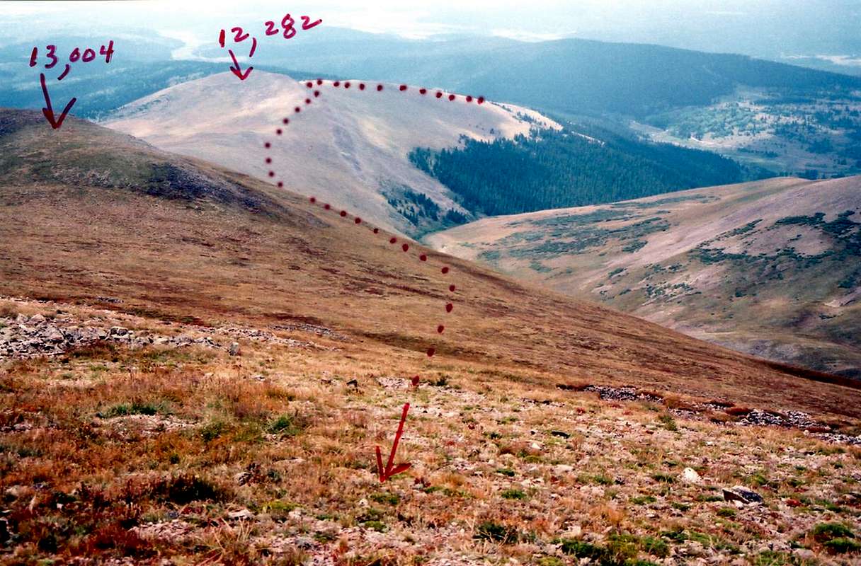
S. Ridge Route looking down
View High-Resolution Image
S. Ridge Route looking down
Easy to follow route, if visibility is good. White-out due to clouds, mist, or snow, could cause a mis-direction due to vast openess of area. Make GPS waypoints to help find your way back on the descent. 9-7-07
« PREV
NEXT »
slowbutsteady
on
Sep 22, 2007 8:22 pm
Comments & voting
Other parents
Lat/Lon:
39.33920°N / 106.0047°W
Image Type(s):
Informational
Image ID:
339733
990 Hits
0
% Score
0
Votes
Log in to vote
Comments
No comments posted yet.
to post!
Don't have an account?
Mount Silverheels
(Mountain/Rock)
« PREV
Viewing
#77 of 77
GALLERY
You are at
the Last
Image
slowbutsteady's Image Gallery
« PREV
Viewing
#657 of 670
GALLERY
NEXT »
×
You need to login in order to vote!
User Name
Password
Remember me
Forgot your password?
Log me out when I close my browser.
Keep me logged in all the time.
sign in as a user
Don't have an account?
Register now for FREE
Rating available
Suggested routes for you
People who climb the same things as you
Comments Available
Create Albums
Register Here


