
|
|
Custom Object |
|---|---|
|
|
Test site |
Sandbox
This is a sandbox, intended for testing page layout, HTML scripting, etc.Please do not vote for this page.
Map
 Approach
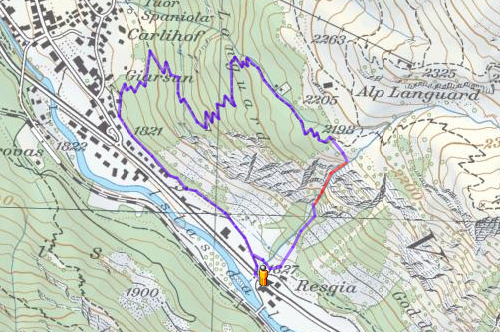

From Chur over the Julier pass to Pontresina or from Austria following the Inn valley. Trains operate from Chur to Pontresina with a changeover in Samedan. Nearest train stop to the fall is Surovas, one stop behind Pontresina.
Along the Via da Bernina, 650 m southeast of the city of Pontresina to a public parking lot (parking meter, ca 1 CHF/hour) at the company Seiler (1827 m).
From the parking lot follow the slope through the forest directly to the fall (30 min).
Google Earth Overview
Placemarks:
Dirruhorn Subpeaks & cols Other summits
Routes Approaches Huts
Views:
Routes:
Dirruhorn Subpeaks & cols Other summits
Routes Approaches Huts
Views:
Routes:
| Blue | SSE Ridge |
| Yellow | N/NNW Ridge |
| Red | Dirrujoch NE Couloir |
| Green | Selle E couloir |
| Purple | Nadelgrat Ridge |
| Black | Approaches |