
Viewing: 1-1 of 1
zola - Aug 13, 2014 12:44 pm - Hasn't voted
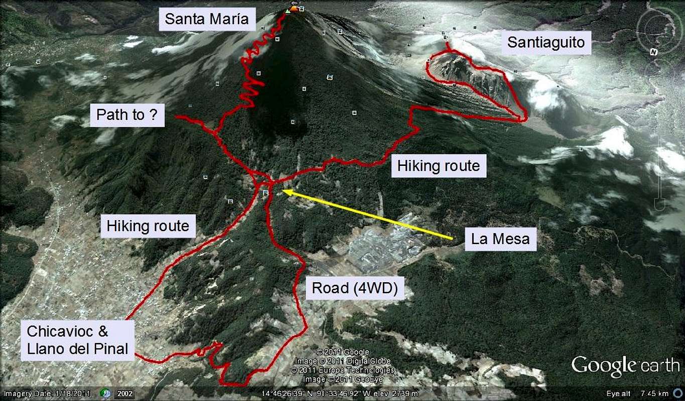
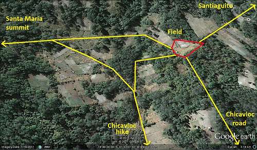
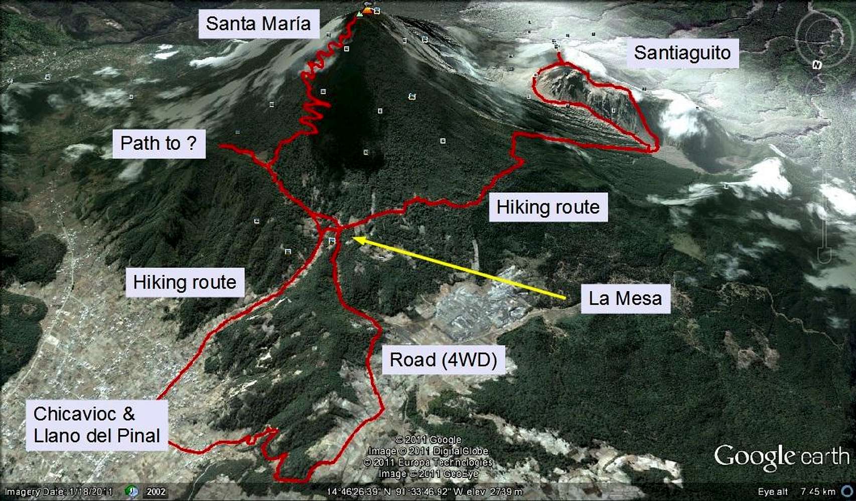
Path to?This is actually the path from Llano del Pinal (no tilde). The condition of the path is great. To reach the main summit trail from Llano del Pinal, one veers to the right towards Santa Maria just before reaching the top of a plateau nestled between Santa Maria and a small mountain ridge on the left, approximately 1 hour of walking from where the bus drops you off for the hike. The path is a ditch about 2-3 feet deep littered with white gravel/rocks that leads into the woods. A white arrow painted on a tree marks the trail for the summit. Happy trails!
Viewing: 1-1 of 1


Comments
Post a Comment