
|
|
Mountain/Rock |
|---|---|
|
|
60.74547°N / 46.04994°W |
|
|
Hiking |
|
|
Summer |
|
|
1260 ft / 384 m |
|
|
Overview
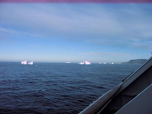 icebergs outside the port at Qaqortoq
The city has a population of about 3,500 and the buildings are all gaily painted. The official website for Qaqortoq has a hiking trails map which I have attached as a link, but it does not have any details on how one should approach this summit. One approach is to hike up to the town soccer field which can be reached as described below. From the NE corner of the field, you can find a faint trace of a trail heading up a gully in a NE direction.
Qaqortoq is an Inuit word meaning “the white place”. That description probably is true much of the year, but on July 6, 2010, they had one of their unusual sunny days and we made the most of it climbing to Peter's cairn and then doing Saqqaarsik.
Getting There
 colorful buildings in Qaqortoq
Red Tape
There does not appear to be any problem with hiking across the hillsides in Qaqortoq.Route description
To reach the summit, starting from the town pier, take the following streets…go to the visitor center (N of the pier); turn right (E) and follow Vatikanbakken street E and NE; take a right on Sanatorievej street; take the first left onto Ringvej street and continue to the soccer field.From the NE corner of the soccer field, go NE up the drainage to the ridge top.
 gully to ridge top
 route photo
An alternative route can be used to descend heading west after reaching the valley floor at the base of the mountain. This will take you into the edge of town where the trail map show the trail that heads around the large lake north of town.