Toggle navigation
Mountains
Routes
Images
Trip Reports
Forum
What's New
People
Areas & Ranges
Articles
Trailheads
Canyons
Huts & Campgrounds
Albums
Logistical Centers
Fact Sheets
Lists
Custom Objects
Gear
Plans & Partners
WELCOME TO SUMMITPOST
SIGN IN
REGISTER
Rhinogs/Rhinogydd
Additional Parents
Image
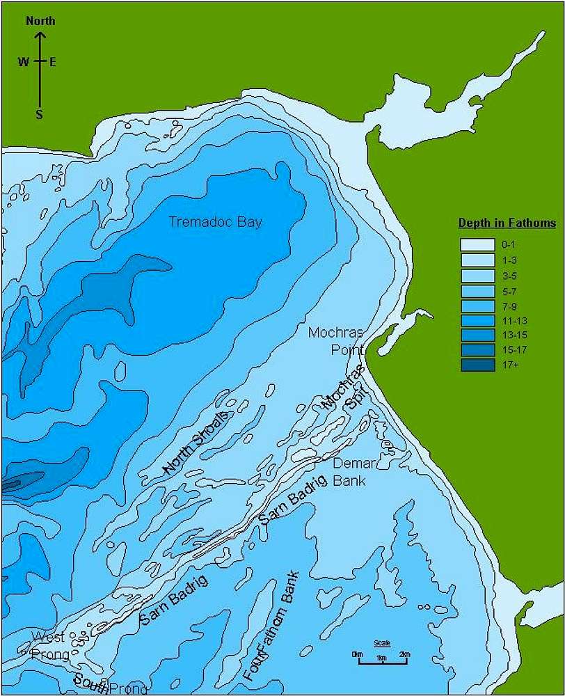
Sarn Badrig
View High-Resolution Image
Sarn Badrig
Ocenaographic map of Sarn Badrig showing depth in fathoms.
This map is based upon Ordnance Survey material with the permission of Ordnance Survey on behalf of the Controller of Her Majesty’s Stationery Office © Crown copyright. Unauthorised reproduction infringes Crown copyright and may lead to prosecution or civil proceedings.
« PREV
NEXT »
Nanuls
on
Apr 25, 2007 3:24 pm
Comments & voting
Other parents
Lat/Lon:
52.79114°N / 4.21875°W
Image Type(s):
Topo/Diagram
Image ID:
288346
8344 Hits
0
% Score
0
Votes
Log in to vote
Comments
No comments posted yet.
to post!
Don't have an account?
Rhinogs/Rhinogydd
(Area/Range)
You are at
the First
Image
Viewing
#1 of 1
GALLERY
You are at
the Last
Image
Nanuls's Image Gallery
« PREV
Viewing
#2335 of 2366
GALLERY
NEXT »
×
You need to login in order to vote!
User Name
Password
Remember me
Forgot your password?
Log me out when I close my browser.
Keep me logged in all the time.
sign in as a user
Don't have an account?
Register now for FREE
Rating available
Suggested routes for you
People who climb the same things as you
Comments Available
Create Albums
Register Here


