
|
|
Route |
|---|---|
|
|
40.70700°N / 110.948°W |
|
|
Hike/scramble |
|
|
Most of a day |
|
|
Class 2+ |
|
|
Approach
Bald Mountain Trailhead: This signed trailhead is located off Highway 150 on the west side 29 miles east and north of Kamas, or 49 miles south of Evanston.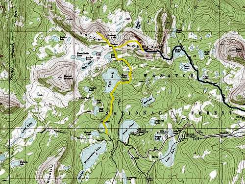 Blue = Notch Lake Route.
Route Description
From the trailhead, take the trail west that is posted for Notch Lake. The other trail leads to the summit of Bald Mountain (see the page for Bald Mountain for information on hiking Bald Mountain). The trail heads west and then northwest around the base of Bald Mountain to Clegg Lake, which is about 1.5 miles from the trailhead. Clegg Lake is in a beautiful setting with views of Bald Mountain and Reids Peak rising to the east. The trail skirts around Clegg Lake and heads north. Notch Lake is reached after another .7 miles past Clegg Lake. Notch Lake is in a spectacular setting with the impressive east summit of Notch Mountain rising to the west. Reids Peak forms a perfect cone east of the lake. Many peaks of the High Uintas Wilderness Area are also visible from Notch Lake.From the west end of Notch Lake, climb cross-country through the benches to the southwest and climb up to the south ridge of the summit of Notch Mountain. Scramble and boulder-hop north up the steep ridge to a false summit. The highest peak can be reached by heading west along the ridge for .5 miles. There are spectacular views of all the surrounding lakes, basins, and peaks. A very scenic climb indeed!
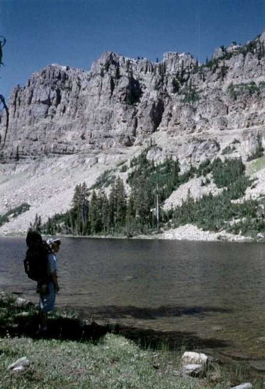 Notch Mountain from Bench Lake.