|
|
Route |
|---|---|
|
|
40.69510°N / 111.018°W |
|
|
Scramble |
|
|
One to two days |
|
|
Class 2+ |
|
|
Approach
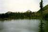
From Oakley (State Route 32), turn east on the Weber Canyon Road. Follow this road east for about 12 miles to where the Smith and Morehouse Road turns south. Go straight and pass under the big ranch gate that says "Thousand Oaks Ranch". This is a public road, the ranch just wants to make it look private. Read the sign that informs you that either side of the road is private land for the next several miles. The land between Thousand Oaks and Holiday Park is private, so stay on the main road and don't camp along it. Follow the good gravel road to Holiday Park. Once at Holiday Park, follow Uinta Road to the parking lot and outhouse . You will need a 4wd for the remainder of the drive, unless the road has been recently improved by the forest service. From the parking lot described above, drove to the west end of the parking lot and cross the river. The crossing used to be really rough, but the forest service has done work on it in recent years. Follow the road west to a junction and turn left. There is a sign pointing the way to Gardners Fork. Follow the road southwest to another junction. Both tracks meet up eventually, so either fork is fine. There are also a few short dead end side tracks, so some backtracking might be necessary. Do not take any of the side tracks that head too far away from the stream. Drive as far as you can and park. In the late 1990's, the best place to park was went a cliff was just west (right) of the road, but rumor has it that the road is not as rough as it used to be.Route Description
This is a very solitary route and a good map and routefinding skills are required.From the 4wd trailhead near the cliff (see above), walk up the steep 4wd track. This track becomes a trail after just a short distance. The trail is easy to follow for just over a mile to Fran Lake (named on the Division of Wildlife Service maps, but not on the USGS or Forest Service maps), but there is one section accross a meadow that is a bit faded. There is a trail around this lake, but the trail to Anchor Lake is hard to find at this point. Time to pull out the map and compass, or the GPS. There are two possible routes to Anchor Lake. One is to go to Rhodes and Olsen Lakes and then south, and the second is south along the base of the mountain to Anchor Lake. The second route will be the one described here. Note that which ever route you choose, that the topo and forest service maps bear no relationship to reality when it comes to showing trails in the area, and if a trail is shown on the map, it often doesn't exist or is marked in the wrong location! From Fran Lake, head south then southeast from Fran Lake staying close to the base of the mountain to the west. After about .4 miles, a pretty good trail is picked up. Follow this trail southeast along the base of the ridge. Shortly after the trail takes a trun to the south, there is a four-way junction, but it is not marked and may be missed. Just continue along the base of the ridge until Anchor Lake is seen below in a bowl. There is a carined route directly down the extremely steep slope to the lake. An easier route is to head left (east a bit) and descend another for a short distance to another carined route. Either way, the final section of the route to Anchor Lake is very steep and you must choose a route carefully to avoid a few small cliffs. Keep a close eye out for cairns. The lake sits in a beautiul and secluded bowl with views of many spectacular peaks.
There are several route possibilities from the Anchor Lake area. If you wanted to climb the north peak Long Mountain, you could head east on on indistinct trail from the hard-to-find four way junction mentioned above. If you do't find any of the trail, just forget about looking for the trail and head west to the pass marked as 10,803 on the topo map. The route is marked with cairns and is steep, but not difficult. From the pass, you can follow the ridge south over the north peak of Long Mountain, down to another pass, then continue south to the highest summit of Long Mountain. This route stays above timberline for a long distance and you must not do the route if there is a threat from thunderstorms.
The easiest way to climb the highest summit of Long Mountain only from Anchor Lake is as follows. Forget about finding any of the trail marked on the map, as it is not worth the effort to try to find it. After several trips and searching I have come to the conclusion that it doesn't exist. From Anchor Lake, climb south and down a bench and follow the base of the ridge of "North Long" and Long Mountains to the west for about two miles. There are many beautiful and secluded meadows and ponds throughout this area. This is an up-and-down route. Your goal is the obvious pass located to the southeast of Long Mountain. Climb up the slope to the pass. From the pass, follow the ridge northwest to the summit of Long Mountain. There is some boulder-hopping and scrambling along the route.
The total round-trip distance is 12 miles, but since much of the route doesn't have a trail, it is a very long day hike. There are many secluded campsites along the way, so consider doing the trip in two days.