
|
|
Area/Range |
|---|---|
|
|
52.54073°N / 2.80346°W |
|
|
Hiking, Mountaineering, Trad Climbing, Bouldering, Mixed, Scrambling |
|
|
Spring, Summer, Fall, Winter |
|
|
1772 ft / 540 m |
|
|
Section-1 Shropshire as a county:-
There is a lot to say about the county of Shropshire, with its many hills, dales and valleys, it is a county of true picture post-card quality and is worth sharing with everyone. This page covers in detail the portion of Shropshire famous for its enchanting Area of Outstanding Natural Beauty (AONB), the Lat/Long of which is given here as the town of Church Stretton, which lies almost central to the AONB area when the Elevation of 540 metres given is for the summit of Brown Clee Hill the highest point within the AONB area.| “In his London exile over 80 years ago, the poet A. E. Housman, recalling the land about the rivers of Onny, Teme and Clun, remembered it as ‘The country for easy livers, the quietest under the sun”. People do not hurry here in Shropshire |
A little bit about Shropshire:-
Within England there is an area bordering Wales known as the Welsh Marches. Within this area is one of the greatest and most ancient counties of England, known as Shropshire. This is one of the largest Land Bound counties in the United Kingdom, for the county has no coastline.
Despite lacking a coastline, the county of Shropshire has many features that make it an area worthy of visiting. It has the longest river in England, Scotland and Wales passing through it, this being the mighty River Severn, where its source starts high up within the Cambrian Mountains on the great summit of Plumlumon Fawr.
The county also has one of the most historic and prettiest county towns you could ever wish to visit, this being the great town of Shrewsbury, where the streets are clad with black and white timber-framed buildings dating back to the Tudor period, a lovely medieval castle and the very impressive medieval church of St Mary’s. This mighty church now redundant and owned by the Churches Conservation Trust is famous for its medieval stained glass windows. Its spire, a landmark for miles around is said to be the third highest in England and rises over 300 feet above the great meandering curve of the River Severn that winds round the town.
 Welsh Bridge Shrewsbury
 Shrewsbury Town Centre
 English Bridge Shrewsbury
Section-2 The area of Shropshire known as the AONB:-
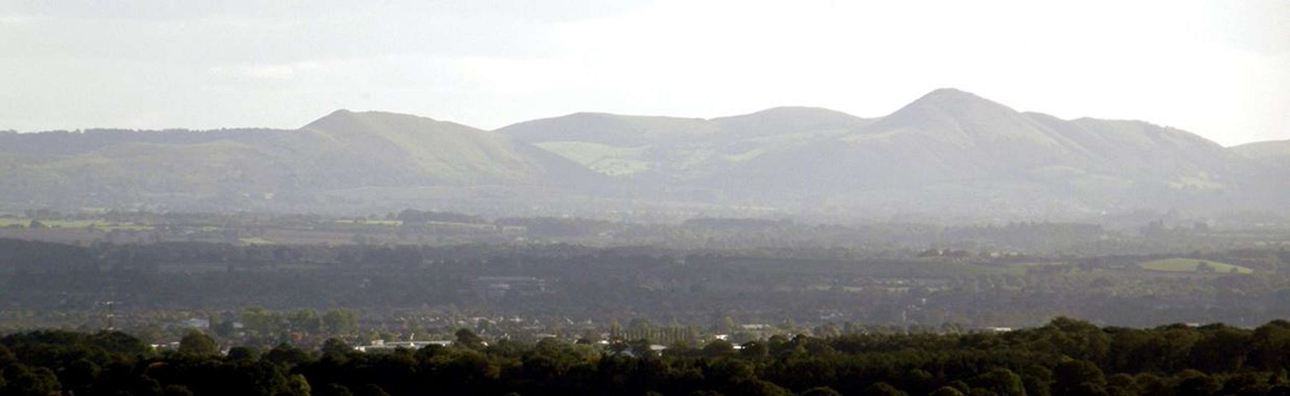
Getting to the serious stuff:-Getting down to the serious stuff; the county then has its wild and remote side consisting of striking upland. This has impressive hills along with deep valleys, bleak, barren open moorland and is dotted with quaint historic towns and villages.
 Heather covered Long Mynd seen from Pole Cottage near Pole Bank
This is where the Area of Outstanding Natural Beauty, or AONB for short, makes up the region called The South Shropshire Hills. Its AONB status was designated in the year of 1958 and the area encompasses a vast region of about 310 square miles. This area of land is situated primarily in the South Shropshire district of the county. The A49 a major road and the Welsh Marches Railway both bisect the area north-south, both of these pass through or near the main towns of Shrewsbury, Church Stretton, Craven Arms, Ludlow and Leominster.
The history of this area ranges from Iron Age hill-forts, Saxon earthworks and Norman castles. These are just a small reminder of the battles that were fought here in these hills many years ago…!
Section-3 The hills that make up the AONB area:-
  |
The area has a magic touch to it and even a sense of mystery. The Long Mynd and Stretton Hills along with their characteristics could make you think more of the landscapes associated with central Wales, the Fells of North Yorkshire or the Scottish Southern Uplands, as in Moffat and the Cheviots. The Stiperstones Ridge and its rocky tors have a totally different feel and give a sense of somewhere like that of Haytor Rocks on the vast area of Dartmoor in Devon.
The only difference of course is there heights.
Many of the hills within the AONB area have the status of a UK Marilyn, see the list of summits below for more details.
| Summit - Top Name | Height Metres | Height Feet | OS - Map | Grid Reference and Streetmap Link | Summit Feature | Marilyn | SubMarilyn | Dewey |
| Brown Clee Hill | 540 | 1772 | 137 and 138 | SO 59365 86555 (Streetmap Link) | trig point: OS measurement | TRUE | FALSE | TRUE |
| Stiperstones - (Manston Rock) | 536 | 1759 | 137 | SO 36755 98650 (Streetmap Link) | trig point: OS measurement | TRUE | FALSE | TRUE |
| Titterstone Clee Hill | 533 | 1749 | 137 and 138 | SO 59140 77955 (Streetmap Link) | trig point: OS measurement | TRUE | FALSE | TRUE |
| Long Mynd - (Pole Bank) | 516 | 1693 | 137 | SO 41520 94445 (Streetmap Link) | trig point: OS measurement | TRUE | FALSE | TRUE |
| Clee Burf | 510 | 1673 | 137 and 138 | SO 594 843 (Streetmap Link) | no feature | FALSE | FALSE | TRUE |
| Caer Caradoc Hill | 459 | 1506 | 137 and 138 | SO 47745 95395 (Streetmap Link) | summit rocks | TRUE | FALSE | FALSE |
| Heath Mynd | 452 | 1483 | 137 | SO 33560 94085 (Streetmap Link) | trig point: OS measurement | TRUE | FALSE | FALSE |
| The Wrekin | 407 | 1335 | 127 | SJ 62805 08100 (Streetmap Link) | trig point: OS measurement | TRUE | FALSE | FALSE |
| Ragleth Hill | 398 | 1306 | 137 and 138 | SO 454 921 (Streetmap Link) | no feature | FALSE | TRUE | FALSE |
| Sunnyhill | 393 | 1289 | 137 | SO 327 837 (Streetmap Link) | no feature | FALSE | TRUE | FALSE |
| Burrow | 358 | 1175 | 137 | SO 38115 83090 (Streetmap Link) | grassy knoll | TRUE | FALSE | FALSE |
| Callow Hill | 335 | 1099 | 137 and 138 | SO 46060 85040 (Streetmap Link) | tower west corner; true summit | TRUE | FALSE | FALSE |
| View Edge | 321 | 1053 | 137 | SO 42270 80995 (Streetmap Link) | mound in trees | TRUE | FALSE | FALSE |
| Earl's Hill | 320 | 1050 | 126 | SJ 40948 04837 (Streetmap Link) | trig point: OS measurement | FALSE | TRUE | FALSE |
Section-4 The three main peaks of Shropshire:-
Brown Clee Hill, Stiperstones Ridge and Titterstone Clee Hill:-These are the three highest peaks of Shropshire and are all worth a visit. All three of these summits have the status of a UK Marilyn and support OS-Trig points. Brown Clee Hill's trig-point is now sadly replaced by a viewing plate. All three of these summits command fine views.
 Brown Clee Hill
 Stiperstones Ridge
 Titterstone Clee Hill
1 - Brown Clee Hill:-
Although not as dramatic in shape when compared to many of the other hills within the AONB it is Shropshire’s highest. The hill reaches a height of 540 metres at the main summit top known as Abdon Burf. This height also gives the county of Shropshire another point of interest. The hill as in facts, figures and heights, also gives the county of Shropshire the 13th highest hill per county within England.
Abdon Burf commands fine views in all directions. On the clearest of days you can see the buildings within the city of Birmingham. In fact the large space age looking square telecommunications radio tower on its summit belongs to British Telecom and use to be a long distance line-of-sight microwave link through to the famous landmark British Telecom tower that dominates the skyline of central Birmingham.
The summit is crowned by the two large radio towers, the British Telecom one and second the smaller one belonging to West Mercia Police Authority. The summit also has a panoramic plate that sadly replaced the summits OS-Trig point. There are a number of natural ponds on the summit. There is a really easy way to access this summit by following the road that is there for vehicle access to the radio towers. There is a locked gate at the bottom with a style on the fence then just follow this road all the way up. For the more interesting routes up there are other footpaths from smaller roads that skirt round the northern and western sides of the hill.
The hill has another top further to the south known as Clee Burf. This reaches a height of just over 500 metres and is like many of Shropshire’s other high points, crowned by two more radio towers. The two radio towers here are the Rx or Receive site for the National Air Traffic Tx or Transmit site radio station on the neighbouring Titterstone Clee Hill which is clearly visible from here across the way when looking south.
Streetmap link - Brown Clee Hill
2 - Stiperstones:-
This is the second highest of Shropshire’s hills, reaching a height of 536 metres at its OS-Trig point. The Stiperstones Ridge also has to be one of the most unusual. The geological structure has considerable interest due to the large distinctive outcrops of quartzite that are scattered along its ridge. These are known more commonly as tors and these rock features are more common to areas such as Dartmoor in Devon and Bodmin Moor in Cornwall, where they consist of granite not quartzite. Another area that is also famous for its tors is the Pennines that stride throughout the counties of Yorkshire and Derbyshire.
The Stiperstones consist of a long slender ridge that runs in a south-west to north north-east direction. In comparison to the Clee Hills this is a bleak, lonely and quiet place, which in the winter can be harsh. The area has also been known to have a supernatural reputation and there are deserted ruins of the local lead mines at the village of Snailbeach that contribute to the areas eerie atmosphere.
Particularly notable on the ridge are the tors of Cranberry Rock, Devil's Chair and Shepherd's Rock. The highest of its tors is that known as the Manstone Rock. This tor that supports the OS-Trig point commands fine views especially when looking west into Wales. These views are very impressive and many of the big Welsh summits such as Cadair Idrs, The Arans and Arenigs are visible on clear days.
Streetmap link – Stiperstones
3 - Titterstone Clee Hill:-
This is Brown Clee Hill’s neighbour, located a few miles south and nearer to the town of Ludlow. The summit with its OS-Trig point at 533 metres is now home to two large radar towers both surmounted with white domes on there tops. The largest of these on a concrete column is the Air Traffic Control radar for the UK’s National Air Traffic Services or known as NATS. The other, a lattice steel tower with the smaller dome is for the national weather belonging to the NRSA. The summit also has two large radio towers both belonging to the NATS at there strategic control centre. Many years ago the hill had thriving industry on it and the scars left behind of the now deserted quarries that strewn across its western banks show to this. It is the third highest of Shropshire’s hills and like Brown Clee Hill commands fine views in all directions.
Access to this hill is very easy as a road leads direct from the main road at the villages of Angelbank, Dhustone and Farden. This road leads to a viewpoint and public car park just near one of the many old quarries. From here you can walk up the steep banks almost direct to the summits OS-Trig point or follow the large tarmac road up past the radio towers then up to the radar structures and you can access the OS-Trig point that way making things a bit easier but longer.
Streetmap link – Titterstone Clee Hill
 Abdon Burf radio towers
 Stiperstones Ridge and tors
 Titterstone Clee Hill radars
Section-5 The Long Mynd and Pole Bank:-
After the three peaks of Shropshire, The Long Mynd being the fourth highest is a vast area of upland consisting of bleak and open moorland. The area which is characterised by a series of smoothly swelling hills has more the feeling of central Wales, such as the Cambrian Mountains or Radnor Forest, than that of its English neighbours. The other area it has the feel for is the Scottish Southern Uplands like the hills of Moffat and the Cheviot. The Long Mynd with Burway Hill and Carding Mill Valley from Hazler Hill
As its name suggests the Long Mynd, Mynd being a bastardisation of Mynydd, meaning mountain in Welsh, is long, in fact it is very long. The upland area stretches about 6 miles long in a south-west to north-east direction. It has some very impressive valleys, known here as hollows or batches. These cut deep into its sides in a north-west to south-east direction with the most famous of these being that of Carding Mill Valley. This is a fine valley that belongs to the National Trust. The one main problem the area can suffer is that it becomes very over populated in the summer months. Being a main National Trust visitors centre with a café on site and the area also being of geological interest, many school day trips are also spent here. This does not matter though as you can always walk out onto the Long Mynd’s vast open summits and walk in the silence for miles without seeing anyone.
 Looking up Cardingmill Valley
 The White Spout Waterfall
 Looking down Cardingmill Valley
At the end of the Cardingmill Valley the Long Mynd has a pretty little waterfall known as the White Spout. It drops about 30 feet over a cliff and the stream runs off the areas upper levels. In the summer months the Long Mynd is dappled in purples, pinks and reds with the many wild types of heather that grow. Also on its summits are yellow patches from the Gorse that grow out on its barren landscape.
The highest point of the Long Mynd is at a place known as the Pole Bank reaching a height of 516 metres. It is here where the OS-Trig point is, along with a panorama plate surmounted on a circular brick pillar giving the names of all the summits in view from this point. Pole Bank a UK Marilyn is within easy reach from one of the minor roads that run along the length of this large area of upland. These roads can in the winter be very dangerous and it is advised not to take your car up them in the extreme ice or heavy snow. A road that is definitely worth driving up to get out onto the Long Mynd is that called the Burway. This very steep and narrow road with its passing places heads up onto the Long Mynd from the town of Church Stretton. The road commands some fine views up into the Cardingmill Valley but keep your eye on the road as there is no protection on the edge. When the road levels out near its top it is worth stopping and taking a walk up the steep ridge also called the Burway. From here the views out over Church Stretton, up through the Cardingmill Valley and out across all of the Stretton Fault Line summits are impressive.
Streetmap link – Pole Bank
 The Long Mynd looking west into Wales from Pole Bank
Section-6 Hills of the Stretton Fault line:-
The famous Church Stretton fault line created some of the most distinctive hills in this area these being The Wrekin, Caer Caradoc, The Lawley and the much smaller Ragleth Hill. The shapely summit of Caer Caradoc Hill just before a storm
This is a dormant fault line in the earth's crust. When this fault was active many eons ago there would have been many volcanic eruptions and earthquakes in the area. This fault line is clearly visible especially from the summit of The Wrekin when looking in a south west direction. When looking south west the summits of The Lawley and Caer Caradoc are both seen in the line that the fault followed.
The fault line showed its presence At 14.50 on 2nd April in the year 1990 when there was a small earthquake in Shropshire due to a slight movement in this fault. Only minor damage was caused to buildings in some of the local towns. I remember this earthquake very well as I was at a boarding school just north of Shrewsbury when it happened. There was a thud like noise and the room shook. Out of all the subjects we were studying at the time it was geography…!
 Caer Caradoc from the north
 The Wrekin early evening
 The Lawley from Burway Hill
Caer Caradoc Hill:-
Caer Caradoc Hill at 459 metres, and having the status of a UK Marilyn, has to be one of the most impressive of Shropshire’s Hills. Being a distinctive hill making up part of the fault line and pushed up by the crustal instability of the land. It too, like The Wrekin, has large impressive outcrops of volcanic rock all along its south eastern side. These were pushed through by instability, along with earth quakes and volcanic activity. The hills summit is surmounted by large banks and ditches which are all part of what was once a mighty hill fort dating back to the times of the Iron Age period. The hill runs in a south-west to north-east direction in line with the Stretton Fault and when seen from these angles it takes the shape of a typical steep sided conical volcano. This volcano look to the summit is made even more distinctive and dramatic by the hill fort on its summit. When seen from the north-west or the south-east the hill has a much more gentle and easy look to it and being whale back in shape.
Streetmap link – Caer Caradoc Hill
The Wrekin:-
There is a lot to say about this stunning Shropshire Hill. I will only mention a small part about it on this page as it has what was a front-featured summitpost page of its own. Although only 407 metres it too, like Caer Caradoc, has the status of a UK Marilyn and this land feature dominates the area of mid Shropshire between the large towns of Telford and Shrewsbury. The Wrekin is like Caer Caradoc being whale back in shape when seen from the north-west and south-east. It gives it a long gentle and easy looking hill. When seen from the north-east and the south-west its looks are completely different. From these angles the hill resembles a steep sided conical pyramid and has the characteristic shape of a volcano. It is not the highest hill in Shropshire but has to be the most well known, many other summits trigs and tops are visible from The Wrekin again for its height and position in a complete 360degree panorama cover Welsh summits as far as the Black Mountains and Brecon Beacons in the far south, Cader Idris, The Aran’s and The Berwyns in the Central and Snowdonia regions of Wales.
Streetmap link – The Wrekin
The Lawley and Ragleth Hill:-
The Lawley at 377 metres is a distinctive hill that makes up along with The Wrekin and Caer Caradoc Hill part of the Stretton Fault line standing between the summits of The Wrekin and Caer Caradoc Hill. The hill is not as high and not as shapely as its counter parts within the fault line but is still worth climbing on to its open summit marked by a wooden post. The Lawley can easily be combined into a days walk along with Caer Caradoc.
Ragleth Hill is a much smaller hill. Around 396 metres in height it is situated at the extreme south-west end of the Stretton Fault line and overlooks the valley down into the pretty little village of Little Stretton. It commands fine views down through the valley and across the south-west regions of the Long Mynd
Streetmap link – The Lawley
Streetmap link – Ragleth Hill
 The impressive Stretton fault line and its hills seen from The Long Mynd
Section-7 Other South Shropshire Hills that are not part of the Stretton Fault line:-
Wenlock Edge:-A place of considerable geological history, this steep escarpment runs in a south-west to north-east direction for about 15 miles ( 24 km ). The ridge runs south of Church Stretton and between the towns of Craven Arms at its most south-west end and to its north-east end is the delightful timber framed town of Much Wenlock. It is seen at its best when approached from the north-west, where it appears as a dramatic tree covered ridge. The ridge for many centuries has been quarried for the building stone that gives a distinctive appearance to the local villages. The B4371 road runs most of the way along its ridge and there is a fine viewpoint about a mile west of a village called Presthope. Viewpoint reference OS Map 137 grid reference SO 575967. The Wenlock Edge ridge stands between the valleys of Hope Dale and Corve Dale which are some of most quiet and unspoilt areas of this AONB area.
Streetmap link – Wenlock Edge
 The north-west escarpment of Wenlock Edge
Corndon Hill, Callow Hill, Heath Mynd, Lyth Hill, Pontesford and Earls Hill:-
Other distinctively shaped hills within the area like the summit of Corndon Hill at 513 metres, whose highest point at its OS-Trig-point is actually just over the border and in the county of Powys in Wales. Back in Shropshire the area then has the isolated hill of Heath Mynd. This rises to a height of 452 metres and due to it being well isolated does not get the attention that it deserves. The hill is a UK Marilyn and is higher than The Wrekin. Other smaller and much easier hills to access are those such as Callow Hill which is just north-east of Craven Arms town and forms the very end part of the Wenlock Edge escarpment. The hill has a stone tower near its true summit which was built as a folly. Just south from the tower is an OS-Trig point at 334 metres. Lyth Hill is part of a country park located just to the south of Shrewsbury near the village of Bayston Hill. There are also the hills of Pontesford and Earls Hill. Eals Hill is marked by an OS-Trig point at 320 metres and the hill is situated on the far north end of the Stiperstones Ridge near the village of Pontesbury just south of Minsterley.
Streetmap link - Corndon Hill
Streetmap link – Heath Mynd
Streetmap link - Callow Hill
Streetmap link – Lyth Hill
Streetmap link – Pontesford and Earls Hill
 Heath Mynd from the west
 Corndon Hill from Black Mixen
 Callow Hill from the A49
My connections with the county of Shropshire:-
Shropshire to me has its own special touch. Although I was born in the city of Canterbury which makes me a Man of Kent, I attended a private boarding school near Shropshire’s county town of Shrewsbury for 10 years.
This was through most of my teenage life and it makes me feel more like part of Shropshire as in a Proud Salopian as today I still know Shropshire better than my home county of Kent. This connection I have had with Shropshire has drawn me back here every year and in most cases more than once…!
That is why I wanted to share as much information on this page with all you other SP members and sincerely hope you get as much pleasure from this scintillating area of beautiful countryside.
Section-8 The summits and there radio towers:-
Many of Shropshires finest hills sadly have there summits crowned with radio, telecommunication masts, towers and radars. These being the summits of Brown Clee Hill on both its tops Abdon Burf and Clee Burf, Titterstone Clee Hill and The Wrekin. Below is some information and photos of these summit landmark structures. As I have worked on towers and masts for most of my career I find these structures interesting and there must be others out there with a similar interest to them.The Wrekin:-
The tower that stands on the summit of The Wrekin is a high power main station TV-Transmitter covering the western reaches of the Midlands. The tower belongs to a company called Arqiva that own and maintain many towers and masts for TV and Radio broadcasting throughout the UK.
Brown Clee Hill - Abdon Burf and Clee Burf:-
There are two towers on the summit of Brown Clee Hill at Abdon Burf. The large space-age looking square tower was once a long distance microwave link tower for British Telecom. Now that fibre optics and other technology has superseded the tower has had virtually all of its microwave radio dishes removed. The second tower on the summit is property of West Mercia Police Authority. The two smaller radio towers on the top called Clee Burf are the RX radio station for the Air Traffic Services tachtical control centre situated on Titterstone Clee Hill.
Titterstone Clee Hill
The summit of Titterstone Clee Hill has towers and radars all over it. The two large radio towers in the Air Traffic Services tachtical control centre are the TX radio station. The two large structures with the white domes on the tower tops are the Air Traffic Control Radar and the weather radar stations. The two rather odd lower structures near the summits trig point are also radars which are property of the Air Traffic Control.
 Abdon Burf
 The Wrekin
 Air Traffic Radar
 TX radio station
Section-9 Rock Climbing in and around South Shropshire:-
 Me sitting on top the Needle, part of a large mass of volcanic rock on the summit of The Wrekin
There are many places within the South Shropshire Hills AONB and not far from the area in fact that rock climbing as a sport can be done. In the following section I have only covered a few of the sites known. Check on the internet via a Google Search and you are bound to find more on rock climbing within this area.
The Wrekin:-
Climbs 2 – Rocktype Rhyolite – Altitude 407m a.s.l – Faces S
More information via this link:-
The Wrekin
Pontesford Rocks:-
Climbs 42 – Rocktype Welsh igneous – Altitude 300m a.s.l – Faces SE
More information via this link:-
Pontesford Rocks
Stiperstones:-
Climbs 21 – Rocktype Quartzite
More information via this link:-
Stiperstones
Gaer Stone:-
Climbs 4 – Rocktype Rhyolite – Altitude 302m a.s.l – Faces SW
More information via this link:-
Gaer Stone
Ippkins Rock:-
Climbs 25 – Rocktype Limestone – Faces NW
More information via this link:-
Ippkins Rock
The following three climbing sites and web links are for places that are just north of Shrewsbury. Although these are not within the AONB area they certainly worth a visit as climbing goes.
Grinshill Hill:-
Climbs 90 – Rocktype Sandstone (soft) – Altitude 140m a.s.l – Faces SW
More information via this link:-
Grinshill Hill
Harmer Hill:-
Climbs 10 – Rocktype Sandstone (soft) – Faces SW
More information via this link:-
Harmer Hill
Nesscliffe:-
Climbs 94 – Rocktype Sandstone (soft) – Faces SW
More information via this link:-
Nesscliffe
UK Climbing home page via this link:-
UK Climbing
Section-10 Getting there:-
The area covered by the Shropshire Hills AONB may be vast, but this part of Shropshire is within easy reach from many different places.The A49 is a major road linking the large town of Preston in Lancashire with the much smaller town of Ross on Wye in Herefordshire. The road passes through many counties along with major towns and cities. The road passes direct down through the county of Shropshire itself and the county town of Shrewsbury. It then passes through the towns of Church Stretton, Craven Arms and Ludlow in the AONB down to the town of Leominster in the county of Herefordshire. From here it then continues down to the town of Ross on Wye.
 Area map of the South Shropshire Hills AONB
The two main towns situated on the A49 giving links to many other roads and cities are as follows:-
Shrewsbury:-
This is where to head for from anywhere north, north-west and North Wales, north-east and the Midlands.
From Shrewsbury you then take the A49 south to the AONB area.
Leominster:-
This pronounced as Lem-ster, as in the O and the In being silent is where to head for from anywhere south, south-east and east, south-west and west.
From Leominster you then take the A49 north to the AONB area.
View Larger Map
Ordnance Survey Maps:-
Ordnance Survey Britains national mapping organization publish two sets of maps that are useful for navigating your way round this area. These being the Landranger series maps which are a scale of 1:50 000 and the more detailed Explorer series maps at a scale of 1:25 000. The maps that cover the area are listed below.
OS Landranger series maps:-
Sheet 126 – Shrewsbury and Oswestry area
Sheet 127 – Stafford and Telford area
Sheet 137 – Ludlow and Church Stretton area
Sheet 138 – Kidderminster and the Wyre Forest area
OS Explorer series maps:-
Sheet 201 – Knighton and Presteigne / Tref-y-clawdd a Llanandras area
Sheet 203 – Ludlow area
Sheet 216 – Welshpool and Montgomery / Y Trallwng a Threfaldwyn area
Sheet 217 – The Long Mynd and Wenlock Edge area
Sheet 242 – Telford, Ironbridge and The Wrekin area
More information is available on Ordnance Survey and there maps from there official website.
Ordnance Survey Website
Public Transport:-
Bus services are complex covering many services from many areas. I advise you to look bus travel up on the internet.
Travel and transport in Shropshire
Shropshire Traveltransport Website
Train services are available via the Welsh Marches Line. The line links the main places of Shrewsbury and Hereford. The route has stations at all the major AONB towns.
More train information via this link:-
National Rail Enquiries Website
Airports:-
Major airports that are in relatively close distance to this area are as follows.
The nearest of these is Birmingham closely followed by Liverpool and Manchester.
Detailed links to there sites are below:-
Birmingham International Airport
Manchester International Airport
Liverpool John Lennon Airport
 The Stiperstones Ridge seen at sunset from Pim Hill north of Shrewsbury
Section-11 Towns and villages in and around the AONB:-
 The Town Hall in Bishops Castle town centre
Church Stretton:-
The largest town within the AONB area is the lovely quaint town of Church Stretton. This town sometimes known as "Little Switzerland" has a population of approximately 4,000. The restrictions that have been placed on the town by being within the AONB halted any further expansion of it and created the problem of a local housing shortage.
Craven Arms:-
After Church Stretton development then shifted south to the smaller town of Craven Arms. This is located just outside the development restriction boundaries, and is where the Shropshire Hills AONB Partnership and its visitor centre is based.
Clun:-
This is a very small town of 1,000 located to the east, in the Clun Valley, and is the only other town (apart from Church Stretton) within the boundaries of the AONB. It has an impressive ruined medieval castle.
Ludlow:-
This is regionally the largest town, and is the district capital of South Shropshire which the Shropshire Hills are primarily within. It has the mighty parish church of St Laurence a landmark for many miles around and the ruined medieval castle whos walls and turrets overlook the steep banks of the River Teme.
Bishop's Castle:-
A quaint small town of approximately 1,500, which is located in a niche near the Welsh border to the west. Bucknell is a small village in the south.
Section-12 Geology and the rivers of the AONB area:-
The geology here in the South Shropshire Hills is varied and complex.The Shropshire Hills are renowned for their varied geology, which spans many geological eras; 700 million years ago to recent ice and river deposits. The fossilised seabeds of Wenlock Edge, the rugged volcanic rocks of the Stretton hills and the rounded sandstones of the Clun Forest, have created the character of today's landscape.
To find out more information concerning the complex geology of this beautiful area just do a search on google via the following link:-
Geology of Shropshire (Google Search Link's)
Below is a map and a cut-through section of the area showing how complex and varied the areas geology actually is…!
 Gelogical map of Shropshire
Glaciation:-
Glaciations have perhaps had the most significant effect on the natural landscape. Shropshire was subjected to repeated glaciations during the course of its history. During the last Ice Age, an ice sheet, up to 300 metres thick in places, covered the county until about 20,000 years ago.
 |
Rivers.
Many rivers pass through the county of Shropshire and pass through the AONB area. Below is some information on the main ones.
 The River Severn and Clee Hill's seen from The Wrekin's summit
Severn:-
The River Severn, or Afon Hafren in Welsh, is the longest river in Great Britain. It is 220 miles long and rises at an altitude of 610 m on the eastern slopes of Plumlumon near Llanidloes, Powys, in the Cambrian Mountains of mid Wales. The river then flows through the English counties of Shropshire, Worcestershire and Gloucestershire, with the county towns of Shrewsbury, Worcester, and Gloucester on its banks. The river has an average discharge of 107 m³/s at the Gloucestershire village of Apperley, the Severn is England's greatest river in terms of water flow, and is considered one of the ten major rivers of the United Kingdom.
Teme:-
The River Teme, or Afon Tefeidiad in Welsh, rises in the area of Mid Wales, south of Newtown in Powys on Kerry Hill at an altitude of about 500 metres. The river flows for 60 miles and flows through Knighton in Powys, Ludlow in Shropshire, then to the north of Tenbury Wells on the Shropshire/Worcestershire border. From here the river then continues on its way to join the mighty River Severn south of Worcester. The whole of the River Teme was designated as an SSSI, Special Site of Scientific Interest, by English Nature, in 1996.
Corve:-
The River Corve is a small river starting in the upper reaches of the wide picturesque valley to the south of Wenlock Edge known as Corve Dale. There are many small streams that make up what is known as the River Corve. The river passes through the village of Stanton Lacey and then meets up with the Teme at the historic Shropshire town of Ludlow.
Rea:-
The River Rea is a small river that flows through south east Shropshire and passes just to the east of the small market town of Cleobury Mortimer, before entering the Teme at Newnham Bridge in the county of Worcestershire. The upper stretch of the river is known as the Rea Brook. For a short stretch between the town of Cleobury Mortimer and the village of Neen Sollars the river forms part of the Shropshire-Worcestershire county border.
Clun:-
The River Clun is a small river that starts just to the west of Clun town in a village called Anchor. The river runs from here and then on through the small village of Newcastle to the town of Clun itself. The small river then meets with the Teme at the village of Leintwardine.
Onny:-
The River Onny is a river in Shropshire. It is one of the major tributary rivers of the Teme. The river has its sources in the Shropshire Hills at White Grit, located in the Mid and South-west of Shropshire. The river has two branches, the East Onny and West Onny, which converge at Eaton, to the east of Lydham. The River Onny then flows in a South-easterly direction, through Craven Arms and Onibury, before it finally has its confluence with the River Teme just upstream from the town of Ludlow at Bromfield. The Onny has the type section just west of Craven Arms of the Caradocian series of the Ordovician system and there is a trilobite genus Onnia.
Lugg:-
The River Lugg, or Afon Llugwy in Welsh, rises on Pool Hill at an altitude of 490 metres near Llangynllo in Powys. The river then flows through the border town of Presteigne in Wales then on through the county of Herefordshire including the town of Leominster. The river then runs south to its confluence with the great River Wye, which it joins at the village of Mordiford about 45 miles from its source.
Section-13 South Shropshire Hills AONB and nature:-
 Wild Foxgloves
 Wild Orchid
 Wild Gorse
On the tops of these hills various heather, grasses and bracken’s flourish. Growing in boggy wet land on the tops and in the streams there are the sparkling yellow flowers of bog asphodel. Other plants of interest are the delicate cotton grass and marsh violets which grow alongside them.
The upland areas of these hills are home to many different birds. These include red grouse, curlew, skylark and meadow pipit. Raven, crows along with birds of prey such as buzzards and the occasional red kite can be seen soaring above the hills. Sheep grazing, harvesting and burning maintains the areas diversity.
The valleys and hills of this area consist of a patchwork made up of small fields with natural hedges where you can still find wildflower meadows.
Other birds such as wood warbler, pied flycatcher and redstart can be seen here in the summer months, and again, careful management of the area ensures a healthy habitat for a multitude of flowering plants. Other plants of interest are the many mosses, fungi, lichens along with innumerable insects such as butterflies and moths.
 Peacock Butterfly
 Cabbage White Butterfly
 Tortoiseshell Butterfly
Trees are another important feature of the Shropshire Hills. The area here is a stronghold of the black poplar, one of Britain’s rarest native trees. A large number of veteran trees have been recorded in the area. These provide an idea habitat for many rare and specialized invertebrates. Many of the rivers and streams within the AONB are lined with typical water side trees such as alder and willow. These trees were traditionally coppiced for the making of timber clog soles, firewood and charcoal gunpowder. The nature that thrives in this area is down to the careful management and control from the many organizations associated with it.
Section-14 Red-Tape Access and Safety:-
Red tape and access:-Open access land defined under the Countryside & Rights of Way (CRoW) Act 2000 often coincides with high quality conservation habitats including Sites of Special Scientific Interest such as the AONB. Below is a link to an on line PDF File from the AONB official website giving details on rights of way and public access across the area.
PDF Document via this link
The Shropshire Hills, England, UK - A Walker's Guide:-
This is a good guidebook and explores walking Shropshire’s hills from Ludlow to the Wrekin, Bewdley to Stiperstones, Wenlock Edge and the Long Mynd in 21 half-and full-day walks. Special features on Ironbridge, Ludlow, Much Wenlock and Bridgnorth and Sabrina Fair.
More information on this book via the following link:-
Cicerone Books Website - The Shropshire Hills
Safety:-
The hills here in Shropshire should not be of any serious danger to anybody. The summits are all within easy reach from roads or are close to villages and towns. Mobile phone service is to a high quality out on the summits so if ever there is a problem call 999 for emergency services. Make sure you know what service to ask for, Police, Ambulance or Fire giving exact details of where you are.
For a detailed forecast of the local weather use the BBC 5 Day forecast website below.
BBC 5 Day weather forecast via this link
Section-15 Shropshire accommodation, tourism and attractions:-
Accommodation:-Many bed and breakfasts can be found throughout the towns and villages of Shropshire depending on what sort of accommodation you require.
Below are just a few of the larger towns within or near the AONB area and the easiest way to find your accommodation is to carry out a search in a search engine such as Google by adding the towns name and the type of accommodation you require afterwards.
 Shrewsbury and its historic town centre
For example: Shrewsbury bed and breakfast, Shrewsbury Youth Hostels or Shrewsbury Travelodge.
 Shrewsbury, St Mary's Church spire
Shrewsbury:-
Telford:-
Ludlow:-
Church Stretton:-
Craven Arms:-
Bishops Castle:-
Ironbridge:-
Knighton:-
Leominster:-
Much Wenlock:-
Tenbury Wells:-
Bridgnorth:-
Tourism and attractions:-
There are many attractions of historical or tourist interest located within the county of Shropshire and the AONB area. These include great castles, ancient hill forts, churches, manor houses and working farms.
Below are some of these attractions in a bit of detail:-
Stokesay Castle:-
Just south of Craven Arms town is well-preserved fortified manor house positioned in the midst of Shropshire. The property is now owned and maintained by the English Heritage.
More information on this fine property via the English Heritage Website.
English Heritage - Stokesay Castle
Ludlow Castle:-
This fine castle in the town of Ludlow and now a ruin was constructed in the 11th Century as the border stronghold of one of the Marcher Lords, Roger de Lacy. The castle walls over look the steep banks of the River Teme.
More information on these romantic ruins via the official website.
Ludlow Castle - Official Website
Clun Castle:-
Dominating the small town of Clun this is a large ruined castle which started as a motte and bailey castle, built by the Norman, Robert de Say, around 1140-50, as part of the Marcher lordship known as the Honour of Clun. The towering keep overlooking the River Clun also dwarfs the buildings in Clun village.
More information on Clun Castle via this link.
Clun Castle - Castle Wales Website
Acton Burnell Castle:-
Tucked away in a quiet backwater of Shropshire stand the remains of a fine thirteenth century fortified manor house known as Acton Burnell Castle. The ruins consist of a fine outer shell of the building in red sandstone. The property is now owned and maintained by the English Heritage.
More information on this property via the English Heritage Website.
English Heritage - Acton Burnell Castle
This following website has a lot of information on castles throughout Shropshire and Wales.
Castle Wales - Official Website
Offa's Dyke:-
This is a linear earthwork which roughly follows the Welsh/English boundary. It consists of a ditch and rampart constructed with the ditch on the Welsh-facing side, and appears to have been carefully aligned to present an open view into Wales from along its length.
Offa’s Dyke is now the route of a long distance footpath and is a challenge to all walkers.
There is more information about this amazing man made landmark via this Offa’s Dyke Association link.
Offa’s Dyke Association - Official Website
Acton Scott Historic Working Farm:-
Just off the A49 south of Church Stretton the museum is one of Britain's leading historic working farm museums.
The site specialises in practical demonstrations of historic farming using traditional skills and period horse-drawn machines. You can see farm life unfold on the land, around the farm yard and in the cottage with each day being rounded off with milking by hand.
More information available on this museum via the following link
Shropshire Gov.Uk - Museums Acton Scott
Shropshire Hills AONB Discovery Centre:-
This is the museum and visitors centre dedicated to the AONB area and covers virtually all you wish to know. If you ever visit the area you must pay a visit here. The visitor centre situated just of the A49 and south of Craven Arms consists of an eco-system building part underground with a grass roof.
More information via there official website
Shropshire Hills AONB - Official Website
National Trust Properties:-
The National Trust owns a significant amount of the open land out on the hills in this area such as the beautiful area of Carding Mill Valley. They also own a number of fine historic houses and castles within the region.
More Information on the National Trust and its connections with Shropshire via this link
National Trust Website - Shropshire
 The very impressive historic Ironbridge
The Ironbridge Gorge (Birthplace of industry):-
Ironbridge on the River Severn and in the shadow of The Wrekin is a World Heritage Site once described as “the most extraordinary district in the world”, today the gorge here is home to 10 amazing museums that pay tribute to what happened in this great valley almost 300 years ago. This area is complemented by many restaurants, shops and guesthouses all nestled around the world famous Iron Bridge. Beyond Ironbridge there is a fantastic choice of attractions to explore, accommodation and local events that make this unique part of Shropshire a perfect holiday destination for visitors of all ages.
More information on this world heritage site via these links
Ironbridge - Official Website
Ironbridge - Visitironbridge Website
Churches:-
There are many churches within Shropshire and all of them have played an important part in Shropshire’s history. There are two churches of significant interest due to there size and history.
These being the two churches of St Mary’s in Shrewsbury and St Laurence’s in Ludlow. These are two very large churches and are certainly worth visiting when in the area.
St Mary’s of Shrewsbury Churches Conseravtion Trust website.
Churches Conseravtion Trust - Shrewsbury St Mary's church
St Laurence’s Ludlow there official website.
Ludlow St Laurence's church - Official Website
A photo website showing Shropshire’s Churches.
Virtual Shropshire – Churches of Shropshire
More Shropshire related information can be found via these links:-
The Shropshire Tourism website:-
This has many links to other external sites offering further information about Shropshire.
Shropshire Tourism
Shropshire County Council:-
This covers many issues associated with the management of Shropshire.
Shropshire County Council
Telford and Wrekin Council:-
This covers many issues associated with the management of Telford and its area also covering that of The Wrekin.
Telford and Wrekin Council
Shrewsbury Bed and Breakfast's
Telford Bed and Breakfast's
Shropshire Youth Hostel YHA information
Welcome to the Shropshire Hills AONB
This regional area has many other websites that cover it so just type what you wish in a search such as Google and follow through from there.
Section-16 Associated Summitpost website pages:-
Finally these are places mentioned that also have there own Summitpost page.Cambrian Mountains
Pumlumon Fawr
Moffat Hills
Stiperstones Ridge
Haytor Rocks Dartmoor
Marilyn’s of the British Isles
Cadair Idris
The Arans Fawddwy and Benllyn
Arenigs (Arenig Fawr)
Radnor Forest
The Wrekin
Pennines
Black Mountains
Brecon Beacons
The Berwyn Range