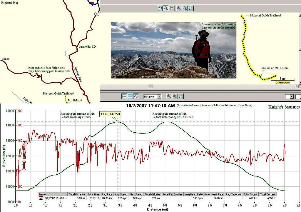
Stat of the Mt. Belford Climb

Stat of the Mt. Belford Climb

Statistical information taken by my Garmin Forerunner 305 GPS unit; it displays a regional map and data on the elevation gained and lost during my approach up and down Mt. Belford (14,197 ft.). I inserted a pic of me at the summit.
Aspen
on Oct 21, 2007 4:41 pm
Image Type(s): Topo/Diagram
Image ID: 349616

Comments

Post a Comment
Viewing: 1-1 of 1
TJ311

TJ311 - Nov 11, 2007 8:33 am - Hasn't voted

Garmin

I LOVE my Forerunner 305. Have you ever used it with motionbased.com and google earth? It's even better than the Training Center software!

Viewing: 1-1 of 1