
|
|
Mountain/Rock |
|---|---|
|
|
48.24336°N / 121.1163°W |
|
|
Snohomish |
|
|
7140 ft / 2176 m |
|
|
Overview
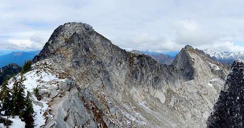
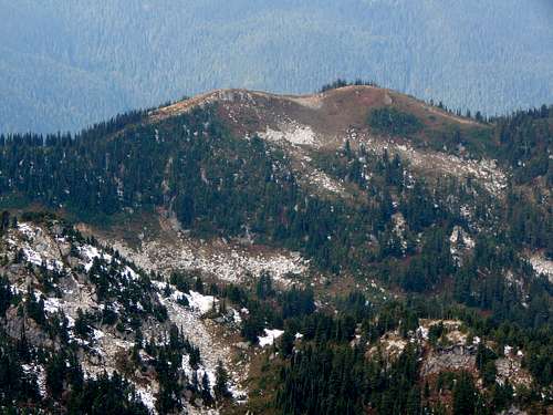
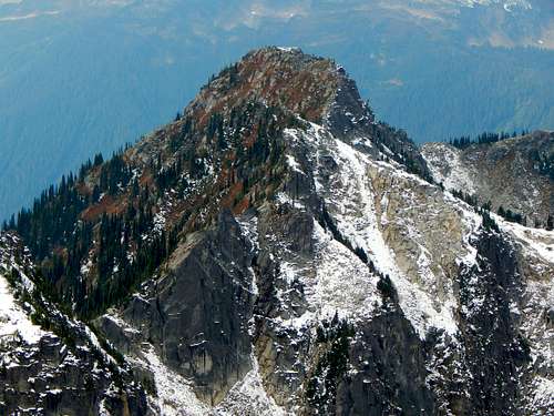
Point 7140 summit block and 'Sho-ghud-ope'
Defining which high point in the area qualifies as the summit depends on who you ask: For 95% of the hikers on the Sulphur Mountain Trail, the summit is the 6200'+ Sulphur Point (once an old lookout site in the 1930's - likely no permanent building at this location) located at the end of the trail. For USGS cartographers, the summit is prominently labeled as the 6735' high point located less than one mile SE of the old lookout site. Unfortunately for both of these peaks (despite their great views), they don't even get so much as a mention on the ListsofJohn website, as neither breaks the 300' prominence threshold.
For the 'professional peakbagger', the obvious choice for the Sulphur Mountain summit would have to be Point 7140. It is (just barely) the highest peak in the area, offers enjoyable scrambling, incredible views, and a generous 1280' of prominence. In fact, it has the unique distinction of being the most prominent peak in Snohomish County without a name, either official or unofficial.
Just why exactly Point 7140 has received so little attention over the years is something of a mystery to me. Perhaps some are put off by the total elevation gain (7000') or distance (14 miles RT). Perhaps some are put off by the notion of climbing a 'no name' peak. Oh well - everyone else's loss can be your gain - an easily accessed, brush-free scramble in the Glacier Peak Wilderness with great scenery and almost guaranteed solitude.
Update: Thanks to John Roper for providing some more information on peak names in this area. Sho-ghud-ope was the name given to the north 7140' peak by the Suiattle Indians and means 'gray earth'. The south 7140' peak (the main subject of this page) has received the John Roper designation of 'Kaiwhat Peak' - Kaiwhat was the Suiattle Indian name for Sulphur Creek. For this reason, I have added Kaiwhat Peak to the title for this page. Additionally, this peak has also been called 'Shower Mountain' by others in the past. There seems to be some disagreement as to whether Kaiwhat Peak or Sho-ghud-ope is higher. Klenke has assured me he will settle this debate when he heads into this area. If someone beats him to it, could you please take GPS or theodolite app readings from both summits?
Getting There
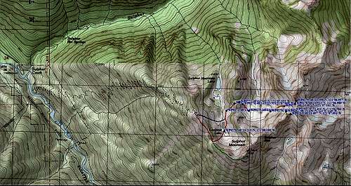
Sulphur Mountain Route Map
Route
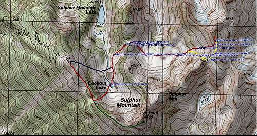
Sulphur Mountain Route Map Closeup
As you approach the ridge crest, the views finally start to open up. For those so inclined, a spur to the left will lead down towards Sulphur Mountain Lake.
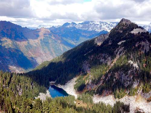
Sulphur Mountain Lake and Point 6438 from Sulphur Point
For everyone else, continue on the main trail to the right, which will lead to Sulphur Point after a short distance (6200'+).
Sulphur Point from Point 7140
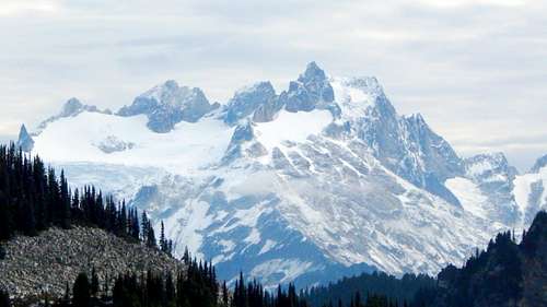
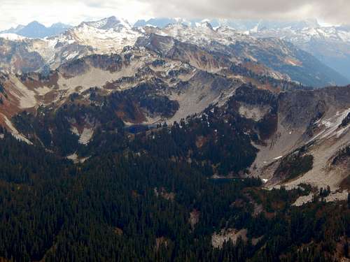
Dome Peak from Sulphur Point
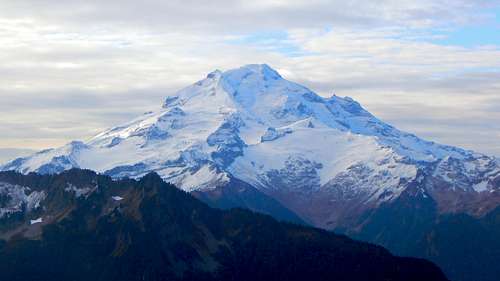
Glacier Peak from Sulphur Point
Lime Ridge from Sulphur Point
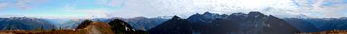
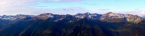
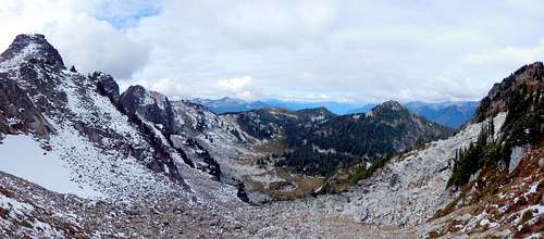
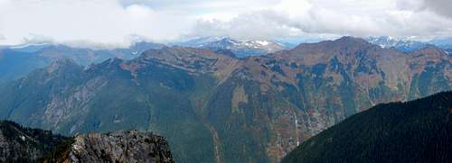
Sulphur Point pano
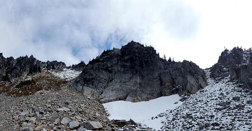
The 'official' Sulphur Mountain from Point 7140
Point 7140 (left of center) from Sulphur Point
You may notice at this point that two basins and a ridgeline separate you from the summit. Do not be afraid - it is not as bad as it looks. In fact, if you practice your Julie Andrews routine in the meadows along the way, you may even enjoy it!
The start of the route towards Point 7140 closely matches what is known as the 'Bath Lakes High Route'. For those interested in completing this arduous, but interesting journey, a pdf link to the book 'Routes and Rocks' may be found here.
From Sulphur Point, follow a faint path SE - in about 1/4 mile, you will arrive at an obvious saddle located just SE of Lookout Lake. Now drop down steep heather slopes to Lookout Lake, which will likely be dried up in late season.
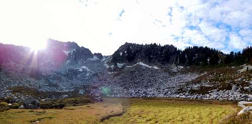
Lookout Lake on Sulphur Mountain (dried up)
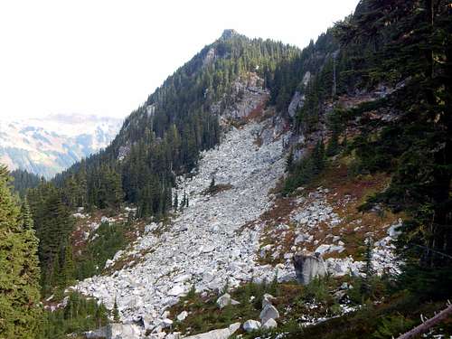
Ravine leading from Lookout Lake to second basin on Point 7140 scramble
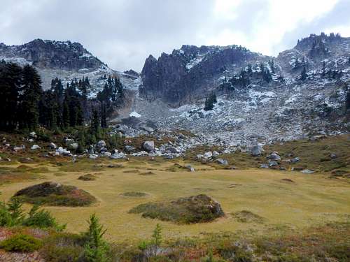
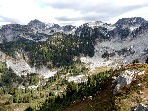
Meadow in second basin on way to Point 7140
Meadow in second basin on way to Point 7140
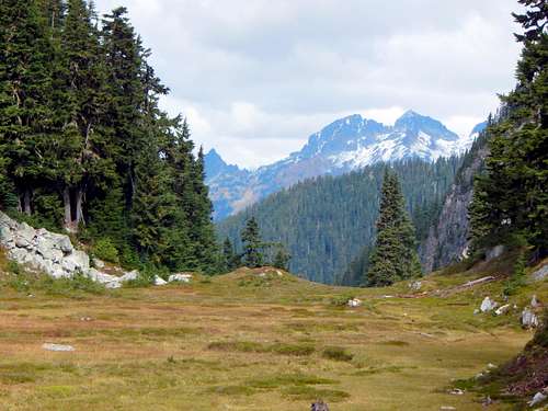
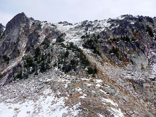
Point 7140 (far left) and Sulphur Mountain from second basin
After soaking in the meadowy goodness, continue due east across the basin, and start up the obvious slope that terminates just south of Point 7140's summit. At about 6300', you will need to make a choice between going straight ahead (steep class 2), or making a slight turn to the right, then taking a gully to a 6600' saddle. Going straight ahead will likely work most of the time, but we chose to descend via the second option due to a couple inches of wet snow (our descent shown in yellow on route map).
Point 7140 route at 6300'
Looking west toward Sulphur Point from 6500' on Point 7140
Point 7140 (far left) from 6600' saddle to the S/SW
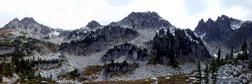
Point 7140 summit block and 'Sho-ghud-ope'
Point 7140 summit with 'Sho-ghud-ope' in background

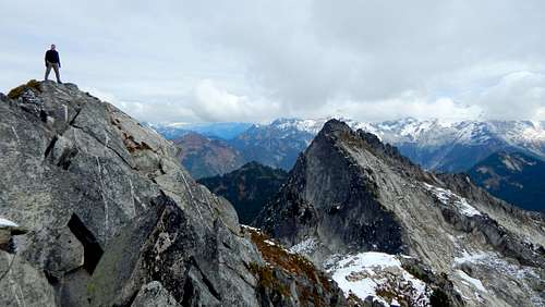
Point 7140 summit pano
Downey Mountain and Bachelor Peak aka Pilot Peak from Point 7140
Bannock Mountain and Bath Lakes from Point 7140

'Lake 5737' just south of Point 7140
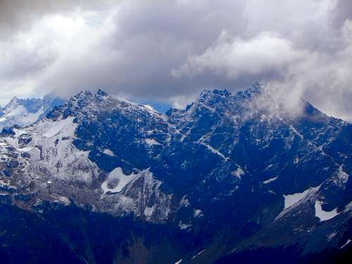
Plummer Mountain from Point 7140
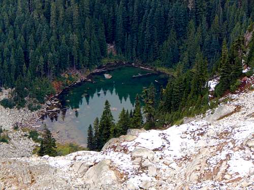
Unnamed lake at 4900' just north of Point 7140