
Comments
No comments posted yet.
|
|
Trip Report |
|---|---|
|
|
36.79169°N / 75.12451°W |
|
|
Download GPX » View Route on Map |
|
|
Nov 30, 2011 |
|
|
Hiking |
|
|
Fall |
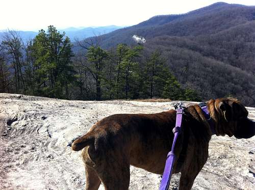
This was my first hike to a peak. This is a great state park in South Carolina that I have visited many times before and have hiked the lesser Carrick Creek Trail which is a very easy loop without any signifigant elevation changes. I have viewed the great granite face of Table Rock many times from afar and really wanted to get the view from the top. Upon suggestion from a couple of friend of mine who have climbed the peak I brought my 6 year old female boxer "Ava". This was her first signifigant hike as well. We arrived at the park at about 9:00am and promptly set of on the trail.
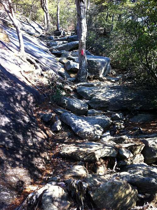
There were very few people at the park this early in the morning. During the first 1.5 miles I saw a total of three people. The trail starts off as a very moderate hike with the occasional steeper sections. Ava managed them very well and we reached the split of the Table Rock trail and the other trail to Pinnacle Mountain. At first it seemed as if the steepest terrain was behind us, however we soon began the approach to Governors Rock (not sure if this is the correct name, I will have to come back and do some editing). This approach goes up some really steep sections and what I would consider the most strenuous part of the hike.
The total ascent according to my GPS was 1,929 feet with a total descent of 382 feet.
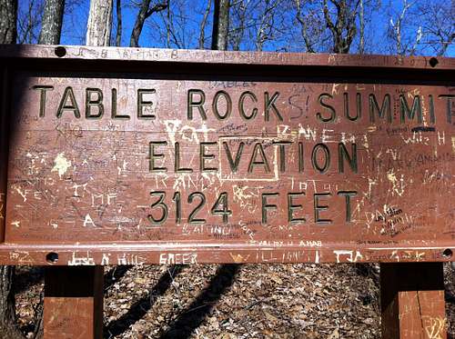
After passing Governors Rock you soon approach the summit proper of Table Rock mountain at a little over 3,000, roughly 2,000 feet above where the hike begins.
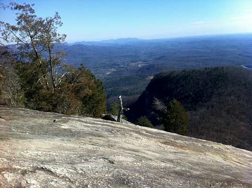
Just beyond the summit, the trail passes the granite rock face and comes to an end about a hundred yards beyond. The trail ends at an opening of flat rock ground. In a break in the trees we had a great view of a water fall in the distance. After this we headed back to the granite rock face where the mountain gets its name and enjoyed the views. The trip to this point took about 2 hours and fifteen minutes. Another 2 hours to get back down.
Name: Table Rock Ascent
Date: Dec 10, 2011 9:31 am
Map:
(valid until Jun 23, 2012) View on Map
Distance: 3.26 miles
Elapsed Time: 2:15:43
Avg Speed: 1.4 mph
Max Speed: 4.5 mph
Avg Pace: 41' 37" per mile
Min Altitude: 1,191 ft
Max Altitude: 3,065 ft
Start Time: 2011-12-10T14:31:29Z
Start Location:
Latitude: 35.032120º N
Longitude: 82.700913º W
End Location:
Latitude: 35.052322º N
Longitude: 82.700661º W