|
|
Mountain/Rock |
|---|---|
|
|
46.86437°N / 121.47747°W |
|
|
Yakima |
|
|
Hiking, Scrambling |
|
|
Spring, Summer, Fall |
|
|
6567 ft / 2002 m |
|
|
Overview
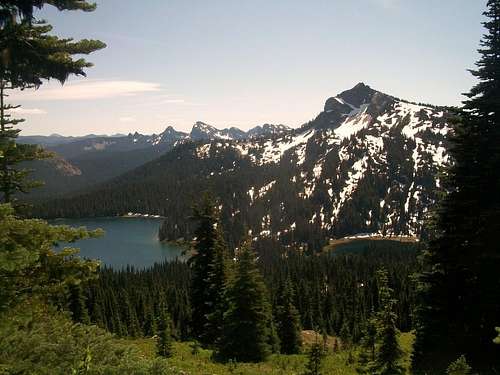
Tahtlum Peak located close to Chinook Pass is absolutely incredible gem of a mountain. The mountain has it all; a killer 360 degree view summit, relatively easy access to the trailhead, relative easy effort to the summit (barely Class 2 max, 6 miles, 1500 of elevation gain), and peace and tranquility. For about half the effort of many other more popular mountains in the I-90 area (Mount Si, McClellan Butte) you are granted a view that is twice as dazzling and contains dramatically less people. Rarely does more than one party visits this summit in day or even a week and because of that I was a little reluctant to write about this cool find.

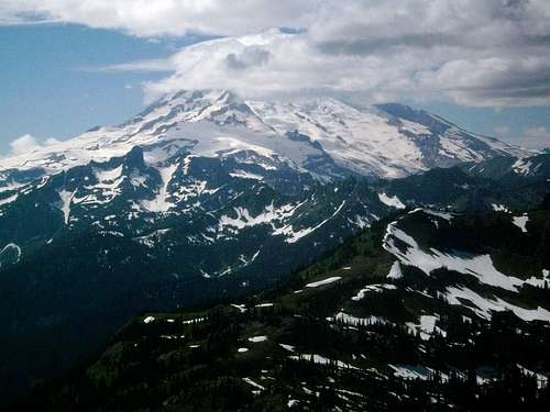
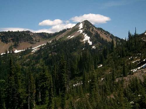
The pyramid shape peak is visible from Highway 410 but often overshadowed by neighboring and closer Naches Peak. The peak itself sits in an area that provides great views of the domanant Mount Rainier. The location also gives it good views of the Crystal Mountain area, the Dark Devide, Goat Rocks Wilderness and Mount Saint Helens. The summit itself is treeless though smaller trees do lie just below on the west side but don’t block any views.


In order to get to Tahthum Peak you should park at the day use area right at the foot of Yakima Park just on the east side of Chinook Pass. From there take the Pacific Crest Trail south all the way to the height of land between Naches Peak and Tahtlum Peak. Once above 100 feet passed the height-of-land pick up the well established bootpath or fainter than average trail on the left (it will be well marked with mulitple bootpaths crossing each other) and take the fairly well established bootpath to the base of Tahtlum Peak. From there the bootpath will fade out in places and become faint. The route up will steepen up and a couple times it will come out on the exposed north side. This side is no more that 40 degrees but the dirt can cause for some tougher traction. Continue to climb up the sometimes visible bootpath all the way to the true summit where amazing 360 degree view of Mount Rainier, Mount Adams, Mount Saint Helens, Crystal Mountain, and even Mount Stuart await you.