Toggle navigation
Mountains
Routes
Images
Trip Reports
Forum
What's New
People
Areas & Ranges
Articles
Trailheads
Canyons
Huts & Campgrounds
Albums
Logistical Centers
Fact Sheets
Lists
Custom Objects
Gear
Plans & Partners
WELCOME TO SUMMITPOST
SIGN IN
REGISTER
Llano de la Guardia
Additional Parents
Image
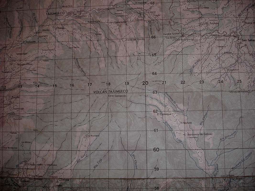
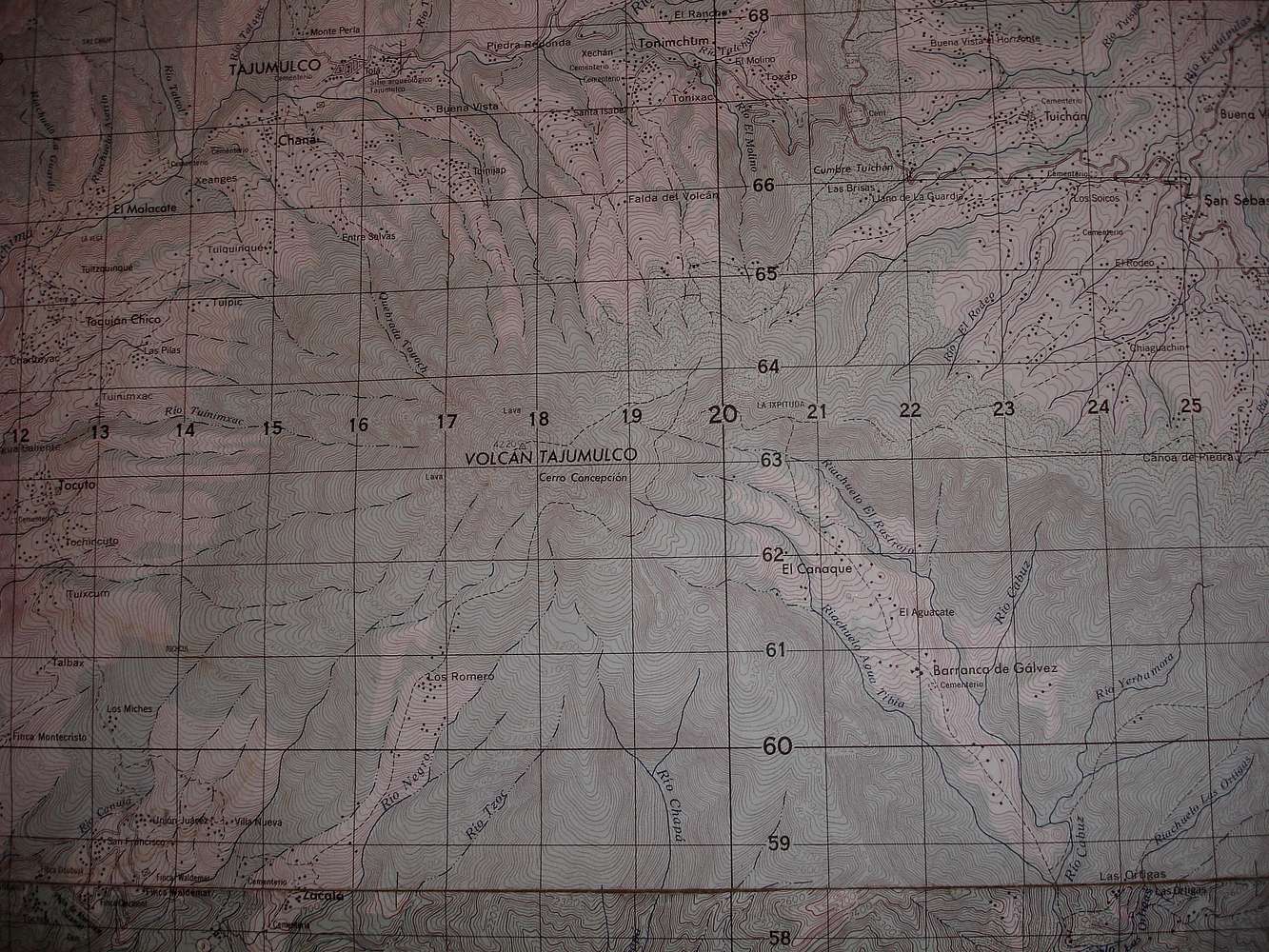
Tajumulco Topo Map
View High-Resolution Image
Tajumulco Topo Map
« PREV
NEXT »
BLong
on
Sep 19, 2009 2:57 pm
Comments & voting
Other parents
Lat/Lon:
15.03330°N / 91.9°W
Image Type(s):
Hiking
Image ID:
554891
3602 Hits
71.06
% Score
1
Votes
Log in to vote
Comments
No comments posted yet.
to post!
Don't have an account?
Llano de la Guardia
(Route)
« PREV
Viewing
#4 of 6
GALLERY
NEXT »
BLong's Image Gallery
« PREV
Viewing
#250 of 362
GALLERY
NEXT »
"Guatemalan Shortcut" south route Tajumulco
(Route)
Loading....
×
You need to login in order to vote!
User Name
Password
Remember me
Forgot your password?
Log me out when I close my browser.
Keep me logged in all the time.
sign in as a user
Don't have an account?
Register now for FREE
Rating available
Suggested routes for you
People who climb the same things as you
Comments Available
Create Albums
Register Here


