Toggle navigation
Mountains
Routes
Images
Trip Reports
Forum
What's New
People
Areas & Ranges
Articles
Trailheads
Canyons
Huts & Campgrounds
Albums
Logistical Centers
Fact Sheets
Lists
Custom Objects
Gear
Plans & Partners
WELCOME TO SUMMITPOST
SIGN IN
REGISTER
Tamadaba
Additional Parents
Image
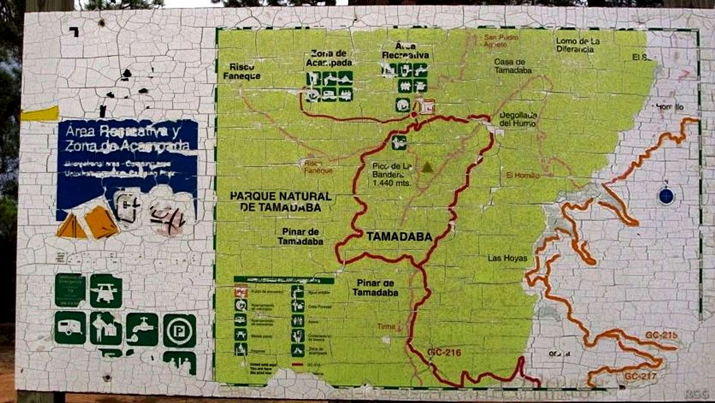
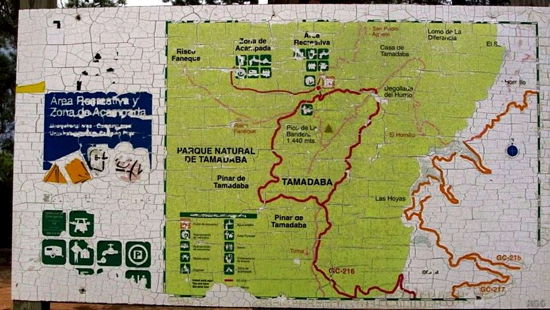
Tamadaba area map
View High-Resolution Image
Tamadaba area map
At a sharp bend in the road up to the Tamadaba high plateau is this old and not very clear map. 11 December 2013.
« PREV
NEXT »
rgg
on
Jan 15, 2014 4:53 am
Comments & voting
Other parents
Lat/Lon:
28.05710°N / 15.6891°W
Image Type(s):
Informational
Image ID:
883288
1460 Hits
0
% Score
0
Votes
Log in to vote
Comments
No comments posted yet.
to post!
Don't have an account?
Tamadaba
(Album)
« PREV
Viewing
#29 of 30
GALLERY
NEXT »
rgg's Image Gallery
« PREV
Viewing
#8565 of 8665
GALLERY
NEXT »
×
You need to login in order to vote!
User Name
Password
Remember me
Forgot your password?
Log me out when I close my browser.
Keep me logged in all the time.
sign in as a user
Don't have an account?
Register now for FREE
Rating available
Suggested routes for you
People who climb the same things as you
Comments Available
Create Albums
Register Here


