Toggle navigation
Mountains
Routes
Images
Trip Reports
Forum
What's New
People
Areas & Ranges
Articles
Trailheads
Canyons
Huts & Campgrounds
Albums
Logistical Centers
Fact Sheets
Lists
Custom Objects
Gear
Plans & Partners
WELCOME TO SUMMITPOST
SIGN IN
REGISTER
Mount Custer
Additional Parents
Image
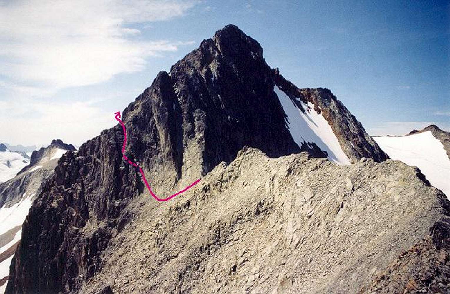
The east side of Mt. Custer...
View High-Resolution Image
The east side of Mt. Custer...
The east side of Mt. Custer on August 3, 2003. Pink line is the Class 4 route. It's pretty much the only way to go to complete the Rahm-Custer traverse.
« PREV
NEXT »
Klenke
on
Jan 27, 2005 9:34 pm
Comments & voting
Other parents
Lat/Lon:
48.98910°N / 121.2497°W
Image ID:
87158
4464 Hits
78.09
% Score
9
Votes
Log in to vote
Comments
No comments posted yet.
to post!
Don't have an account?
Mount Custer
(Mountain/Rock)
You are at
the First
Image
Viewing
#1 of 1
GALLERY
You are at
the Last
Image
Klenke's Image Gallery
« PREV
Viewing
#231 of 5376
GALLERY
NEXT »
×
You need to login in order to vote!
User Name
Password
Remember me
Forgot your password?
Log me out when I close my browser.
Keep me logged in all the time.
sign in as a user
Don't have an account?
Register now for FREE
Rating available
Suggested routes for you
People who climb the same things as you
Comments Available
Create Albums
Register Here


