
Humphreys Peak (of Arizona) comes in at 12,637 feet (3,852 meters).
It's the highest of a group of ancient volcanic peaks known as the San
Francisco Peaks of northern Arizona. It's also the highest point in the
U.S. state of Arizona, and is located within Kachina Peaks Wilderness in
Coconino County, about 11 miles (17.7km) north of Flagstaff, Arizona.
The summit can be (most easily) reached by hiking the 4.5 miles (7.2 km)
long 'Humphreys Trail' that begins at the Arizona Snowbowl (ski resort)
in the Coconino National Forest. The last mile (1.6 km) of the trail
traverses the only region of tundra in Arizona, at an elevation of more
than 11,500 feet or 3,505 meters.
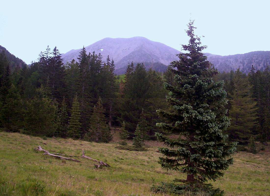
This photo of Humphreys Peak was taken from the 'Inner Basin' side. The
Inner Basin is an ancient caldera of the San Francisco Peaks volcano,
which can be reached via the Lockett Meadow Road from AZ's Highway 89.
A man named J.W. Weatherford built and extended a road through Lockett
Meadow into the Inner Basin in 1926, using only hand labor and animals.
Model-T Fords could sputter up to Doyle and Fremont Saddles. The toll road
had few customers in the Depression years and fell into disrepair. Today,
only hikers and climbers (on foot) can travel the old Weatherford Road.
The trail's gentle grade AND excellent views make it a good choice for a
family outing. (However, you must be forewarned that a sudden thunderstorm
can occur ANY TIME between mid-June and mid-September.)
Although it's possible to reach Humphrey's summit from the
Inner Basin/Weatherford Trail, the length of this journey discourages
most climbers intent on "bagging this one." Energetic hikers who have
ARRANGED a car shuttle can continue on the Weatherford Trail (another 3.4
miles from 10,800-foot Doyle Saddle) TO the trail's end at the junction with Humphrey's Trail. From there, it's about another 2 miles roundtrip
to the summit of Humphreys Peak. Please keep in mind that in those two
miles you will be passing over a "treeless tundra;" it's strongly
recommended that you have potable water and foul-weather gear with you.
On a recent trip to the Inner Basin caldera, my wife and I experienced a
sudden WHOPPER of a thunderstorm, and unfortunately discovered that we
had left out foul-weather gear in the car. We had to find refuge beneath
a very large Corkbark fir growing in the area, similar to the one you see
in this picture.
July 2, 2008


Comments
Post a Comment