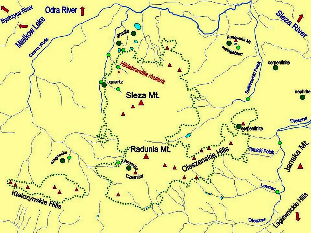
A scheme map of waters in the Sleza Massif (dark green circles - sites of outcrops or past quarries of rocks or minerals; light green circles - sites documented by photos in this album; red triangles - main summits and hills; ponds or small lakes in blue; forested area of the massif outlined by green dots).

