Toggle navigation
Mountains
Routes
Images
Trip Reports
Forum
What's New
People
Areas & Ranges
Articles
Trailheads
Canyons
Huts & Campgrounds
Albums
Logistical Centers
Fact Sheets
Lists
Custom Objects
Gear
Plans & Partners
WELCOME TO SUMMITPOST
SIGN IN
REGISTER
Horseshoe Peak
Additional Parents
Normal Route
Image
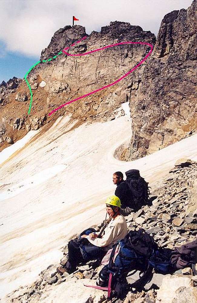
The two final approaches to...
View High-Resolution Image
The two final approaches to...
The two final approaches to the final notch. Green is leftward approach; pink is rightward approach. The ice field was steeper than it looks. Aluminum crampons were a must. On our way to Mt. Buckner. August 30, 2004.
« PREV
NEXT »
Klenke
on
Sep 15, 2004 7:14 pm
Comments & voting
Other parents
Lat/Lon:
48.49420°N / 121.008°W
Image ID:
69789
4673 Hits
73.06
% Score
3
Votes
Log in to vote
Comments
No comments posted yet.
to post!
Don't have an account?
Horseshoe Peak
(Mountain/Rock)
« PREV
Viewing
#6 of 25
GALLERY
NEXT »
Klenke's Image Gallery
« PREV
Viewing
#2323 of 5376
GALLERY
NEXT »
Normal Route
(Route)
Loading....
×
You need to login in order to vote!
User Name
Password
Remember me
Forgot your password?
Log me out when I close my browser.
Keep me logged in all the time.
sign in as a user
Don't have an account?
Register now for FREE
Rating available
Suggested routes for you
People who climb the same things as you
Comments Available
Create Albums
Register Here


