Toggle navigation
Mountains
Routes
Images
Trip Reports
Forum
What's New
People
Areas & Ranges
Articles
Trailheads
Canyons
Huts & Campgrounds
Albums
Logistical Centers
Fact Sheets
Lists
Custom Objects
Gear
Plans & Partners
WELCOME TO SUMMITPOST
SIGN IN
REGISTER
Pico Aislado
Additional Parents
Image
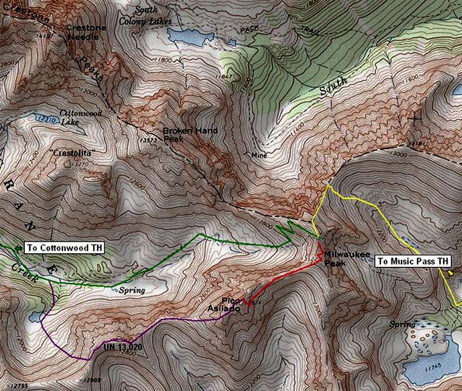
The Wedgie route map
View High-Resolution Image
The Wedgie route map
Pico Asilado's
The Wedgie
route. Map generated with TOPO! software.
GREEN - Cottonwood Creek approach YELLOW - Music Pass approach RED - main section of climbing PURPLE - West Face descent route
« PREV
NEXT »
RyanS
on
Sep 19, 2005 4:50 pm
Comments & voting
Other parents
Lat/Lon:
37.94440°N / 105.5584°W
Image ID:
126964
21004 Hits
72.08
% Score
2
Votes
Log in to vote
Comments
No comments posted yet.
to post!
Don't have an account?
Pico Aislado
(Mountain/Rock)
« PREV
Viewing
#23 of 31
GALLERY
NEXT »
RyanS's Image Gallery
« PREV
Viewing
#754 of 811
GALLERY
NEXT »
The Wedgie
(Route)
Loading....
×
You need to login in order to vote!
User Name
Password
Remember me
Forgot your password?
Log me out when I close my browser.
Keep me logged in all the time.
sign in as a user
Don't have an account?
Register now for FREE
Rating available
Suggested routes for you
People who climb the same things as you
Comments Available
Create Albums
Register Here


