
Viewing: 1-2 of 2

Dean - Dec 23, 2002 4:08 pm - Hasn't voted
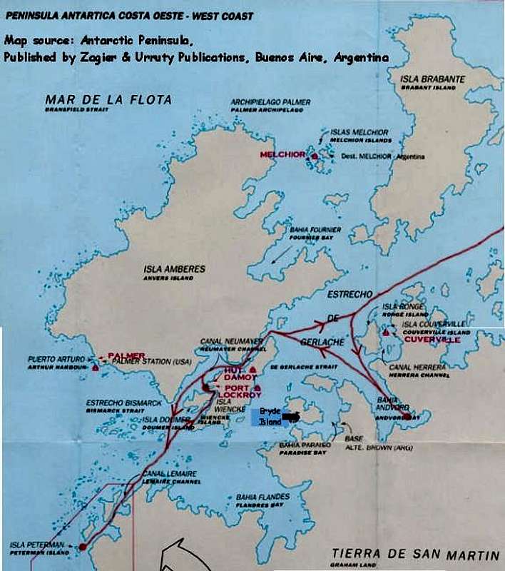
Thanks for the mapIt really helps a page to put a map on it like you did with this one. Now I know where the Humpback is and can relate to where it is overall since I know where Palmer station is. Keep up the good work. I'm enjoying all of your pics and the fine effort you are putting into this most interesting summit.

peakwolf - Dec 23, 2002 4:28 pm - Hasn't voted
Re: Thanks for the mapThanks Dean. It is amazingly hard to find maps of this region, even crummy undetailed ones like this. As a serious map-lover I found this a little hard to deal with!
Viewing: 1-2 of 2


Comments
Post a Comment