

RckyMtneer - Sep 9, 2007 11:45 pm - Hasn't voted
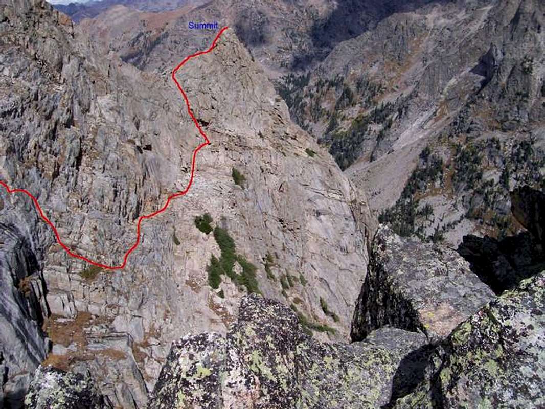
Downclimb area...The leftmost part of the drawn route, covering the "4th Class" area, which is more like 5.2 or 5.3, is actually about 20 to 30 feet more to the north than shown here. Other than that, pretty accurate. I'll post another picture later that shows a little more of the area with the route.

Scott - Sep 10, 2007 9:50 am - Hasn't voted
Re: Downclimb area...The leftmost part of the drawn route, covering the "4th Class" area, which is more like 5.2 or 5.3, is actually about 20 to 30 feet more to the north than shown here. Other than that, pretty accurate.
If you are speaking of the route in the Roach guidebook, we didn't use that route, but actually took a different route variation to the south and descended and reached the traverse earlier, skipping the section where the optional rappel is.
I may have got the route mismarked though, so you're photo will probably be better.


Comments
Post a Comment