Toggle navigation
Mountains
Routes
Images
Trip Reports
Forum
What's New
People
Areas & Ranges
Articles
Trailheads
Canyons
Huts & Campgrounds
Albums
Logistical Centers
Fact Sheets
Lists
Custom Objects
Gear
Plans & Partners
WELCOME TO SUMMITPOST
SIGN IN
REGISTER
Mosquito Range
Additional Parents
Image
This route photo, taken from...
View High-Resolution Image
This route photo, taken from...
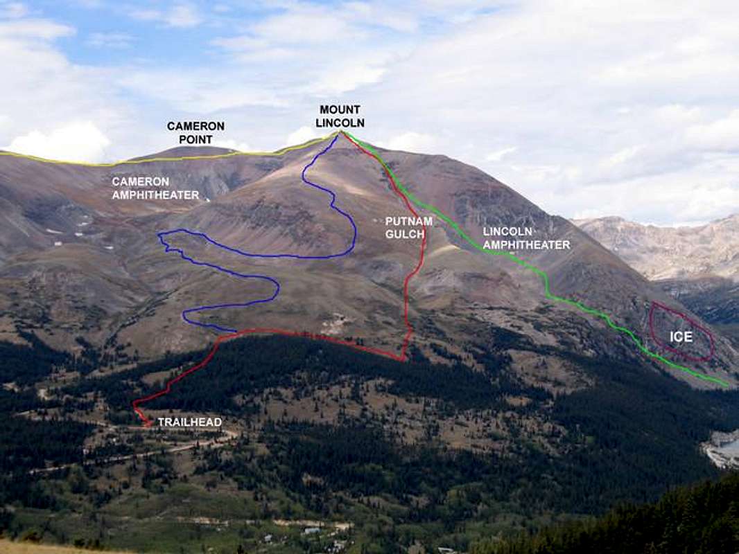
This route photo, taken from the lower slopes of Mount Silverheels, shows several routes for Mount Lincoln.
RED=
Putnam Gulch Ski Route
BLUE=
East Ridge Route
GREEN=
Montgomery Reservoir Route
YELLOW=
West Ridge Route
PURPLE=
Lincoln Icefall Ice Climbing Area
« PREV
NEXT »
Ed F
on
Sep 10, 2005 5:26 pm
Comments & voting
Other parents
Lat/Lon:
39.35140°N / 106.1108°W
Image ID:
125396
7479 Hits
74.92
% Score
5
Votes
Log in to vote
Comments
No comments posted yet.
to post!
Don't have an account?
Mosquito Range
(Area/Range)
« PREV
Viewing
#83 of 154
GALLERY
NEXT »
Ed F's Image Gallery
« PREV
Viewing
#316 of 962
GALLERY
NEXT »
Mount Lincoln
(Mountain/Rock)
Loading....
East Ridge
(Route)
Loading....
×
You need to login in order to vote!
User Name
Password
Remember me
Forgot your password?
Log me out when I close my browser.
Keep me logged in all the time.
sign in as a user
Don't have an account?
Register now for FREE
Rating available
Suggested routes for you
People who climb the same things as you
Comments Available
Create Albums
Register Here


