In fact it is not the intention here to make you visit the most famous castles of the Aosta Valley and even to make you climb the most important mountains. If you want to do bought a book or an illustrative guide or contact the Association of Guides Valdostane.
. Only an incurable
always looking for something that others have discarded or by long put into the hemioblivion. We seek instead to make traveling between what is misunderstood and that is why most charming and exploratory. Follow and you will see that you will discover things as beautiful and interesting.
All those who go in the Basin Verrayes / St. Denis travel for to climb the Becca di aver or Cima di Longhede. Or both, while someone else goes to the Col des Bornes or to that of St. Pantaleon, perhaps by then the
. Instead, we go in the opposite direction and by Grand-Villa
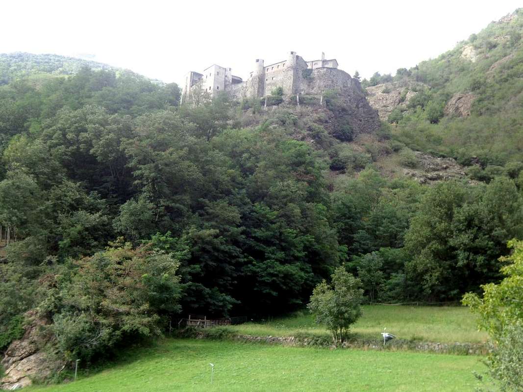
bordering the Valley of St. Barthélemy. Even in winter with snowshoes. Then we go down to Saint Denis where, just before the Municipality of Chambave, we expect a beautiful castle, located on a promontory
over the Baltea. From there you take in most part of the Central Valley.
Non son famosi e neppur troppo conosciute, ma buone Gite sicuramente sì. infatti non é qui l'intenzione di farvi visitare i castelli più rinomati della Valle di Aosta e neppure quella di farvi scalare le montagne più importanti. Se volete ciò fare compratevi un libro od una guida illustrativa oppure rivolgetevi all'Associazione delle Guide Valdostane.
Noi non siam né Guide e tantomen Ciceroni. Soltanto inguaribili
clochards" sempre alla ricerca di qualcosa che gli altri han scartato. Cerchiamo invece di farvi fare un viaggio tra quello che risulta misconosciuto e per questo motivo più affascinante ed esplorativo. Seguite e vedrete che scoprirete cose altrettanto belle ed interessanti.
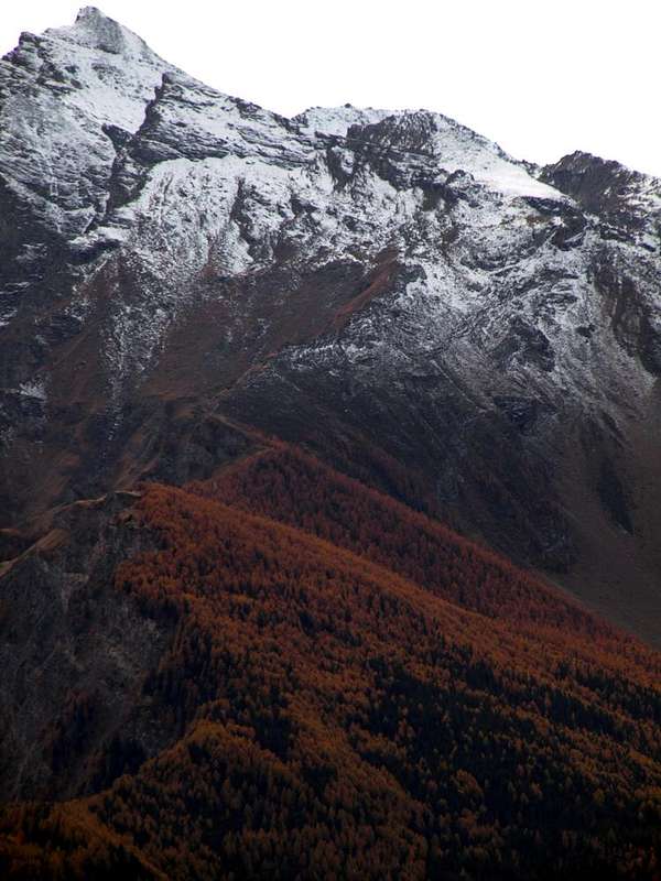
1)- Al Monte Andèr passando da Verrayes e poi St. Denis. Tutti quelli che vanno nella Conca di Verrayes/St. Denis si recano a salire la Becca d'Aver o la Cima di Longhede. Oppure tutte e due, mentre qualcunaltro và al Col des Bornes od a quello di St. Pantaleon, magari facendo poi il
Tour de St. Evence. Noi invece andiamo nella direzione opposta e da Grand-Villa
(1407 m) saliamo al Monte Andèr
(1931 m) al confine con la Valle di St. Barthélemy. Anche d'inverno con le racchette da neve. In discesa andiamo a St. Denis ove, appena prima del Comune di Chambave, ci attende un bel Castello, posto in un promontorio
(800 m) sopra la Dora. Da lì ammirate quasi tutta la Valle Centrale.
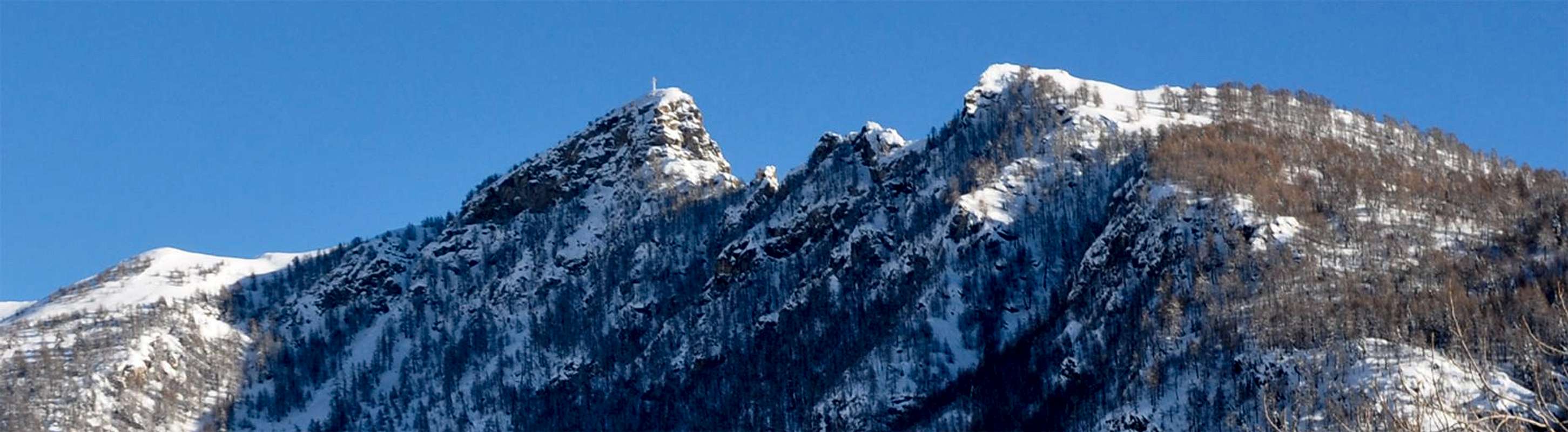
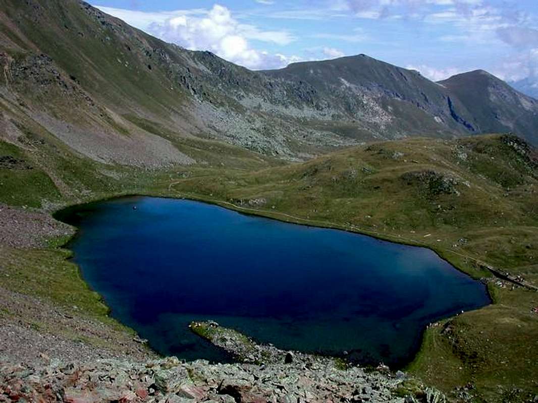
![]() M. Andèr from St. Barthélemy or Northwest (in right the Normal Route)
M. Andèr from St. Barthélemy or Northwest (in right the Normal Route)
by Emilio Bertona aka emilius2)-
At Croix de Fana going from Villair de Quart and then Avisod (Trois Villes). Coming towards Aosta, just before you find the crossroads after Villefranche
(557m) to the Villair de Quart and you reach it by taking a look at neighboring and overlying
Tour de Chétoz. Here, right behind the
Castle of Villair de Quart (740 m), a steep path
n° 7 along which the whole wild Val Sainte or Valseinte first reach the renowned Oratory of St. Emeric
(1140m) and then the pasture of the same name
(1400m). A short crossing to the East via the private road leads to the Village of Avisod
(1398m) where the trail begins just above
n° 2bis or at the last Village Fonteil
(1423m) always the same or to
n° 2 on the initial part of the Comba Dèche both towards the Croix de Fana
(2212m), large lookout over much of the Central Valley. If you can organize into two groups can make the descent into the car through the Regional Road that from Trois Villes descends to the State Road n° 26 at Chetoz-La Plantaz two almost adjacent Hamlets
(540m).
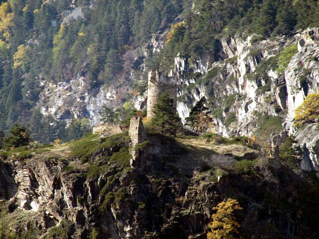
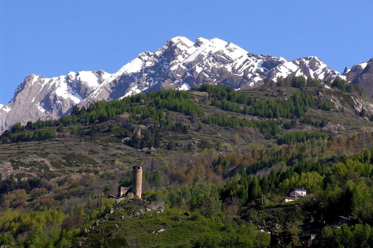
![]() "Villair de Quart 1185 Castle built by Barons Quart below the Valseinte"
"Villair de Quart 1185 Castle built by Barons Quart below the Valseinte"
by Osw2)-
Alla Croix de Fana salendo la Valsainte dal Villair de Quart e poi da Avisod (Trois Villes). Venendo verso Aosta, appena prima trovate il bivio dopo Villefranche
(557 m) per il Villair de Quart e lo raggiungete dando un'occhiata alla vicina e soprastante
Tour de Chétoz. Qui, subito dietro il
Castello del Villair de Quart (740 m), parte il sentiero
n° 7 che percorrendo tutta la selvaggia Val Sainte raggiunge dapprima l'Oratorio di Sant'Emerico
(1140 m) indi l'omonimo alpeggio
(1400 m). Una breve traversata verso Oriente tramite poderale vi conduce al Villaggio di Avisod
(1398 m) dove inizia il sentiero
n° 2bis oppure appena sopra presso l'ultimo Villaggio di Fonteil sempre il medesimo o quello
n° 2 lungo la parte iniziale della Comba Dèche entrambi verso la Croix de Fana
(2212 m), grande belvedere su gran parte della Valle Centrale. Se sapete organizzarvi in due gruppi la discesa la potete effettuare in auto tramite la Regionale che da Trois Villes scende sin a raggiungere la Statale presso Chétoz-La Plantaz
(540 m).
![]()
Winter descent from Croix de Fana
by Ilario Antonio Garzotto3)-
Monte Faroma from Oyace passing through Betenda's Bridge and visiting the Tornalla at Valpelline and Oyace Tower. Reached Valpelline Common (ancient
"House Tornalla" built by the Lords of Quart) it continues to the Municipality of Oyace where a small path
n° 3, currently under renovation after a Church and some farms, up towards the
Tour of Oyace, leaving left (fork with signals) the path that descends to the Betenda's Bridge over the Torrent de Valpelline, about which there is a beautiful legend of two knights and a girl. After the
"Gouffres de la Betendaz" continues to Southeast with the trail
n° 5/Alta Via n° 1 and, crossed the Alps Arp-Nouva, Arp-Vieille and Arp Damon Ardamùn, you reach the Vessona Hill. From this first on tracks and then surpassing easy small rocks (a passage of I°+, to circumvent South) at Faroma
(3073m).
3)- Al Monte Faroma da Oyace passando dal Ponte della Betenda e visitando la Tornalla a Valpelline e la Tour d'Oyace. Raggiunta Valpelline (antica "Casa Tornalla" dei Signori di Quart) si continua verso il Comune di Oyace dove un sentierino n° 3, attualmente in fase di ristrutturazione dopo la Chiesa ed alcune fattorie, sale in direzione della Tour d'Oyace, lasciando a sinistra il bivio che scende al Ponte della Betenda sopra il Torrent de Valpelline, a proposito del quale esiste una bella leggenda di due cavalieri ed una fanciulla. Oltrepassate le "Gouffres de la Betendaz", si continua verso Sudest con il sentiero n° 5/Alta Via n° 1 e, superate le Alpi Arp-Nouva, Arp-Vieille ed Arp Damon-Ardamùn, si raggiunge il Colle di Vessona. Da questo dapprima su tracce e poi superando facili roccette (un passaggio di I°+, aggirabile a Sud) al Monte Faroma (3073 m).
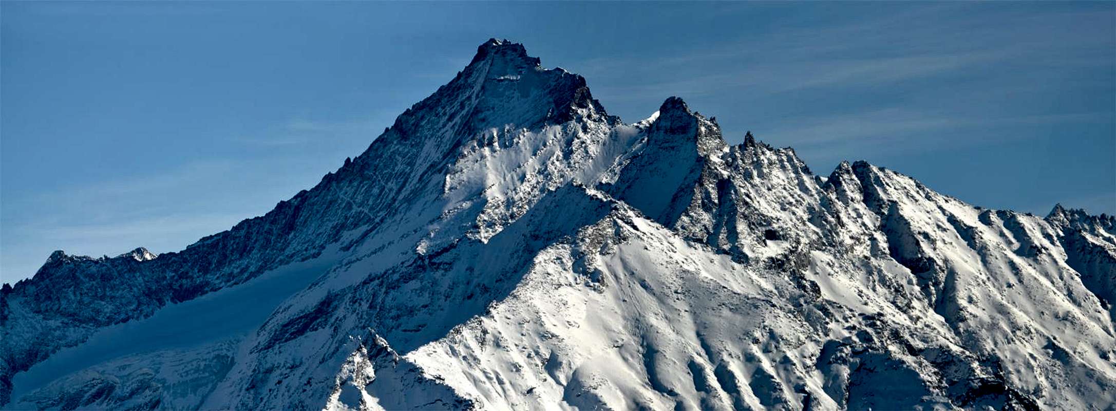
![]()
Monte Faroma from Comba di Vessona or North (to the left Normal Via)
by emilius4)-
Pointe de Metz by Sarre observing the great landslide of 1564 and visiting Sarriod de la Tour and Sarre Castles. By the Municipality of Sarre (
5.8 km. West of Aosta City with
Sarre and Sarriod de la Tour Castles, preferably be visited on the way back to the valley floor) go up with the Regional Road and to the North, across the
"Via dei Salassi" reach the important Fraction of Ville sur Sarre
(1212m). From this village well in turn, first in the West and then to the Northeast you get to New Thouraz
(1593/1652m; "Ranch Horse") with full view of the great
Landslide above ancient Thôra of 1564 from Becca France (2312m). Soon after, leaving at the crossroads
1638 metres the dirt road towards the Vallon of Chiusella and Mont Fallère
(3061m), you continue more to the East for a short distance with the farm dirt road and then continuing further North with the small path
n° 7B is reached fork
2008 metres, above the Alp Condemine de Metz and the next locality called
"la Tsitra" (2176m). All that remains is to continue with the little route
n° 8C along the easy Southern Crest, before through the forest and then the grassy hillocks of debris, reaching the Pointe de Metz
(2553m).
![]()
"The Great Landslide of July 06th, 1564" on SE Slope of Becca France,
by Osw4)-
Punta di Metz da Sarre osservando la grande frana del 1564 e visitando i Castelli Sarriod de la Tour e di Sarre. Dal Comune di Sarre (
5,8 Km. ad Ovest di Aosta;
Castelli di Sarre e Sarriod de la Tour) salire con la Regionale verso Settentrione ed, attraversata la
"Via dei Salassi" raggiungere Ville su Sarre
(1212 m). Da questo villaggio con largo giro, dapprima a Nordest e poi ad Occidente s'arriva alla Nuova Thouraz
(1593/1652 m; "Ranch dei Cavalli") con piena vista sulla grande
Frana del 1564 alla Becca France (2312 m). Subito dopo, abbandonando al bivio 1638 metri la poderale per il Vallone di Chiusella ed il Mont Fallère
(3061 m), si continua ad Oriente per breve tratto con la poderale e poi continuando più a Nord con il sentiero
n° 7B si raggiunge il bivio
2008 metri, sopra l'Alpe Condemine de Metz e la successiva località detta
"la Tsitra" (2176 m). Non rimane che continuare col sentiero
n° 8C lungo la facile Cresta Sud, dapprima tramite la foresta e poi per dossi detritico-prativi, arrivando alla Cima
(2553 m).
![]()
Pointe de Metz or Met (outline right the Standard Route)
by Maria Grazia Schiapparelli5)-
Court de Bard from Challancin (La Salle) dominating Chatelard Tower. From La Salle come up with the paved road to the overlying Fractions of Croix des Prés, Cheverel
(1470m) and Challancin (
1610m; small parking lot) from this village up towards the Northeast through the path
n° 2 coming to Les Ponteilles
(1731m). Abandoning the left (North) trail that climbs
n° 2A to Les Ors, mostly in Southeast instead continue reaching Arpilles Pasture (
1.862m; wooden fountain), take an immediate right into the path that goes into the woods and climb with short diagonal alternating hairpin bends that back with beautiful views of the iced North Face Mont Paramont which stands directly opposite. Crossed two small Torrents of Arpilles Charvaz with a diagonal more moderate to the right to reach the Bard Pass
(2176m). From this worth making a detour to get to the South, crossing a vast grassy plateau and small rocks into the end always with the path, the bastion of the Court de Bard
(2262m) with great view of the Grivola.
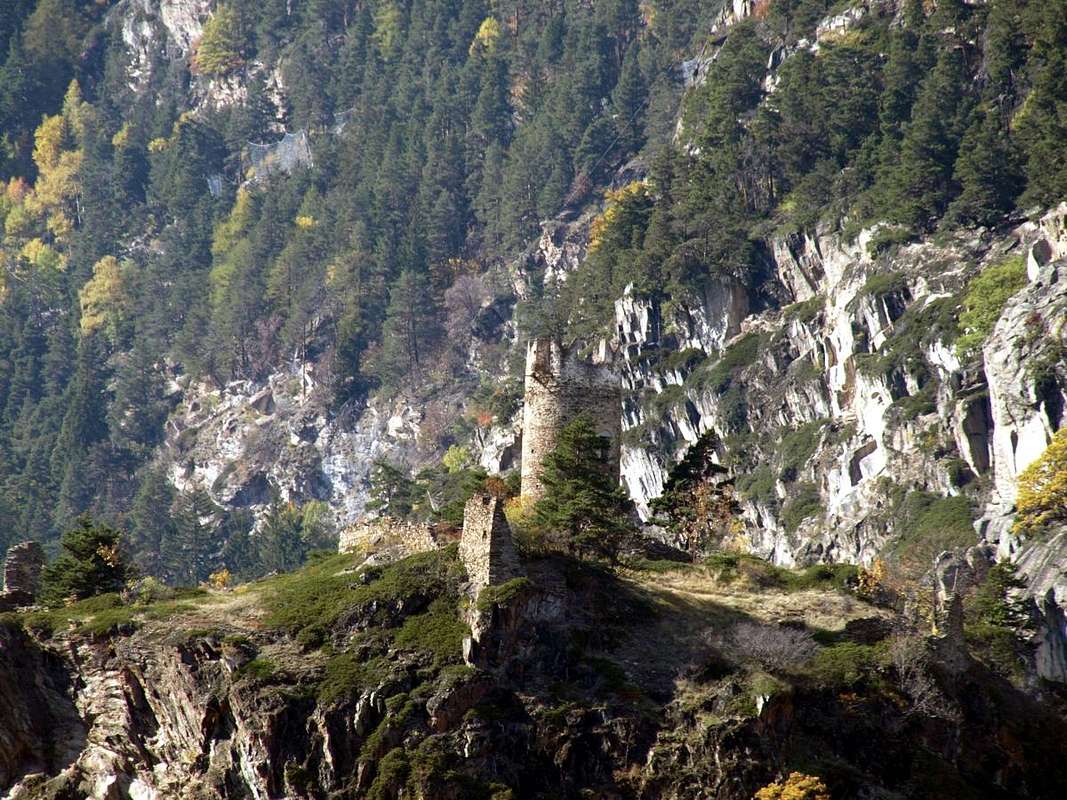
![]() "Tour & Tower Chatelard 1235 by Provost Grossy above the Central Valley"
"Tour & Tower Chatelard 1235 by Provost Grossy above the Central Valley"
by Osw5)-
Court de Bard da Challencin (La Salle) dominando la Torre Chatelard. Dal Comune di La Salle salire con la strada carrozzabile verso le soprastanti Frazioni di Croix de Prés, Cheverel
(1470 m) e Challancin (
1610 m; piccolo parcheggio), lasciando sulla sinistra la continuazione per Morge e Planavalle. Da questo villaggio salire verso Nordest tramite il sentiero
n° 2 arrivando all'Alpe Les Ponteilles
(1731 m). Abbandonando a sinistra (Nord) il sentiero
n° 2A che sale al Tramail Les Ors, continuare invece maggiormente a Sudest raggiungendo l'Alpe di Arpilles (
1862 m; fontana nel tronco); prendere subito a destra il sentiero che addentrandosi nel bosco e risale con brevi diagonali alternati a stretti tornanti che lo risalgono con bella vista sulla ghiacciata Parete Nord del Mont Paramont stagliantesi proprio affronte. Attraversati i due piccoli Torrents de Arpille e Charvaz con un diagonale più moderato verso destra si raggiunge il largo Col de Bard
(2176 m). Da questo merita effettuare una digressione verso Mezzogiorno per raggiungere, attraverso un vasto plateau erboso e roccette nella parte terminale, sempre con evidente sentiero, l'ampio spalto della Court de Bard
(2262 m) con grande vista sulla Grivola.
![]() The Grivola from the Court de Bard
The Grivola from the Court de Bard
by emilius6)-
Montmayeur Tower, Mont de l'Âne and Cross 2439 metres by Grand Haury (Arvier) visiting Les Combes. From Aosta
(583m) follow the State Road n° 26 toward the Mont Blanc. Once near Arvier Municipality (
751m; Tower and Castle), turn left on the road in asphalt that goes up to the Villages of La Crête
(830m), Petit Haury
(1081m), Grand Haury (
1177m; from here in just over 10 minutes to visit what remains of the horrid
Castle and Tower Montmayeur above the entrance in Valgrisenche), and Les Combes (
1323m, the site of Popes John Paul II° and Benedetto XVI° last visits to the Valley), where the hike begins. From Les Combes
(1323m), continue on the trail that runs parallel to the road that winds through farms, until the trail forks
1537metres, at the Western end of Plan de la Pera. There, the trail goes on to Alpe Leytin
(1787m), eventually merging back into the road. Head Southeast, avoiding the wide switchback for Moccossoney
(1900m). Once at Plan Bry
(1918m), turn East toward the watershed, which you reach near Maison Clou
(2219m). Climb Southwest on a faint trail to the Mont de l'Âne
(2367m), ad reach the following Cross
(2439m) towards Becca de Chamin.
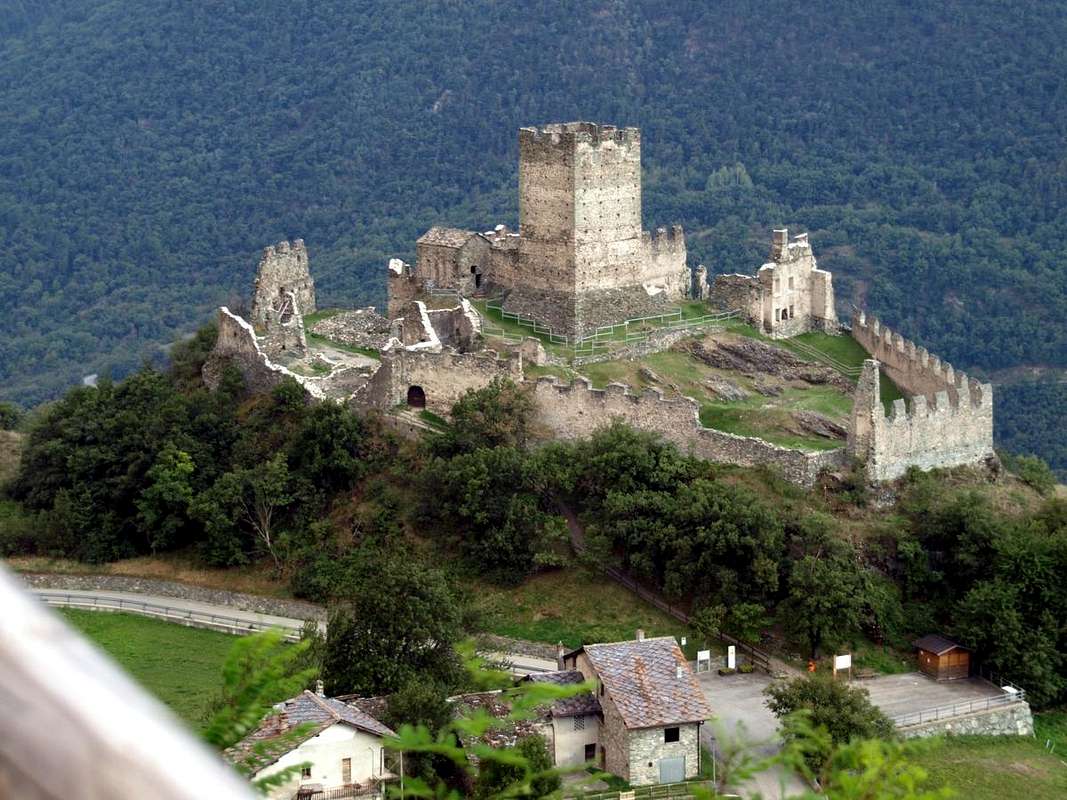
![]() "Montmayeur Castle & Tower nearby Les Combes Popes Residency",
"Montmayeur Castle & Tower nearby Les Combes Popes Residency",
by Osw6)-
Castello di Montmayeur, Mont de l'Âne e Croce 2439 metri da Grand Haury (Arvier) visitando Les Combes. Dalla Città di Aosta
(583 m) si percorre la Strada Statale n° 26 per il Monte Bianco e, giunti nei pressi dell'abitato di Arvier (
751 m; Castello con Torre), si prende sulla sinistra la strada che sale alle Frazioni di La Crête
(830 m), Petit Haury
(1081 m), Grand Haury (1177 m; da qui in poco più di 10 minuti visita a ciò che resta del
Castello e Torre di Montmayeur) e Les Combes (
1323 m, sede delle ultime visite dei Papi Giovanni Paolo II° e Benedetto XVI°), dove inizia l'itinerario a piedi. Da Les Combes
(1323 m), proseguire per la strada poderale sul sentiero parallelo sino al bivio
1537 metri, al margine Occidentale del Plan de la Pera, dove il sentiero prosegue per l'Alpe Leytin
(1787 m) congiungendosi nuovamente nell'ultimo tratto con la poderale. Proseguire a Sudest evitando il largo tornante per Moccossoney
(1900 m) e, raggiunto il Plan Bry
(1918 m), voltare ad Est indirizzandosi alla cresta spartiacque, raggiungendola nei pressi di Maison Clou
(2219 m). Proseguire su tracce evidenti a Sudovest e, doppiato il Mont dell'Âne
(2367 m), raggiungere in breve tempo la successiva Croce
(2439 m).
![]() "M. de l'Âne below Becca de Chamin",
"M. de l'Âne below Becca de Chamin",
by Osw7)-
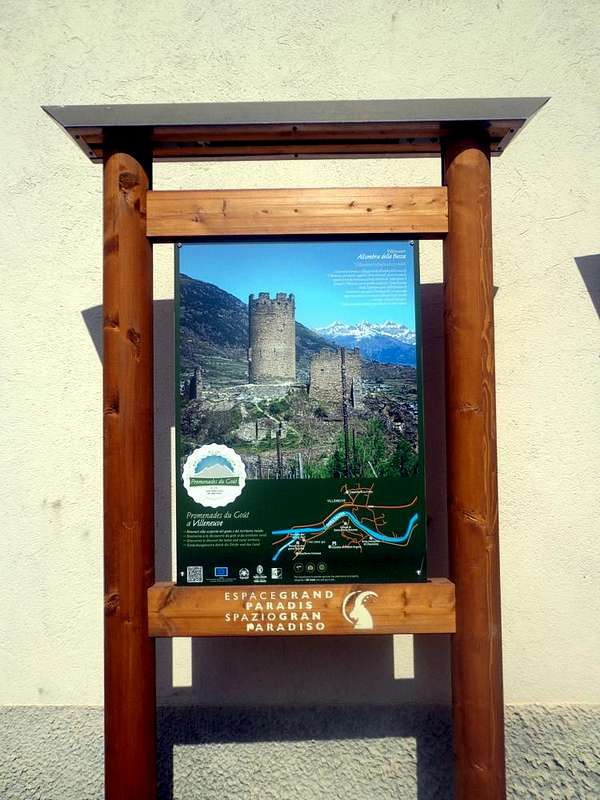
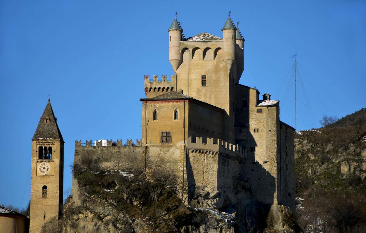
Chatel Argent and Mont de Poignon from Villeneuve. From the Municipality of Villeneuve (
10 Km. to the West of Aosta City) go up quickly to the famous
Chatel Argent by a beautiful stone staircase that starts at the bridge over the Dora Baltea just before entering the village. Continuing through the first Southeast path
n° 1 towards Alpages Prorayé (here comes the trail
n° 1A from the above Village of Champlong Dessus, reached with a deviation immediately after the country) and so much more to the South is easy to reach the Mont de Poignon
(1567m), which precipitates with a large wall above the Village of Pondel or Pont d'Ael and Grand'Eyvia Torrent in Val di Cogne.
![]() "Chatel Argent XI° Century by Bard's Lords above Chavonne-Villeneuve"
"Chatel Argent XI° Century by Bard's Lords above Chavonne-Villeneuve"
by Osw7)-
Chatel Argent e Mont de Poignon da Villeneuve. Dal Comune di Villeneuve (
10 Km. ad Ovest della Città di Aosta) salire in breve tempo al famoso
Chatel Argent per mezzo di una bella scalinata in pietra che inizia presso il ponte sulla Dora Baltea appena prima di entrare in paese. Continuando verso dapprima Sudest tramite il sentiero
n°1 fino all'Alpe Prorayé (qui arriva anche il sentiero
n°1A dal Villaggio soprastante di Champlong Dessus, raggiungibile da una deviazione subito dopo le abitazioni) e quindi decisamente più verso Sud si raggiunge facilmente il Mont de Poignon
(1567 m), precipitante con grande parete sopra Pondel o Pont d'Ael e la grand'Eyvia in Val di Cogne.
![]() "Mont de Poignon above Chatel Argent nearby Villeneuve",
"Mont de Poignon above Chatel Argent nearby Villeneuve",
by Osw