TOPO! map of the approach to...
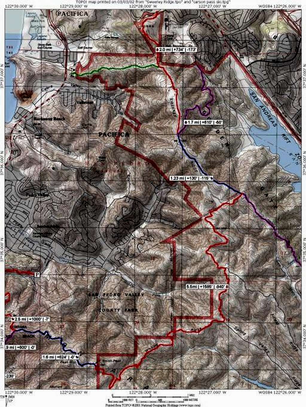
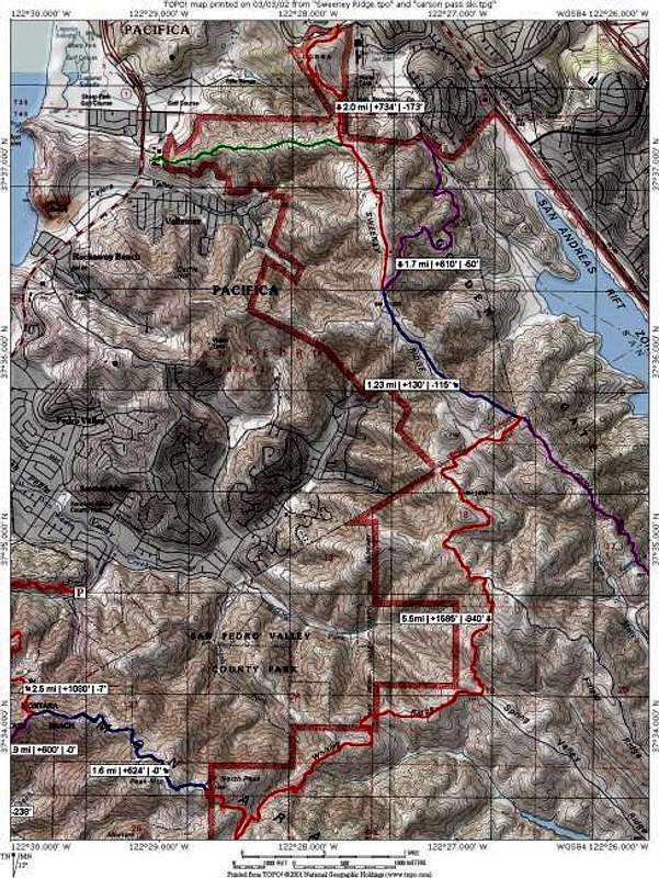
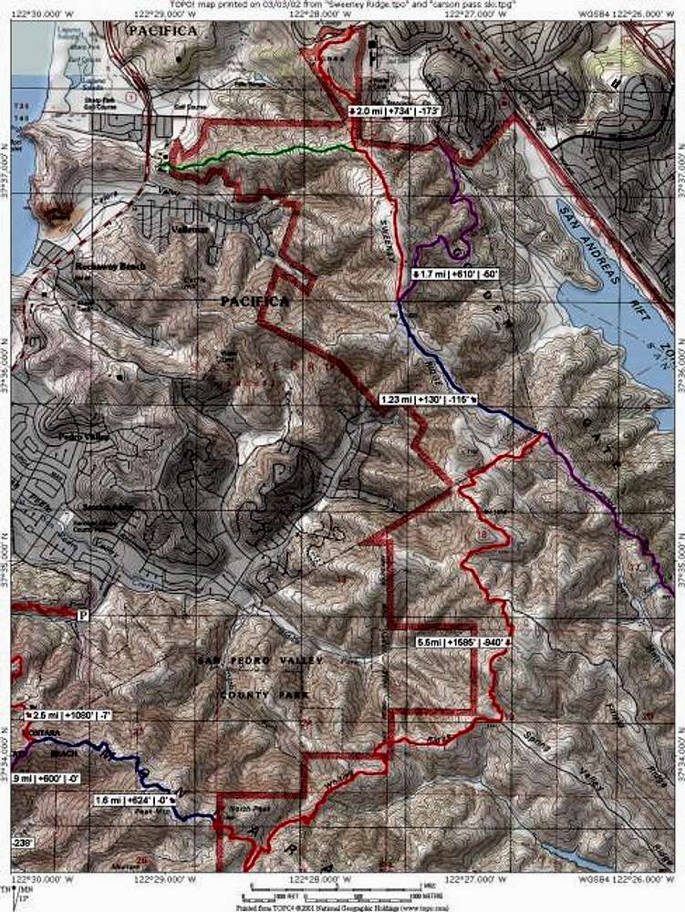
TOPO! map of the approach to Montara Mountain from Sweeney Ridge. The shortest approach, from the GGNRA parking lot at the end of Sneath Lane, is 8.7 miles one way. The longer approach, from Skyline College, is around 9 miles one way. Either route climbs well over 2000 feet.


