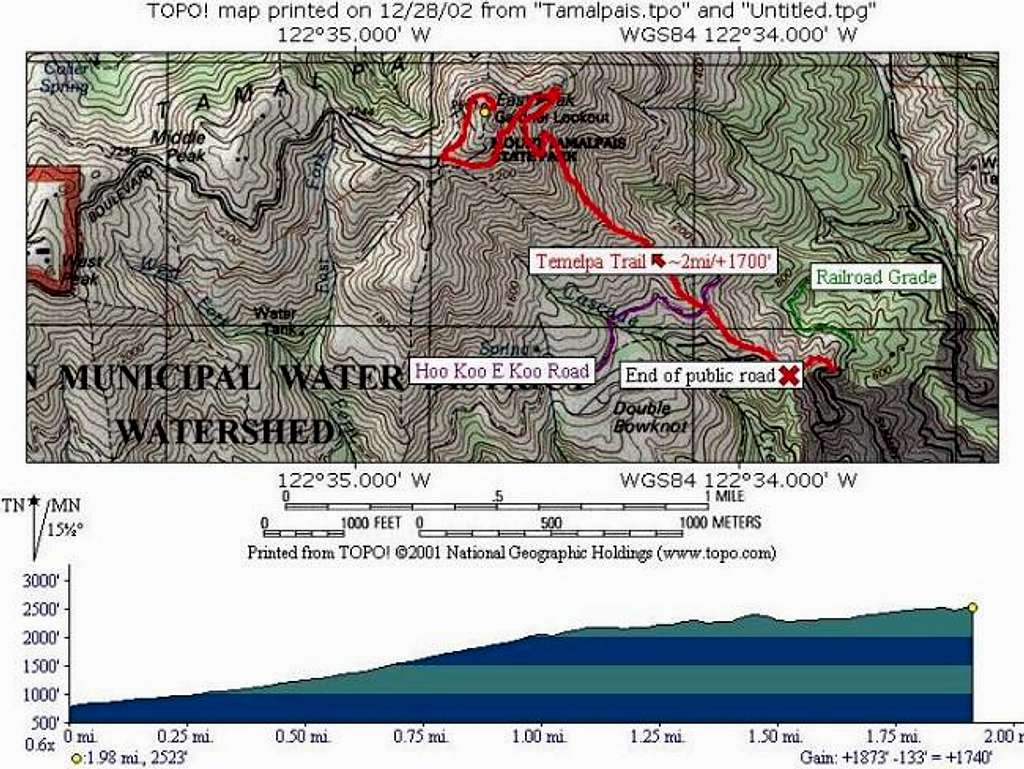
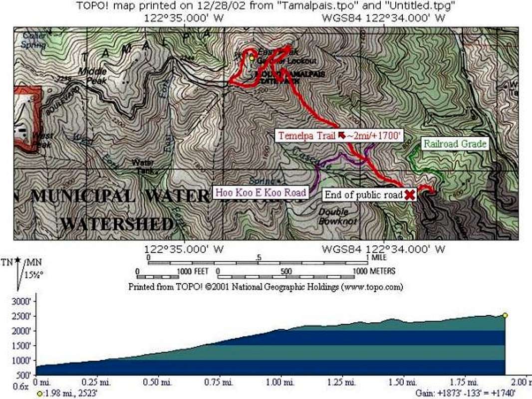
Topographical map of the...
Topographical map of the climb up Tamalpais via the Temelpa Trail. Small, marked parking areas are numerous near the end of Summit Avenue/Fern Canyon Rd., though the road ends earlier than the map indicates. The trail is fairly obvious, though there are a couple variations. When in doubt, follow the trail that leads uphill fastest, even if it is rockier. On the way down from the summit, we took a "nicer" spur trail and ended up crossing Cascade Creek and meandering for at least an extra mile.


