Toggle navigation
Mountains
Routes
Images
Trip Reports
Forum
What's New
People
Areas & Ranges
Articles
Trailheads
Canyons
Huts & Campgrounds
Albums
Logistical Centers
Fact Sheets
Lists
Custom Objects
Gear
Plans & Partners
WELCOME TO SUMMITPOST
SIGN IN
REGISTER
Silver Run Peak
Additional Parents
Image
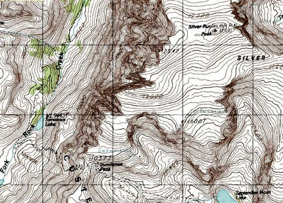
Topographical Map of the...
View High-Resolution Image
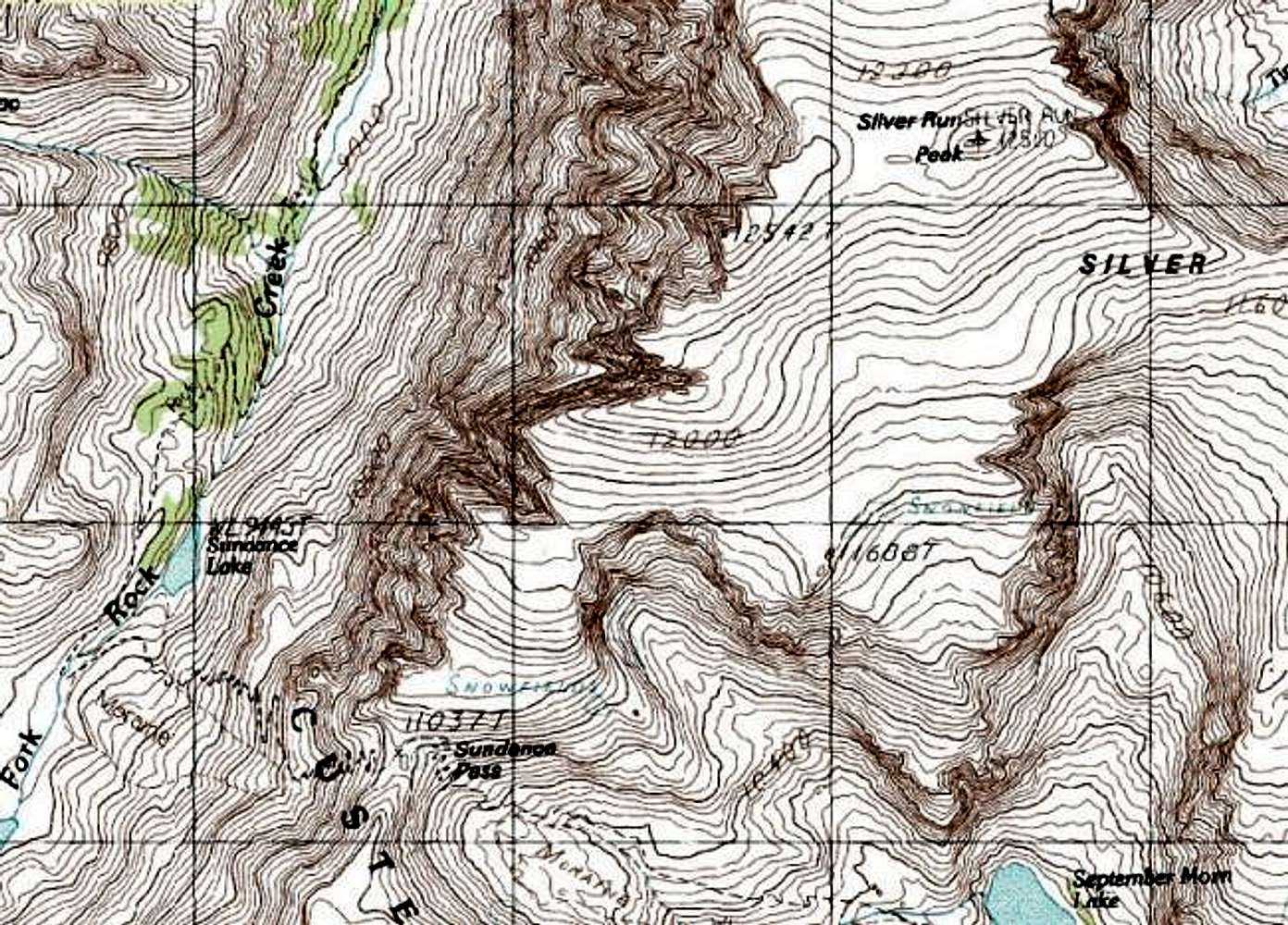
Topographical Map of the...
Topographical Map of the Silver Run Peak summit area. Note that the USGS lists the lower 12,500 foot summit as Silver Run Peak. Most people refer to the summit as the higher 12,542 foot peak one-half mile to the west-south-west.
The lines on the map are on a 1 Km grid.
« PREV
NEXT »
Brice Neugebauer
on
May 11, 2004 12:25 pm
Comments & voting
Other parents
Lat/Lon:
45.12110°N / 109.5444°W
Image ID:
52761
3940 Hits
74.01
% Score
4
Votes
Log in to vote
Comments
No comments posted yet.
to post!
Don't have an account?
Silver Run Peak
(Mountain/Rock)
« PREV
Viewing
#12 of 31
GALLERY
NEXT »
Brice Neugebauer's Image Gallery
« PREV
Viewing
#85 of 156
GALLERY
NEXT »
×
You need to login in order to vote!
User Name
Password
Remember me
Forgot your password?
Log me out when I close my browser.
Keep me logged in all the time.
sign in as a user
Don't have an account?
Register now for FREE
Rating available
Suggested routes for you
People who climb the same things as you
Comments Available
Create Albums
Register Here


