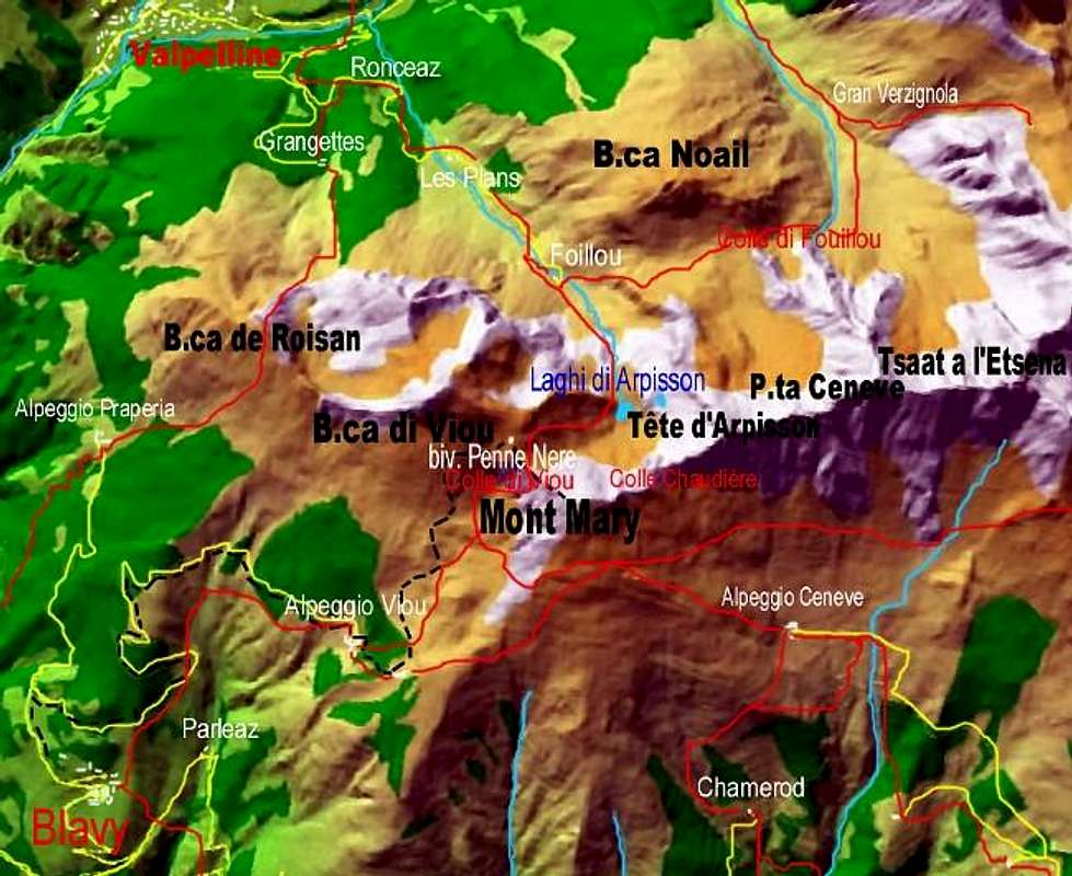
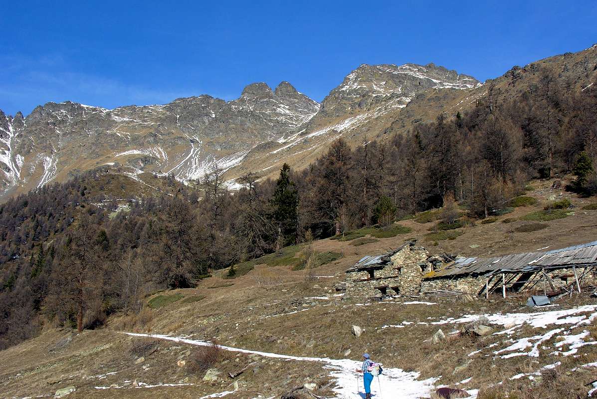
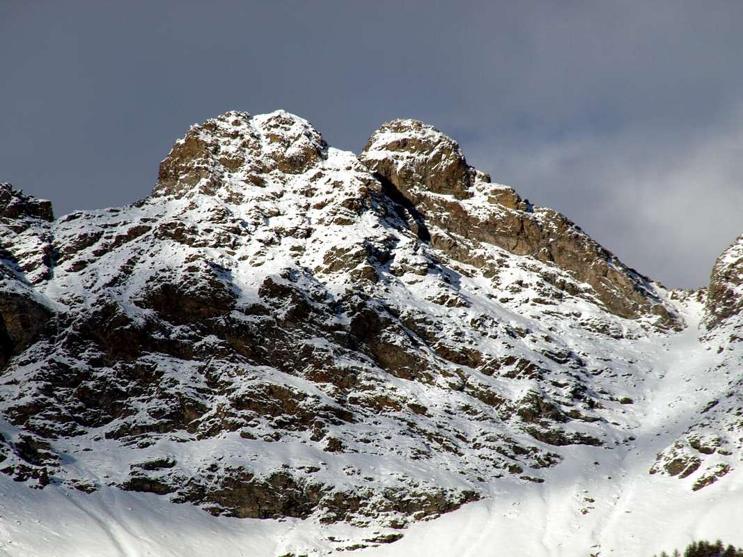
Secondo Giorno: discesa dal bivacco alle Alpi di Viou e traversata ad Est sotto il Versante Sud del Mont Mary all'Alpe di Senevé nell'omonima Comba
fino all'Alpe di Viou Superiore, ma non calate a quella di Sotto. Viou significa
che, attraversando dapprima a Sudest e poi a Nordest, raggiunge il fondo dello stretto e profondo vallone discendente verso Mezzogiorno dal Mont Mary. Questo, di aspetto veramente e desolatamente lunare, separa dalla attigua Comba di Senevé, dove un'altro importante ed isolato alpeggio domina i valloni sopra il Comune di Quart. Transitando sopra quelli di Aosta e Saint Christophe. Non trovate acqua, ma poi, sapendo cercare, trovate una piccola sorgente appena al di sopra. il percorso del medesimo non é difficile, ma altrettanto mai banale. Oltrepassata la mezzeria lo stesso
e doppiando il promontorio successivo scende all'Alpe di Senevé. Un antico sentiero di collegamento che lega gli alpeggi della Valle del Gran San Bernardo ad Ovest (per noi specificamente sopra Roisan) a quelli della Valle Centrale della Dora Baltea fino a raggiungere i Comuni di Quart e Nus, ormai allo ingresso della Valle di Saint Barthélemy. Una trasumanza che si perde nella notte dei tempi e che segnava il ritmo della vita ancora prima dello avvento del Popolo dei Salassi e che comportava la possibilità, grazie ad una economia totalmente agreste e pastorale, di sopravvivenza per tutte quelle popolazioni, compresa l'antica
. Una tradizione decaduta alquanto dopo la Seconda Guerra Mondiale con la trasformazione dell'economia prima in industriale e poi turistica, tanto che, mentre a quella di Senevé troviamo ancora le mandrie di vacche, alle Alpi di Viou pascolano soltanto i manzi quasi solitari. Da qui potete anche scendere verso il fondovalle, ma vi consigliamo di fermarvi una notte chiedendo ospitalità e dormendo magari in una stalla di questa grande alpe da poco tempo ristrutturata. Questa scelta
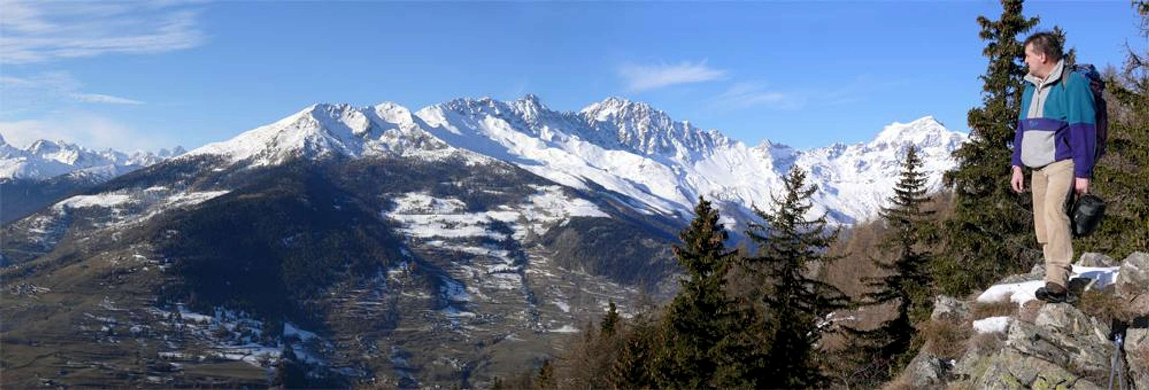
le vostre possibilità per il giorno successivo dando a voi più possibilita per visite culturali-storico-religioso-archeologiche. Dalla Comba di Senevé potete godere d'un panorama d'oltre 220° sul lato Meridionale di quasi tutta la Val d'Aosta.
Third Day: descent from the Alp Cénevé towards valley floor (Quart) with different possibilities and even cultural visits, historical-religious and archaeological
As we go down to the valley floor? There are several possibilities including three or four most important, and we must keep in mind the logistical plan for the return to city.
1)- From Alpe di Sénevé descend directly to the South via the path
n° 1 that, after crossing wide meadows and subsequent forest, reaches an old ruin
(1898m) before a water outlet and inserting itself on the private dirt road. Continuing with the same, concomitant path and passing Alpe Prailles or Prayes with four large hairpin bends, you will reach the renovated chalet
(1745m) where, abandoning the farm road to the west, just continue with the path reaching the old Village
Chamerod (1614m). Always with the same path, adjacent to the farm road that cuts the same reaching the Pastures of Borelly
(1483m), Ayette, one unnamed at hairpin bend of the road
(1376m), the next hairpin bend
1306 metres alongside the Ru (Brook) de Vernier and where begins the private road (no entry for the cars), just before a water outlet and the isolated Village
Praillon or Prayon (1128m). From this, where ending the Municipal Roads from St. Christophe and by Quart, down with two options:
a)- with the same reach the Village
Morgonaz (1205m, 1181m) and from this the path always
n° 1, passing through the small Villages of Etavel, Elobert
(1003m), Crétaplana
(927m), Moulin du Château, Fourneille,
Château de Villair get to
Church of St. Nicholas (774m).
b)- From Morgonaz down to Jeanceyaz (
1087m; Church of San Leonardo), Cretallaz
(1087m), an important junction for
"La Montagne" or "The Mountain Area" (1025m, the road continues West to the Villages Parléaz and Blavy), Veynes, and Maillod
Sorreley (790m), now in the Municipality of St. Christophe, or on-site,
"Saint Cretoublo". From this, passing near the Villages of Thovex and Senin, the junction
692 metres and from this to the Southwest to the
Castles Passerin d'Entrèves, Alpine Military School or Jocteau and Aosta, while in Southeast, passing Fontanalle, towards
St. Christophe-Chieftown (619m).
![]()
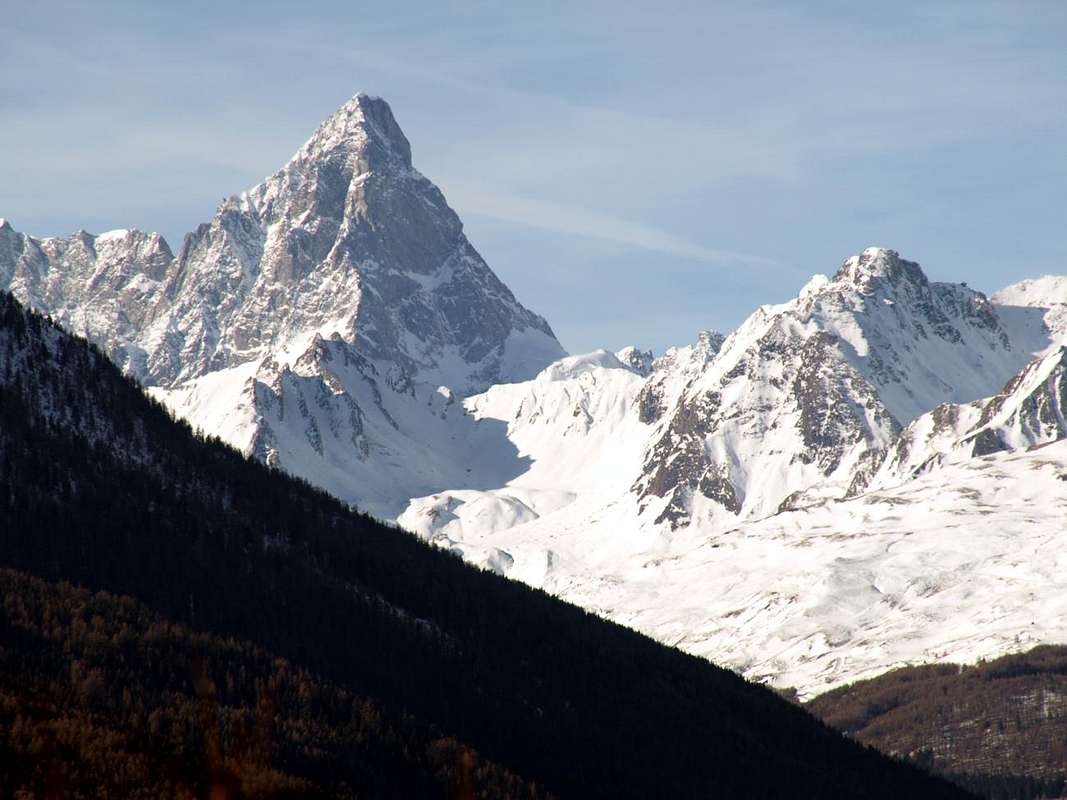
Tsaat a l'Etsena & Fana Pass at the end of crossing on Cénevé Comba ...2)- From Alpe di Sénevé descend in diagonal to the Southeast through the farm dirt road che, passing through the Alpe Lattaz
(1935m) almost in ruins, it is directed more towards the South then reaching those Chamoussin Dèsott and Damon
(1940m, 1856m). From here, flexing further south-southeast, it is directed towards the village of Trois Villes-Avisod
(1398m). Do not follow it to the village, but
about 1 mile before, reaching a height of 1425 metres arrive to a crossroads that goes down towards the Southwest
Valseinte Pasture (1399m). From this a narrow farm road descends steeply to the South along the entire steep rocky and
"mysterious" Val Sainte or Valseinte until you reach the
Oratory of Saint Emeric or Americo (1130m). From this (small open-air altar surmounted by a Cross) a path
not marked and unnumbered descends on long-wooded promontory rocky remaining high above the torrent until you reach the
Château du Villair (774m). This in South to
Quart or West towards
St. Christophe.
3)- from the previous crossroads
about 1425 metres continue on the private dirt road reaching the Village
Avisod (1398m) at the foot of Croix de Fana
(2212m) and by this fall with two possibilities:
c)- by the Regional Road towards the Villages of Porsan
(1299m) , Buignod
(1135m) , Ville sur-Nus-Planeville
(1113m); from this last a farm road go down to Novus
(968m) where a trail
marked but not numbered reaches that of
Vollein (891m) neighboring the homonymous
Neolithic Necropolis, dating to 3000 BC and worth a visit (also adjacent Gym Rock).
d)- Fall further by Planeville with the Regional Road towards the hamlets of Fornail
(1082m) and
Vignil (946m); from this a secondary street, but in asphalt, it is directed to the East towards the
Vollein's Necropolis. Finally, wanting to close our three-day trip, two more reports:
e)- by Avisod you can make a visit to the
"Monument to the Partisan" in front of the imposing Mountain Ranges of Punta Tersiva
(3518m), the Group of Rouèses
(3357m) and Monte Emilius
(3559m). Just over the small Church take a small asphalt road leading to the Village Effraz
(1487m) but leave it almost immediately; a short descent leads to this evocative area.
f)- from the Village of
Porsan (1299m), one of three of Trois Villes, a
unnumbered path down to West-southwest coming near to
Porsod (1063m) from which crosses the West
f/1)- to the Valseinte and the Oratory of Saint Emeric, while another
f/2)-, down more in the Southwest, reaching the small villages of Verney and Josué
(671m) just under the Château de Quart or Villair and then to the
Commons of St. Christophe or Quart. From Vignil that remains is down to the valley floor at
Quart-Villefranche (557m), maybe going to visit the nearby isolated and
Tour de Chétoz just above the State Road n° 26 and nearby the locality of
La Plantaz, in the direction of
Nus Commune.
By Viou little Basin reached Cénevé Comba can drop towards 1) Senevé Alpage; 2) Chamerod Village; 3) Trois Villes below Croix de Fana
Terza Giornata: discesa dall'Alpe Senevè verso il fondovalle (Quart) con diverse possibilità ed inoltre anche di visite culturali-storico-religioso-archeologiche
Come scendiamo a fondovalle? Diverse sono le possibilità tra le quali tre o quattro le più importanti, mentre bisogna tenere presente il piano logistico per il rientro in città.
1)- dall'Alpe di Senevé scendere direttamente verso Sud tramite il sentiero
n° 1 che, dopo avere attraversato ampi prati e la successiva foresta, raggiunge un vecchio rudere
(1898 m) prima d'una presa dell'acqua ed inserendosi sulla strada poderale. Continuando con la stessa, concomitante al sentiero e passando l'Alpe di Prailles o Prayes con quattro larghi tornanti, si raggiunge una baita ristrutturata
(1745 m) dove, abbandonando ad Ovest la poderale, si prosegue solo con il sentiero pervenendo al vecchio Villaggio di
Chamerod (1614 m). Sempre con lo stesso sentiero, adiacente alla poderale, si taglia la medesima raggiungendo gli Alpeggi di Borelly
(1483 m), Ayette, Lo Clou
1420 m), uno innominato presso tornante a gomito della strada
(1376 m), il successivo tornante
1306 metri a fianco del Ru de Vernier e dove inizia la poderale (divieto di transito ai mezzi), appena prima di una presa dell'acqua e dell'isolato Villaggio di
Praillon o Prayon (1128 m). Da questo, dove terminano le Strada Municipali da St. Christophe e da Quart, scendere con due possibilità:
a)- con la medesima procedere verso il Villaggio di
Morgonaz (1205 m/1181 m) e da questo con il sentiero sempre
n° 1, passando per i Villaggetti di Etavel, Elobert
(1003 m), Crétaplana
(927 m), Moulin du Château, Fourneille arrivare al
Château de Villair-Chiesa di San Nicola (774 m).
b)- Da Morgonaz scendere a Jeanceyaz (
1087 m; Chiesa di San Leonardo), Cretallaz
(1087 m), importante bivio per
"La Montagne" (1025 m; ad Ovest continua la strada per i Villaggi di Parléaz e Blavy), Veynes, Maillod e Sorreley (790 m), adesso nel Comune di St. Christophe o, in loco,
"Saint Cretoublo". Da questo, passando presso le Frazioni di Thovex e Senin, al bivio
692 metri e da questo verso Sudovest ai
Castelli Passerin d'Entrèves, Scuola Militare Alpina o Jocteau, dedicato al Generale degli Alpini Antonio Cantore e visitato da nomi illustri quali quattro Presidenti della Repubblica, ed
Aosta, mentre a Sudest, sorpassando Fontanalle, si scende verso
St. Christophe-Capoluogo (619 m).
![]()
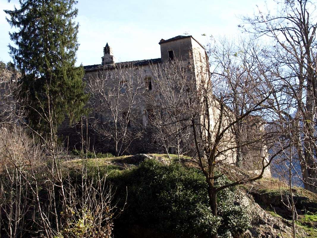
Villair-de-Quart Castle with wooden area towards St. Emeric Oratory ...
2)- dall'Alpe di Senevé scendere in diagonale a Sudest tramite la poderale che, passando per l'Alpe Lattaz
(1935 m) quasi in rovina, si indirizza poi più a Sud raggiungendo quelle di Chamoussin Damon e Dèsott
(1940 m, 1856 m); da qui, flettendo più ad Sud-sudest, si indirizza verso il Villaggio di Trois Villes-Avisod
(1398 m). Seguirla ma non raggiungerlo, bensì
circa 1 Kilometro prima a quota 1425 metri pervenire ad un bivio che scende verso Sudovest all'
Alpe Valseinte (1399 m). Da questa una stretta poderale cala decisamente a Sud percorrendo tutta la ripidamente rocciosa e
"misteriosa" Valseinte o Val Sainte fino a raggiungere l'
Oratorio di Saint Emeric o Americo (1130 m). Da questo (piccolo altare all'aperto e sormontato da Croce) un sentiero
non segnalato e non numerato scende verticalmente sul lungo promontorio boschivo-roccioso restando alto sopra il torrente fino a raggiungere il
Château du Villair (774 m). Da questo in Sud al Comune di
Quart oppure ad Ovest verso quello di
St. Christophe.
3)- Dal precedente bivio
1425 metri circa continuare sulla poderale raggiungendo il Villaggio di
Avisod (1398 m) ai piedi della Croix de Fana
(2212 m) e da questo scendere con due possibilità:
c)- tramite la Strada Regionale verso i Villaggi di Porsan
(1299 m), Buignod
(1135 m), Ville sur Nus-Planeville
(1113 m); da questo ultimo una strada poderale scende verso Novus
(968 m) presso il quale un sentiero
segnalato ma non numerato raggiunge quello di
Vollein (891 m) nelle vicinanze dell'omonima
Necropoli Neolitica, databile al 3000 avanti Cristo e meritevole d'una visita (inoltre attigua Palestra di Roccia).
d)- Scendere ancora con la Regionale da Planeville ai Villaggi di Fornail
(1082 m) e
Vignil (946 m); da questo una strada secondaria, ma in asfalto, s'indirizza ad Oriente verso la
Necropoli di Vollein. Infine, volendo chiudere il nostro viaggio di tre giorni, ancora due segnalazioni:
e)- da Avisod si può effettuare una visita al
"Monumento al Partigiano" di fronte alle imponenti Catene Montuose della Tersiva
(3518 m), delle Rouèses
(3357 m) e del Monte Emilius
(3559 m). Prendere appena oltre la piccola Chiesa una strada in asfalto che conduce al Villaggio di Effraz
(1487 m) ma abbandonarla quasi subito; una breve discesa conduce a questa suggestiva area.
f)- Dal Villaggio di
Porsan (1299 m), uno dei tre di Trois Villes, un sentiero
non numerato scende verso Ovest-sudovest arrivando nei pressi di quello di
Porsod (1063 m) dal quale attraversa ad Ovest
f/1)- verso la Valseinte e l'Oratorio di Saint Emeric, mentre un altro
f/2)-, scendendo più a Sudovest, raggiunge i Villaggetti di Verney e Josué
(671 m) sotto il Château de Quart o Villair e quindi ai
Comuni di St. Christophe o Quart. Da Vignil non rimane che scendere a valle presso
Quart-Villefranche (557 m), magari passando a visitare la vicina isolata
Tour de Chétoz sopra la Statale presso la località
La Plantaz.
By Tois Villes-Avisod Area can drop towards the 4) Valseinte with Villair-Castle; 5) Vollein Necropolis; 6) Tour de Chétoz above Villefranche